
Carsonville Township is a township in Becker County, Minnesota, United States. The population was 252 as of the 2000 census.

Evergreen Township is a township in Becker County, Minnesota, United States. The population was 290 as of the 2000 census.

Height of Land Township is a township in Becker County, Minnesota, United States. The population was 639 as of the 2000 census.

Shell Lake Township is a township in Becker County, Minnesota, United States. The population was 314 as of the 2000 census.

Silver Leaf Township is a township in Becker County, Minnesota, United States. The population was 493 as of the 2000 census.

Spruce Grove Township is a township in Becker County, Minnesota, United States. The population was 358 as of the 2000 census.

Toad Lake Township is a township in Becker County, Minnesota, United States. The population was 465 as of the 2000 census.

Wolf Lake Township is a township in Becker County, Minnesota, United States. The population was 227 as of the 2000 census.
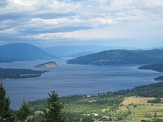
Shuswap Lake is a lake located in south-central British Columbia, Canada that drains via the Little River into Little Shuswap Lake. Little Shuswap Lake is the source of the South Thompson River, a branch of the Thompson River, a tributary of the Fraser River. It is at the heart of a region known as the Shuswap Country or "the Shuswap", noted for its recreational lakeshore communities including the city of Salmon Arm. The name "Shuswap" is derived from the Shuswap or Secwepemc First Nations people, the most northern of the Interior Salish peoples, whose territory includes the Shuswap. The Shuswap call themselves /ʃǝxwépmǝx/ in their own language, which is called /ʃǝxwepmǝxtʃín/, but the ethnonym's original meaning is now lost.
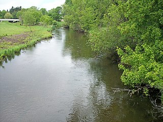
The Redeye River is a tributary of the Leaf River, 73 miles (117 km) long, in central Minnesota in the United States. Via the Leaf and Crow Wing Rivers, it is part of the watershed of the Mississippi River, draining an area of 222 square miles (575 km²) in a rural region. The river's name comes from the Native Americans of the area, who saw many red-eye fish in the river.
Bachelor Lake is a lake in Brown County, Minnesota in the northeastern part of Stark township. Covering 79.80 acres, it is an officially protected water of the State of Minnesota. The lake is within the Cottonwood River Major Watershed. The lake’s elevation is 1,004 feet (306 m), and it is zoned as a shoreland area which is regulated as a shoreland management water.

Temperance River State Park is a state park of Minnesota, USA, located between the communities of Schroeder and Tofte on Highway 61 on the North Shore of Lake Superior. It has campsites, picnic areas, and hiking trails on both sides of the Temperance River.
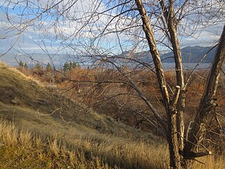
Okanagan Lake Provincial Park is a provincial park in British Columbia, Canada. Established in 1955, the park covers a total area of 98 hectares.
Summit Lake Provincial Park is a provincial park in British Columbia, Canada.
Summit Lake Provincial Park is located on Highway 6, 13 km southwest of Nakusp at the height of land between Slocan Lake and Upper Arrow Lake. The Nakusp Range of the Selkirk Mountains rises 500 metres above the lake, providing a magnificent backdrop to the many recreational opportunities provided by the park.
Park visitors can enjoy fishing for rainbow and cutthroat trout or swimming in the lake's clear, refreshing mountain water. Mountain Goats can often be viewed on rocky outcroppings and each fall a natural spectacle occurs as thousands of toads emerge from the lake and migrate to the nearby forest to hibernate for the winter.

Fairbanks is an unincorporated community in Fairbanks Township, Saint Louis County, Minnesota, United States; located within the Superior National Forest.
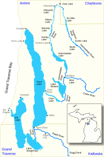
The Elk River Chain of Lakes Watershed is a 75-mile-long (121 km) waterway consisting of 14 lakes and connecting rivers in the northwestern section of the Lower Peninsula of the U.S. state of Michigan, which empty into Lake Michigan.
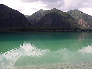
The Terminal Range is the northernmost mountain range of the Canadian Rockies, so-named for its position at the northern terminus of the Rockies. Lying west of Muncho Lake and the Trout River, its northern perimeter is the Liard River. The Sentinel Range lies to its east.

Wall Lake is an unincorporated community in Otter Tail County, in the U.S. state of Minnesota.
Toad River is a stream in the U.S. state of Minnesota.


