Nash Lee is a hamlet in the parish of Ellesborough, in Buckinghamshire, England. It is located to the north of the village, about two miles west of Wendover.
Chumillas is a village and municipality in the Cuenca province of Spain, part of the autonomous community of Castile-La Mancha.

Pastovce is a village and municipality in the Levice District in the Nitra Region of Slovakia.
El Oso is a municipality in the Spanish province of Ávila, in the autonomous community of Castile-Leon.

Érpatak is a village in Szabolcs-Szatmár-Bereg county, in the Northern Great Plain region of eastern Hungary.

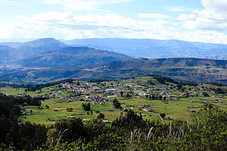
Tópaga is a town and municipality in the Sugamuxi Province, part of the Colombian department of Boyacá. Tópaga is situated on the Altiplano Cundiboyacense with the urban center at an altitude of 2,900 metres (9,500 ft) while the topography varies over the municipality from 2,400 metres (7,900 ft) to 3,200 metres (10,500 ft). It borders Nobsa and Corrales in the west, in the east Mongua and Gámeza, in the north Gámeza and in the south Monguí and Sogamoso. Department capital Tunja is 98 kilometres (61 mi) away. Chicamocha River flows through Tópaga.
Moung Ruessei is a district (srok) of Battambang Province, in north-western Cambodia. The capital lies at the town of Moung Ruessei.

Rathconrath is a village in County Westmeath, Ireland. It is situated on the R392 regional road 12 km (7.5 mi) west of Mullingar.
Esquivias is a municipality located in the province of Toledo, Castile-La Mancha, Spain. According to the 2006 census (INE), the municipality has a population of 4,812 inhabitants.

Carucedo is a village and municipality located in the region of El Bierzo. According to the 2010 census (INE), the municipality has a population of 642 inhabitants. It is one of Galician speaking councils of Castilla y León.

Solovăstru is a commune in Mureș County, Romania that is composed of two villages, Jabenița (Görgénysóakna) and Solovăstru. It has a population of 2,847: 94% Romanians, 5% Romani and 1% Hungarians.

Ouarakuy is a village in the Sanaba Department of Banwa Province in western Burkina Faso. As of 2005 it had a population of 549.
Nemena is a town in the Sanaba Department of Banwa Province in western Burkina Faso. As of 2005 it had a population of 1,017.
Douma is a town in the Tansila Department of Banwa Province in western Burkina Faso. As of 2005 it had a population of 1,154.
Tanama is a village in the Boudry Department of Ganzourgou Province in central Burkina Faso. The village has a population of 532.
Tomena is a village in the Iolonioro Department of Bougouriba Province in south-western Burkina Faso. The village has a population of 503.
Sangolo is a village in the Iolonioro Department of Bougouriba Province in south-western Burkina Faso. The village has a population of 502.

Guisser is a village and rural commune in Settat Province, Casablanca-Settat, Morocco. According to the 2004 census it has a population of 11,339.
Hormilla is a village in the province and autonomous community of La Rioja, Spain. The municipality covers an area of 15.86 square kilometres (6.12 sq mi) and as of 2011 had a population of 453 people.

San Vicente de la Sonsierra is a village in the province and autonomous community of La Rioja, Spain. The municipality covers an area of 48.56 square kilometres (18.75 sq mi) and as of 2011 had a population of 1132 people.


