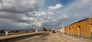
Calama is a city and commune in the Atacama Desert in northern Chile. It is the capital of El Loa Province, part of the Antofagasta Region. Calama is one of the driest cities in the world with average annual precipitation of just 5 mm (0.20 in). The River Loa, Chile's longest, flows through the city. Calama has a population of 147,886.
Catholic University of the North is a university in Chile. It is part of the Chilean Traditional Universities. It is located in Antofagasta, Chile. The Northern catholic university was founded on May 31, 1956.
Antofagasta Province is one of three provinces in the northern Chilean region of Antofagasta (II). The capital is the port city of Antofagasta. Located within the Atacama Desert, it borders the El Loa and Tocopilla provinces to the north,the Pacific Ocean to the West and the Atacama Region to the south.

Los Flamencos National Reserve is a nature reserve located in the commune of San Pedro de Atacama, Antofagasta Region of northern Chile. The reserve covers a total area of 740 square kilometres or 73,986 hectares in the Central Andean dry puna ecoregion and consists of seven separate sections.

El Loa Province is one of three provinces of the northern Chilean region of Antofagasta (II). It is named after the longest of rivers in Chile, the Loa River. The provincial capital is Calama.
Ollagüe is a Chilean frontier village and commune in El Loa Province, Antofagasta Region. The village is 215 kilometres (134 mi) northeast of the city of Calama, and has a station and marshalling yard on the FCAB railine.
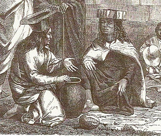
The Atacama people, known as atacameños or atacamas in Spanish and kunzas, Likan-antai or Likanantaí in English, are an indigenous people from the Atacama Desert and altiplano region in the north of Chile and Argentina and southern Bolivia.
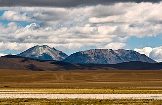
Cerro del León is a stratovolcano located in El Loa province, Antofagasta Region, Chile. It is part of the Chilean Central Volcanic Zone and forms a volcanic lineament with neighbouring Paniri and Toconce that was active into the Holocene. Cerro del León itself was constructed in three stages by andesitic–dacitic lava flows and was subject to glacial erosion.
Socaire is a village located 100 km (62 mi) southeast of the town of San Pedro de Atacama, in the San Pedro de Atacama province of Chile's northern Antofagasta Region. It offers views overlooking the Salar de Atacama.

The Atacama Desert is a desert plateau in South America covering a 1000-km (600-mi) strip of land on the Pacific coast, west of the Andes mountains. The Atacama desert is one of the driest places in the world, as well as the only true desert to receive less precipitation than the polar deserts. According to estimates, the Atacama Desert occupies 105,000 km2 (41,000 sq mi), or 128,000 km2 (49,000 sq mi) if the barren lower slopes of the Andes are included. Most of the desert is composed of stony terrain, salt lakes (salares), sand, and felsic lava that flows towards the Andes.
María Elena is a Chilean town and commune in Tocopilla Province, Antofagasta Region. According to the 2012 census, the commune population was 4,593 and has an area of 12,197.2 km2 (4,709 sq mi).

The Paso de Jama is a mountain pass through the Andes between Chile and Argentina, at an elevation of 4,200 m (13,800 ft) at the border. It is the northernmost road border crossing between the two countries. The pass is reached via Chile Route 27 and via National Route 52 (Argentina). The Chile Route 27 reaches an altitude of 4,810 m (15,780 ft) 100 km west of the border.

Alto Loa National Reserve is a Protected Area located in the province of El Loa, Antofagasta region, Chile. Announced in 2002 and created in 2005, it is Chile's largest natural reserve.

Sico Pass is a mountain pass on the border between Argentina and Chile. The pass is located on the main divide of the Andes. Administratively, it separates the province of Salta in Argentina and the region of Antofagasta in Chile.

San Pedro River is a river of Chile located in the Antofagasta Region of northern Chile. It is formed at the confluence of the Grande and Salado rivers.
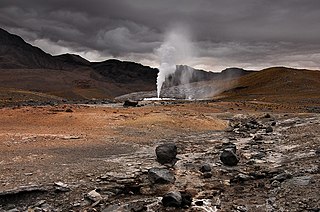
Puritama Hot Springs is a series of eight large pools of geothermal spring water located at the bottom of a canyon in the Atacama Desert, in the Antofagasta Region in the north of Chile. It is located at an altitude of 3,475 meters above sea level, 30 km northeast of the town and commune of San Pedro de Atacama and 348 km northeast of Antofagasta, and is a popular tourist attraction.

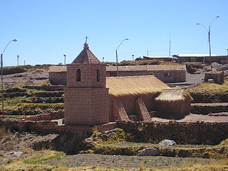
The Church of San Pedro de Atacama is a Catholic church in San Pedro de Atacama, Chile. Constructed during the Spanish colonial period, it is reportedly the second oldest church in Chile. Indigenous adobe material was used in the church's construction, whose appearance is characterized as simple and elegant. The church was built in the seventeenth century, underwent modifications in the eighteenth century, and additions were made in the nineteenth century. The church was declared a historical monument in 1951.
San Pedro de Atacama Airport is a high elevation airport serving San Pedro de Atacama, a town in the Antofagasta Region of Chile. The airport is 3 kilometres (1.9 mi) east of the town.