It is proposed that this article be deleted because of the following concern: Lack of specific secondary references, see WP:V If you can address this concern by improving, copyediting, sourcing, renaming, or merging the page, please edit this page and do so. You may remove this message if you improve the article or otherwise object to deletion for any reason. Although not required, you are encouraged to explain why you object to the deletion, either in your edit summary or on the talk page. If this template is removed, do not replace it . The article may be deleted if this message remains in place for seven days, i.e., after 23:12, 25 July 2018 (UTC). Nominator: Please consider notifying the author/project: {{subst:proposed deletion notify |Tom Patterson (cartographer)|concern=Lack of specific secondary references, see [[WP:V]]}} ~~~~ |
 | This biography of a living person needs additional citations for verification .(September 2008) (Learn how and when to remove this template message) |

Tom Patterson is a cartographer working for the United States National Park Service in Harpers Ferry, West Virginia. He has developed several widely used open-source tools and bases for cartographers.
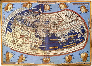
Cartography is the study and practice of making maps. Combining science, aesthetics, and technique, cartography builds on the premise that reality can be modeled in ways that communicate spatial information effectively.

The United States of America (USA), commonly known as the United States or America, is a country composed of 50 states, a federal district, five major self-governing territories, and various possessions. At 3.8 million square miles, the United States is the world's third or fourth largest country by total area and is slightly smaller than the entire continent of Europe's 3.9 million square miles. With a population of over 327 million people, the U.S. is the third most populous country. The capital is Washington, D.C., and the largest city by population is New York City. Forty-eight states and the capital's federal district are contiguous in North America between Canada and Mexico. The State of Alaska is in the northwest corner of North America, bordered by Canada to the east and across the Bering Strait from Russia to the west. The State of Hawaii is an archipelago in the mid-Pacific Ocean. The U.S. territories are scattered about the Pacific Ocean and the Caribbean Sea, stretching across nine official time zones. The extremely diverse geography, climate, and wildlife of the United States make it one of the world's 17 megadiverse countries.

The National Park Service (NPS) is an agency of the United States federal government that manages all national parks, many national monuments, and other conservation and historical properties with various title designations. It was created on August 25, 1916, by Congress through the National Park Service Organic Act and is an agency of the United States Department of the Interior. The NPS is charged with a dual role of preserving the ecological and historical integrity of the places entrusted to its management, while also making them available and accessible for public use and enjoyment.
His earliest public work aside from maps for the Park Service was a set of papers in 1997 and 1998 explaining techniques for generating shaded relief using Adobe Photoshop and Bryce.

Adobe Photoshop is a raster graphics editor developed and published by Adobe Inc. for macOS and Windows. It was originally created in 1988 by Thomas and John Knoll. Since then, this software has become the de facto industry standard not only in raster graphics editing, but to digital art as a whole; it even went to the point that the software's name itself has become a generic trademark, leading to its usage as a verb although Adobe discourages such use. Photoshop can edit and compose raster images in multiple layers and supports masks, alpha compositing, and several color models including RGB, CMYK, CIELAB, spot color, and duotone. Photoshop uses its own PSD and PSB file formats to support these features. In addition to raster graphics, this software has limited abilities to edit or render text and vector graphics, as well as 3D graphics and video. Its feature set can be expanded by plug-ins; programs developed and distributed independently of Photoshop that run inside it and offer new or enhanced features.

Bryce is a 3D modeling, rendering and animation program specializing in fractal landscapes. The name is taken from Bryce Canyon—a rugged region with many of the same landscapes that were first simulated with the software.
In 2000, he explored ways of digitally producing panoramic maps like those of Heinrich Berann.
In 2005, he released the open-source Natural Earth database, which combines land-use data with shaded relief for land and ocean areas. It was inspired by the cartography of Hal Shelton. A second release in 2007 (Natural Earth II) used more generalized land-use information based on natural rather than human-made landscapes.
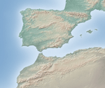
Natural Earth is a public domain map dataset available at 1:10 million, 1:50 million, and 1:110 million map scales. Natural Earth's data set contains integrated vector and raster mapping data.
In 2006 he released plan oblique relief, inspired by Erwin Raisz's physiographic map. These maps are in "2.5 dimensions", allowing the relief equivalent of an axonometric plan. His resulting physical maps of the world and the United States are, as with Natural Earth, free for public use.
In 2007 he released Flex Projector together with Bernhard Jenny (cartographer at the ETH Zurich), an open-source tool to develop pseudocylindrical projections, including his own Natural Earth projection.