Related Research Articles
Tūrangi is a small town on the west bank of the Tongariro River, 50 kilometres south-west of Taupo on the North Island Volcanic Plateau of New Zealand. It was built to accommodate the workers associated with the Tongariro hydro-electric power development project and their families. The town was designed to remain as a small servicing centre for the exotic forest plantations south of Lake Taupo and for tourists. It is well known for its trout fishing and calls itself "The trout fishing capital of the world". The major Māori hapu (tribe) of the Turangi area is Ngāti Tūrangitukua.

Ohakune is a small town at the southern end of Tongariro National Park, close to the southwestern slopes of the active volcano Mount Ruapehu, in the North Island of New Zealand. It is 25 kilometres west of Waiouru, 70 kilometres northeast of Whanganui, 215 kilometres north of Wellington and 292 kilometres south of Auckland. It is part of Ruapehu District and the Manawatū-Whanganui region.

Kakahi ) is a small King Country settlement about 10 kilometres (6.2 mi) up the Whanganui River from Taumarunui, New Zealand. Founded as a sawmill town, it takes its name from the Māori word for the New Zealand freshwater mussel.

Ngāti Tūwharetoa is an iwi descended from Ngātoro-i-rangi, the priest who navigated the Arawa canoe to New Zealand. The Tūwharetoa region extends from Te Awa o te Atua at Matatā across the central plateau of the North Island to the lands around Mount Tongariro and Lake Taupō.
In Māori tradition, Ngātoro-i-rangi (Ngātoro) is the name of a tohunga (priest) prominent during the settling of Aotearoa by the Māori people, who came from the traditional homeland Hawaiki.

Arapuni is a rural town centre on the Waikato river in the South Waikato District of New Zealand. The population on census night 2006 was 2,145 usual residents, slightly down from 2,163 in 2001 and 2,211 in 1996.

Mount Pihanga is a 1,326 metres (4,350 ft) volcanic peak in the North Island Volcanic Plateau, located to the north of Mount Tongariro, between Tongariro and Lake Taupo. Lake Rotoaira lies to the south-west of Pihanga, and the smaller Lake Rotopounamu is situated on the south-western flank of the volcano, near Te Ponanga Saddle. Mt. Pihanga and Lake Rotopounamu are part of the 5,129ha Pihanga Scenic Reserve, which in 1975 was added to the Tongariro National Park. Mt. Pihanga appears to have a large crater, but this is in fact the result of erosion, and the "crater" quickly narrows into a steep gorge.
Okoia is a small rural community approximately 5 km east of Whanganui, New Zealand. It is centred on the Okoia Primary School. The area is predominantly subject to sheep and beef pastoral farming, but in recent years some farms have been divided into lifestyle blocks.
Te Tai Hauāuru is a New Zealand parliamentary Māori electorate, returning one Member of Parliament to the New Zealand House of Representatives, that was first formed for the 1996 election. The electorate was represented by Tariana Turia from 2002 to 2014, first for the Labour Party and then for the Māori Party. Turia retired and was succeeded in 2014 by Labour's Adrian Rurawhe who again retained the seat in 2017.

Hikutaia is a locality on the Hauraki Plains of New Zealand. It lies on State Highway 26, south east of Thames and north of Paeroa. The Hikutaia River runs from the Coromandel Range through the area to join the Waihou River.
Kennedy Bay is a locality in the north eastern Coromandel Peninsula of New Zealand. The Harataunga and Omoho Streams flow from the Coromandel Range past the settlement and into the bay to the east.

Tokaanu is a small settlement close to Turangi at the southern end of Lake Taupo.

Ranana is a settlement 60 kilometres (37 mi) up the Whanganui River from Whanganui, New Zealand.

Pipiriki is a settlement in New Zealand, on the east bank of the Whanganui River, due west of the town of Raetihi and 79 kilometres (49 mi) upriver from Whanganui; it was originally on the opposite bank. It is the home of Ngāti Kura, a hapū of the Ngāti Ruanui iwi. It is also the location of the Paraweka Marae of the hapū Ngāti Kurawhatia of the iwi Te Āti Haunui-a-Pāpārangi.
Matahiwi is a farming community 55 kilometres (34 mi) upriver from Whanganui, New Zealand, home to the Māori hapū known as Ngā Poutama of the iwi Te Āti Haunui-a-Pāpārangi. The township takes its name from the bush-clad puke (hill) on the western side of the Whanganui River, right above the local marae, whose name translates as "the face on the ridge".

Koriniti is a settlement 47 kilometres (29 mi) upriver from Whanganui, New Zealand, home to the Ngāti Pāmoana hapū of the iwi Te Āti Haunui-a-Pāpārangi.

Parikino is a settlement 24 kilometres (15 mi) upriver from Whanganui, New Zealand; the original pā site was across the Whanganui River.

Kaiwhaiki is a settlement 18 kilometres (11 mi) upriver from Whanganui, New Zealand.
Parinui is a small Māori community in New Zealand, based around the Mangatiti Stream on the middle reaches of the Whanganui River. The area, including the neighbouring settlement of Tieke Kāinga, is popular with tourists.
Otukou or Otūkou is a rural community in the Taupo District and Waikato region of New Zealand's North Island.
References
- ↑ "Māori Maps". maorimaps.com. Te Potiki National Trust.
- ↑ "Te Kāhui Māngai directory". tkm.govt.nz. Te Puni Kōkiri.
Coordinates: 39°02′46″S175°36′14″E / 39.046047°S 175.603755°E
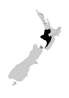
| | This Manawatū-Whanganui geography article is a stub. You can help Wikipedia by expanding it. |