Look up Topeka in Wiktionary, the free dictionary.
Topeka is the capital city of the U.S. state of Kansas.
Contents
Topeka may also refer to:
Topeka is the capital city of the U.S. state of Kansas.
Topeka may also refer to:

Kansas is a state in the Midwestern United States. Its capital is Topeka, and its largest city is Wichita. Kansas is a landlocked state bordered by Nebraska to the north; Missouri to the east; Oklahoma to the south; and Colorado to the west. Kansas is named after the Kansas River, which in turn was named after the Kansa Native Americans who lived along its banks. The tribe's name is often said to mean "people of the (south) wind" although this was probably not the term's original meaning. For thousands of years, what is now Kansas was home to numerous and diverse Native American tribes. Tribes in the eastern part of the state generally lived in villages along the river valleys. Tribes in the western part of the state were semi-nomadic and hunted large herds of bison.

Topeka is the capital city of the U.S. state of Kansas and the seat of Shawnee County. It is along the Kansas River in the central part of Shawnee County, in northeast Kansas, in the Central United States. As of the 2020 census, the population of the city was 126,587. The Topeka metropolitan statistical area, which includes Shawnee, Jackson, Jefferson, Osage, and Wabaunsee Counties, had a population of 233,870 in the 2010 census.

The Kansas Turnpike is a 236-mile-long (380 km), freeway-standard toll road that lies entirely within the US state of Kansas. It runs in a general southwest–northeast direction from the Oklahoma border to Kansas City. It passes through several major Kansas cities, including Wichita, Emporia, Topeka, and Lawrence. The turnpike is owned and maintained by the Kansas Turnpike Authority (KTA), which is headquartered in Wichita.
Google is an American multinational corporation specializing in internet-related services and products.
K-156 is a 175.663-mile-long (282.702 km) west–east state highway in the U.S. state of Kansas. K-156's western terminus is at U.S. Route 50 Business and US-83 Bus. in Garden City and the eastern terminus is at Interstate 70 (I-70) and U.S. Route 40 (US-40) northeast of Ellsworth. Along the way, it intersects several major highways including US-50, US-83 and US-400 in Garden City; US-283 in Jetmore; and US-183 near Rozel, and it overlaps its implied parent, US-56, from Larned to east of Great Bend.
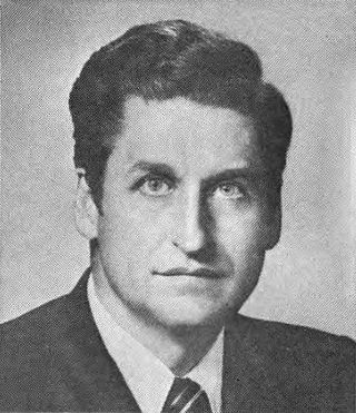
William Robert Roy, also known as Bill Roy, was a United States representative from Kansas, a physician, and a columnist for The Topeka Capital-Journal. He was the Democratic nominee for U.S Senator from Kansas in the 1974 and 1978 senate elections, but lost both races.

Topeka Regional Airport, formerly known as Forbes Field, is a joint civil-military public airport owned by the Metropolitan Topeka Airport Authority in Shawnee County, Kansas, seven miles south of downtown Topeka, the capital city of Kansas. The National Plan of Integrated Airport Systems for 2011–2015 called it a general aviation airport.
K-32, also known as the Kaw Valley Scenic Highway, is an approximately 32.2-mile-long (51.8 km) east–west state highway in the Kansas City metropolitan area of Kansas. K-32's western terminus is just outside Lawrence at U.S. Route 24 (US-24) and US-40. Its eastern terminus is at US-69, also known as the 18th Street Expressway, in Kansas City. Along the way it intersects several major highways, including K-7 in Bonner Springs as well as Interstate 435 (I-435) and I-635 in Kansas City. In Kansas City, K-32 follows the Turner Diagonal from Kaw Drive to Kansas Avenue. From its western terminus to Bonner Springs, the highway is a two-lane rural highway; the remaining section is a four-lane highway that runs through residential areas.
K-28 is a 29.019-mile-long (46.702 km) state highway in the U.S. state of Kansas. K-28's western terminus is at K-14 in Jewell, and the eastern terminus is at K-9 west of Concordia. K-28 passes through the cities of Randall and Jamestown as well as the ghost town of Yuma. The highway also passes within one mile (1.6 km) of the Jamestown Wildlife Area, a popular hunting and fishing destination. The highway is a two-lane paved road its entire length.

K-150 is a 16.645-mile (26.788 km) east–west state highway in the U.S. state of Kansas. The route begins at a roundabout with U.S. Route 56 (US-56) and US-77 northeast of Marion and runs east to a junction with US-50 southwest of Elmdale. It runs through the Flint Hills region of Kansas, and is a two-lane road its entire length. There are no cities or towns along the road, but it provides a direct link for traffic from Marion, Hillsboro, McPherson and points west to Emporia and the Kansas Turnpike.
K-33 is an approximately 10.4-mile-long (16.7 km) north–south state highway in the U.S. state of Kansas. K-33's southern terminus is at K-68 in rural Franklin County east of Ottawa and the northern terminus is at U.S. Route 56 (US-56) in Douglas County, east of Baldwin City and southwest of Kansas City. K-33 provides an important link between US-56 and K-68 to Interstate 35 (I-35) and US-50 in Wellsville. K-33 is a two-lane rural highway for most of its length, except for the section within Wellsville.
Atchison, Topeka and Santa Fe Railway Depot, or variations with Railroad or Station or Passenger and/or Freight may refer to any one of many stations of the Atchison, Topeka and Santa Fe Railway. These include:

K-34 is a 29.26-mile-long (47.09 km) state highway in southwestern Kansas that runs from U.S. Route 160 (US-160) and US-183 near Ashland to US-400 near Bucklin. It is one of the lesser-traveled highways in the state and is not part of the National Highway System. It is a two-lane road for its entire length.
K-23 is a 199.117-mile-long (320.448 km) south–north state highway in the U.S. State of Kansas. It starts as a continuation of Oklahoma State Highway 23 (SH-23) and it runs northward to U.S. Route 83 (US-83) and K-383 near Selden. Along the way it intersects several major east–west highways, including US-54 and US-160 in Meade, US-50 and US-400 in Cimarron, US-56 near Montezuma, K-4 near Healy, and Interstate 70 (I-70) and US-40 south of Grainfield. All but about 1.5 miles (2.4 km) of K-23's alignment is maintained by the Kansas Department of Transportation. The entire section within Cimarron is maintained by the city and a section in Hoxie from Utah Street to Queen Street is maintained by the city.
K-51 is an approximately 79-mile-long (127 km) east–west state highway in the southwestern part of the U.S. state of Kansas. K-51 begins at the Colorado state line as a continuation of County Road M and travels eastward through portions of Morton, Stevens, and Seward counties before ending at U.S. Route 83 (US-83) north of Liberal. Along the way, it runs concurrently with US-56 from Rolla to Hugoton. Although K-51 travels through mostly rural farmlands, it does pass through the cities of Richfield, Rolla and Hugoton. The highway is also a two-lane road most of its length with the exception of short sections within Rolla and Hugoton, where it is four lanes.

Fairfax Field was a wartime (WWII) facility of the United States Army Air Forces and later, the United States Air Force. The installation was north of Kansas City, Kansas. Used as a pre-war Naval Air Station, the United States Army Air Forces leased the municipal airfield and built an Air Force Plant and modification center for North American B-25 Mitchell medium bomber production. Military use of the site continued as late as 1957 by the Strategic Air Command's 3903rd Radar Bomb Scoring Group for bombing practice.
K-49 is a 35.354-mile-long (56.897 km) north–south state highway in the U.S. state of Kansas. K-49 begins at U.S. Route 81 (US-81) in Caldwell, and runs north to K-42 in Viola. Along the way, K-49 has a brief overlap with US-160 south of Conway Springs. The majority of the route exists in Sumner County, with only a mile existing in Sedgwick County.

The 2018 Kansas gubernatorial election took place on November 6, 2018, to elect the next governor of Kansas. Democratic nominee Laura Kelly won the election, defeating Republican nominee Kris Kobach and independent candidate Greg Orman.

K-128 is a 36.9-mile-long (59.4 km) north–south state highway in the U.S. state of Kansas. K-128's southern terminus is at U.S. Route 24 (US-24) and K-9 northwest of Glen Elder, and the northern terminus continues as Nebraska Highway 78 (N-78) at the Nebraska border north of Burr Oak. West of Mankato, a small section of K-128 is co-designated as US-36.
K-98 is a 9.048-mile-long (14.561 km) state highway in the U.S. state of Kansas. Entirely within Meade County, K-98's western terminus is at K-23 north of Meade, and its eastern terminus is at U.S. Route 54 (US-54) south of Fowler. With the exception of the eastern end, the highway travels through flat farmland and is a two-lane road for its entire length.