Topeka, Indiana | |
---|---|
Coordinates: 41°32′22″N85°32′51″W / 41.53944°N 85.54750°W | |
Country | United States |
State | Indiana |
County | LaGrange |
Township | Clearspring, Eden |
Area | |
• Total | 1.61 sq mi (4.18 km2) |
• Land | 1.61 sq mi (4.18 km2) |
• Water | 0.00 sq mi (0.00 km2) |
Elevation | 929 ft (283 m) |
Population (2020) | |
• Total | 1,206 |
• Density | 747.21/sq mi (288.56/km2) |
Time zone | UTC-5 (Eastern (EST)) |
• Summer (DST) | UTC-4 (EDT) |
ZIP code | 46571 |
Area code | 260 |
FIPS code | 18-76184 [3] |
GNIS feature ID | 2397697 [2] |
Website | http://www.topekain.net/ |
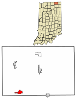
Topeka is a town in Clearspring and Eden townships, LaGrange County, Indiana, United States. The population was 1,153 at the 2010 census. Topeka is located approximately eleven miles south of Shipshewana, Indiana.
Topeka was likely so named because the landscape reminded settlers of Topeka, Kansas. [4]
According to the 2010 census, Topeka has a total area of 1.74 square miles (4.51 km2), all land. [5]
Census | Pop. | Note | %± |
---|---|---|---|
1920 | 512 | — | |
1930 | 489 | −4.5% | |
1940 | 496 | 1.4% | |
1950 | 557 | 12.3% | |
1960 | 600 | 7.7% | |
1970 | 677 | 12.8% | |
1980 | 876 | 29.4% | |
1990 | 912 | 4.1% | |
2000 | 1,159 | 27.1% | |
2010 | 1,153 | −0.5% | |
2020 | 1,206 | 4.6% | |
U.S. Decennial Census [6] |
As of the census [7] of 2010, there were 1,153 people, 421 households, and 291 families living in the town. The population density was 662.6 inhabitants per square mile (255.8/km2). There were 456 housing units at an average density of 262.1 per square mile (101.2/km2). The racial makeup of the town was 94.4% White, 0.3% African American, 1.0% Asian, 1.6% from other races, and 2.7% from two or more races. Hispanic or Latino of any race were 3.6% of the population.
There were 421 households, of which 43.9% had children under the age of 18 living with them, 50.6% were married couples living together, 12.8% had a female householder with no husband present, 5.7% had a male householder with no wife present, and 30.9% were non-families. 26.8% of all households were made up of individuals, and 10.2% had someone living alone who was 65 years of age or older. The average household size was 2.74 and the average family size was 3.34.
The median age in the town was 29.6 years. 33.9% of residents were under the age of 18; 8.7% were between the ages of 18 and 24; 28.2% were from 25 to 44; 21% were from 45 to 64; and 8.2% were 65 years of age or older. The gender makeup of the town was 47.8% male and 52.2% female.
As of the census [3] of 2000, there were 1,159 people, 448 households, and 310 families living in the town. The population density was 841.2 inhabitants per square mile (324.8/km2). There were 482 housing units at an average density of 349.8 per square mile (135.1/km2). The racial makeup of the town was 95.34% White, 0.69% Asian, 1.38% from other races, and 2.59% from two or more races. Hispanic or Latino of any race were 2.67% of the population.
There were 448 households, out of which 37.7% had children under the age of 18 living with them, 49.8% were married couples living together, 12.9% had a female householder with no husband present, and 30.6% were non-families. 26.6% of all households were made up of individuals, and 8.3% had someone living alone who was 65 years of age or older. The average household size was 2.59 and the average family size was 3.10.
In the town, the population was spread out, with 31.1% under the age of 18, 11.4% from 18 to 24, 30.5% from 25 to 44, 17.1% from 45 to 64, and 9.9% who were 65 years of age or older. The median age was 29 years. For every 100 females, there were 95.8 males. For every 100 females age 18 and over, there were 95.1 males.
The median income for a household in the town was $37,105, and the median income for a family was $42,232. Males had a median income of $32,356 versus $23,542 for females. The per capita income for the town was $17,269. About 7.3% of families and 9.1% of the population were below the poverty line, including 11.7% of those under age 18 and 10.1% of those age 65 or over.
Topeka has a public library, a branch of the La Grange County Public Library. [8]
Utica is a town in Utica Township, Clark County, Indiana, United States. The population was 776 at the 2010 census.
St. Paul or Saint Paul is a small town on the border of Decatur and Shelby counties in the U.S. state of Indiana. The population was 1,031 at the 2010 census.
Ashley is a town in Indiana located on the border of Smithfield Township, DeKalb County and Steuben Township, Steuben County. The population was 983 at the 2010 census.
Albany is a town in Delaware and Randolph counties in the U.S. state of Indiana, along the Mississinewa River. The population was 2,295 at the 2020 census. It is part of the Muncie, IN Metropolitan Statistical Area.
Andrews is a town in Dallas Township, Huntington County, Indiana, United States. The population was 1,048 at the 2020 census.
LaGrange is a town in and the county seat of LaGrange County, Indiana, United States. The population was 2,625 at the 2010 census.
Shipshewana is a town in Newbury Township, LaGrange County, Indiana, United States. The population was 658 at the 2010 census. It is the location of the Menno-Hof Amish & Mennonite Museum, which showcases the history of the Amish and Mennonite peoples.
Wolcottville is a town in Orange Township, Noble County and Johnson Township, LaGrange County in the U.S. state of Indiana. The population was 998 at the 2010 census.
New Ross is a town in Walnut Township, Montgomery County, in the U.S. state of Indiana. As of the 2020 census, the town population was 309.
Paragon is a town in Ray Township, Morgan County, in the U.S. state of Indiana. The population was 556 at the 2020 census, down from 659 in 2010.
Albion is a town in Albion and Jefferson townships, Noble County, in the U.S. state of Indiana. The population was 2,349 at the 2010 census. The city is the county seat of Noble County.
Cromwell is a town in Sparta Township, Noble County, in the U.S. state of Indiana. The population was 512 at the 2010 census.
Kendallville is a city in Wayne Township, Noble County, in the U.S. state of Indiana. The population was 10,205 at the 2021 census.
Rome City is a town in Orange Township, Noble County, in the U.S. state of Indiana. The population was 1,361 at the 2010 census.
Clarks Hill is a town in Lauramie Township, Tippecanoe County, in the U.S. state of Indiana. The population was 611 at the 2010 census.
Belleville is a city in and the county seat of Republic County, Kansas, United States. As of the 2020 census, the population of the city was 2,007.
LaGrange is a town in Penobscot County, Maine, United States. The population was 635 at the 2020 census.
Green Township is a township in Indiana County, Pennsylvania, United States. Green Township was formed from Wheatfield Township circa 1816 and was named for the great evergreen forests covering the area. The population was 3,457 at the 2020 census. The township includes the communities of Bencetown, Berringer, Commodore, Cookport, Cush Cushion, Dixonville, Fleming Summit, Grisemore, Leard, Lovejoy, Martintown, Pine Flats, Prosperity Hill, Purchase Line, Shanktown, Starford, Spruce, Utah, Uniontown, and Wandin.
Granger is a city in Yakima County, Washington, United States. The population was 3,624 at the 2020 census. Although it was classified as a town in 2000, it has since been reclassified as a city.
Williams Creek is a town in Washington Township, Marion County, Indiana, United States. It is located about 9 miles (14 km) north of downtown Indianapolis. The population was 430 at the 2020 census. It has existed as an "included town" since 1970, when it was incorporated into Indianapolis as part of Unigov. It is part of Indianapolis, but retains a functioning town government under IC 36-3-1-11.
...the surrounding country resembled Topeka, Kansas.