Stroh, Indiana

Last updated

Stroh, Indiana
Stroh Indiana Big Turkey Lake.jpg
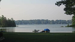
Looking north from Stroh toward Big Turkey Lake
USA Indiana location map.svg
Red pog.svg
Stroh
Usa edcp location map.svg
Red pog.svg
Stroh
Coordinates: 41°34′57″N85°11′57″W / 41.58250°N 85.19917°W / 41.58250; -85.19917
Country United States
State Indiana
County LaGrange
Township Milford
Elevation
[1]
935 ft (285 m)
Time zone UTC-5 (Eastern Standard Time)
  Summer (DST) UTC-4 (Eastern Daylight Time)
ZIP code
46761 (La Grange)
46789 (Stroh)
Area codes 260, 574
FIPS code 18-73790 [2]
GNIS feature ID2830441 [1]

Stroh is an unincorporated community in Milford Township, LaGrange County, Indiana, USA.

Contents

The Stroh post office was established in 1900. [3]

The settlement has five church buildings, Stroh church of God, Stroh church of Christ, Baptist church, Calvary Chapel, Mt Calvery church.

Geography

Stroh is located on the southwestern shore of Big Turkey Lake.

Demographics

Historical population
CensusPop.Note
2023 (est.)284 [4]

The United States Census Bureau defined Stroh as a census designated place in the 2022 American Community Survey. [5]

References

  1. 1 2 U.S. Geological Survey Geographic Names Information System: Stroh, Indiana
  2. "U.S. Census website". United States Census Bureau . Retrieved January 31, 2008.
  3. "LaGrange County". Jim Forte Postal History. Retrieved December 9, 2014.
  4. "B03002 Hispanic or Latino, and Not Hispanic or Latino by Race – Stroh CDP – 2023 American Community Survey 5-Year Estimates". U.S. Census Bureau. July 1, 2023. Retrieved August 1, 2025.
  5. "2022 Geography Changes". United States Census Bureau.