External links
Coordinates: 38°17′45″S144°21′52″E / 38.29583°S 144.36444°E
Torquay Airport is a privately owned airfield situated at 325 Blackgate Rd, Torquay, Victoria, Australia.
Torquay Airport is home to Tiger Moth World and Australian Skydive. (ICAO: YTQY)
Other airports in the area are at Barwon Heads (ICAO: YBRS) and Avalon Airport.
Coordinates: 38°17′45″S144°21′52″E / 38.29583°S 144.36444°E

The Surf Coast Shire is a local government area in the Barwon South West region of Victoria, Australia, located in the south-western part of the state. It covers an area of 1,553 square kilometres (600 sq mi) and in June 2018 had a population of 32,251. It includes the towns of Aireys Inlet, Anglesea, Lorne, Moriac, Torquay and Winchelsea. It was formed in 1994 from the amalgamation of the Shire of Winchelsea, Shire of Barrabool and part of the former City of South Barwon, which was, at that point, part of the City of Greater Geelong.

The de Havilland DH.82 Tiger Moth is a 1930s British biplane designed by Geoffrey de Havilland and built by the de Havilland Aircraft Company. It was operated by the Royal Air Force (RAF) and other operators as a primary trainer aircraft. In addition to the type's principal use for ab initio training, the Second World War had RAF Tiger Moths operating in other capacities, including maritime surveillance and defensive anti-invasion preparations; some aircraft were even outfitted to function as armed light bombers.

Longreach Airport is situated in Longreach, Queensland, Australia. The airport is 1.5 nautical miles northeast of the city.

Geelong Airport was a small airfield specifically for light aircraft located in Mount Duneed, Victoria, Australia. It was primarily used for scenic flights and private aircraft, and was located in the local government area of the City of Greater Geelong.

Fairoaks Airport is a general aviation airport between Chobham and Chertsey in Surrey, England. It is 2 NM north of Woking and 2.8 miles (4.5 km) from Junction 11 of the M25 motorway which is between the M3 and A3 junctions.

RAAF Station Archerfield was a permanent Royal Australian Air Force station at Archerfield Airport in Brisbane, Queensland, Australia, from 1939 to 1956.

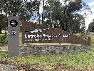
Latrobe Regional Airport is located between the Latrobe Valley towns of Morwell and Traralgon, Victoria, Australia. The airport is about 160 kilometres east of Melbourne, off the Princes Highway, 4 nautical miles west of Traralgon.
Nhill Airport is located 1 nautical mile northwest of Nhill, Victoria, Australia, about four hours northwest of Melbourne. The Nhill Aviation Heritage Centre is located there.
Healy River Airport is a state owned, public use airport serving Healy, a community located in the Denali Borough of the U.S. state of Alaska. It is included in the National Plan of Integrated Airport Systems for 2011–2015, which categorized it as a general aviation facility.

Tamworth Airport is a regional airport serving Tamworth, a city in the Australian state of New South Wales. It is located 10 km (6.2 mi) from the town centre, on New Winton Road. The airport is owned and operated by the Tamworth Regional Council and is listed as being 5 nautical miles west of the city. It is also known as Tamworth Regional Airport.
Point Impossible Beach is a clothes-optional beach located at Torquay, west coast, in the State of Victoria, Australia. It is designated as a legal nudist beach under the Nudity Act 1983.

Christian College is a K-12 private school located over six campuses in Geelong, Victoria, Australia.
Beluga Airport is a private use airport in Beluga, in the Kenai Peninsula Borough of the U.S. state of Alaska. It is privately owned by ConocoPhillips.

The City of South Barwon was a local government area in Victoria, Australia, which contained a number of Geelong suburbs south of the Barwon River, and extending to Torquay in the south and Barwon Heads to the east. The city covered an area of 165.4 square kilometres (63.9 sq mi), and existed from 1863 until 1994.

The Shire of Barrabool was a local government area about 100 kilometres (62 mi) southwest of Melbourne, the state capital of Victoria, Australia. The shire covered an area of 575.18 square kilometres (222.1 sq mi), and existed from 1853 until 1994.

Temora Airport is a small airport located 2 nautical miles northwest of Temora, New South Wales, Australia. Currently no regularly scheduled passenger fights serve the airport. The current owner, the Temora Shire Council, do not charge landing fees for aircraft to use the facility, encouraging a wide variety of general aviation uses, including skydiving, gliding, flight training, kit aircraft assembly and aircraft maintenance. It is also the home of the Temora Aviation Museum, and hosts regularly flying displays and events.
Scone Memorial Airport, is a public airport in the Upper Hunter Valley, 4 km (2.5 mi) northwest of Scone, New South Wales, Australia. It was built to provide a public aerodrome replacing Nandowra aerodrome on located on "Nandowra", approx. 9 km south of Scone.

Point Danger is a limestone headland on the coast of south-western Victoria, Australia on the northern side of Bass Strait. It is adjacent to the coastal town of Torquay, separating the town's front and back surfing beaches. It is the site of Torquay's war memorial and a venue for ANZAC Day services.

Thorunna arbuta is a species of dorid nudibranch in the family Chromodorididae.

Serpentine Airfield is located at the Hopeland, Western Australia.