Barwon Heads Airport

Last updated

Barwon Heads Airport
C172landbarwonheads.jpg
Summary
Airport typePublic
OperatorSouth Barwon Air Services
ServesGeelong
Location Connewarre, Australia
Elevation  AMSL 50 ft / 15 m
Coordinates 38°15′29″S144°25′39″E / 38.25806°S 144.42750°E / -38.25806; 144.42750
Website https://barwonheadsairport.com.au/
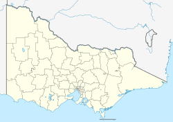
Map
Australia Victoria location map.svg
Airplane silhouette.svg
YBRS
Location in Victoria
Runways
Direction LengthSurface
mft
18/368002,625Sealed
09/275201,706Grass
Sources: AIP [1] and Great Circle

Barwon Heads Airport( ICAO : YBRS) is a small airfield specifically for light aircraft on the Bellarine Peninsula near the township of Barwon Heads, Victoria, Australia. [2] It is primarily used for scenic flights, private aircraft and flight training. [3]

Contents

The airport has remained small and undeveloped until recently, where development is soon to commence.[ when? ] In early 2008, a local council permit was given to construct another five hangars and associated car parking. [4]

The airport has a flight training school with two classrooms, fuel facilities and a seafood outlet. A shower and toilets are located in the terminal building, where there is also a kitchen, snack and drink machines and a lounge area. [5]

The airport has two runways, the main one is a sealed north–south runway, and there is a smaller east/west grass runway, primarily for ultralight aircraft, and light aircraft in stronger wind conditions
History

Runway layout and parking map (page 1 of 2) Barwon Heads Airport (YBRS) Runway Layout and Parking Map.pdf
Runway layout and parking map (page 1 of 2)

The owners of Barwon Heads Airport have regularly raised their concerns in relation to skydiving being conducted in the vicinity of the airport. [6] [7] Their concerns are that the airport runway is too close to many proposed drop zones that have been suggested. In 2005, a ban was placed on skydiving in the vicinity of the airport. In 2008, airport owners accused the business Skydive City of using an illegal runway 200 m (660 ft) from the airport days after the business was evicted from an airport hangar for failing to pay rent. [8] Airport owners claimed that the illegal runway was compromising the safety of airport users.

Accidents and Incidents

On 25 April 2014, a skydiver was killed when his parachute failed to open. An investigation is currently being conducted by the Australian Parachute Federation.

See also

Related Research Articles

<span class="mw-page-title-main">Drop zone</span> Designated site for manned or unmanned parachute landings

A drop zone (DZ) is a place where parachutists or parachuted supplies land. It can be an area targeted for landing by paratroopers and airborne forces, or a base from which recreational parachutists and skydivers take off in aircraft and land under parachutes. In the latter case, it is often beside a small airport, frequently sharing the facility with other general aviation.

<span class="mw-page-title-main">Wingsuit flying</span> Variant of skydiving

Wingsuit flying is the sport of skydiving using a webbing-sleeved jumpsuit called a wingsuit to add webbed area to the diver's body and generate increased lift, which allows extended air time by gliding flight rather than just free falling. The modern wingsuit, first developed in the late 1990s, uses a pair of fabric membranes stretched flat between the arms and flanks/thighs to imitate an airfoil, and often also between the legs to function as a tail and allow some aerial steering.

<span class="mw-page-title-main">Geelong Airport</span> Airport in Grovedale

Geelong Airport was a small airfield specifically for light aircraft located in Mount Duneed, Victoria, Australia. It was primarily used for scenic flights and private aircraft, and was located in the local government area of the City of Greater Geelong.

Tracking is a technique used by skydivers during freefall to increase their horizontal speed. Tracking is considered a fundamental skill in the sport because it allows multiple skydivers to gain separation from each other prior to deploying their parachutes. Nearly all licensing organizations mandate a student show proficiency at tracking in order to obtain their skydiving license.

Goulburn Airport is a general aviation airport located 7 km (4.3 mi) south of Goulburn, New South Wales. Throughout the 1990s, suggestions were put forward to have Goulburn airport as a secondary international airport to service Sydney.

<span class="mw-page-title-main">Zephyrhills Municipal Airport</span> Public Airport in Zephyrhills , Florida, U.S.

Zephyrhills Municipal Airport is a public use airport in Pasco County, Florida, United States. It is owned by the City of Zephyrhills and located one nautical mile (2 km) southeast of its central business district. This airport is included in the National Plan of Integrated Airport Systems for 2011–2015, which categorized it as a general aviation facility.

Allegan City Airport is a general aviation airport located 1 mile (2 km) east of Allegan in Allegan County, Michigan, United States.

Moruya Airport is an airport located 3.5 NM northeast of Moruya, New South Wales, Australia, at the mouth of the Moruya River. It is one of two airports with regular passenger flights in the state's South Coast region, but also caters to general aviation and tourism operators, as well as emergency services.

In the United States, skydiving is a self-regulated sport, which means skydivers, in the US, voluntarily follow a set of basic safety requirements established by the U.S. Parachute Association. Federal requirements can be found in the Federal Aviation Regulations. Most of the regulations concern the aircraft, pilot and rules of flight. However, 14 CFR Part 105, "Parachute Operations" regulates when and where jumps may be made and designates the requirements for parachute equipment and packing. For example, 14 CFR Part 105 requires the person packing either the main chute or the reserve parachute to be a certificated rigger, which means he or she has taken an FAA-approved training course and has passed rigorous FAA testing.

<span class="mw-page-title-main">Skydive Hibaldstow</span>

Skydive Hibaldstow is a parachuting and skydiving drop zone centre in Hibaldstow, North Lincolnshire, England. Skydive Hibaldstow is affiliated with the skydiving company British Skydiving.

Eagles Nest Airport is a privately owned public-use airport serving general aviation aircraft. It was upgraded in April 1989, but had been in operation since the 1960s. It is located two nautical miles north of the community of West Creek, in Eagleswood Township, New Jersey.

Grand Haven Memorial Airpark is a public airport owned and operated by the City of Grand Haven located 2 miles (3.2 km) southeast of Grand Haven, Michigan. The airport is uncontrolled, and is used for general aviation purposes. It is included in the Federal Aviation Administration (FAA) National Plan of Integrated Airport Systems for 2017–2021, in which it is categorized as a local general aviation facility.

<span class="mw-page-title-main">Parachuting</span> Action sport of exiting an aircraft and returning to Earth using a parachute

Parachuting and skydiving is a method of transiting from a high point in an atmosphere to the ground or ocean surface with the aid of gravity, involving the control of speed during the descent using a parachute or parachutes.

Arthur Dunn Airpark is a public-use airport located 2 miles (3.2 km) northwest of the central business district of the city of Titusville in Brevard County, Florida, United States. The airport is publicly owned and is administered under the cognizance of the Titusville-Cocoa Airport Authority. The airport has one paved runway that is 2,961 feet in length and a turf runway that is 1,805 feet in length.

Parachute School of Toronto was a Canadian Sport Parachuting Association affiliated parachuting centre and skydiving drop zone operating from the Baldwin_Airport in Georgina,_Ontario.

Perris Valley Airport is a privately owned and operated airport open to public use and located one mile (1.6 km) southeast of Perris, serving Riverside County, California, United States. It has one runway and is used for general aviation and extensive skydiving. The airport operates from dawn to dusk daily year-round.

<span class="mw-page-title-main">Voss Airport, Bømoen</span> Airport in Bømoen, Voss

Voss Airport, Bømoen is a general aviation airport located on the former Bømoen Base in Vossevangen in Voss Municipality in Vestland county, Norway. The airport consists of an asphalt 1,000-meter (3,300 ft) runway designated 09/27. The municipal airport is used by the helicopter operator Fonnafly as well as for hanggliding, parachuting and sailplane activities.

<span class="mw-page-title-main">West Auckland Airport</span> Airport in Auckland

West Auckland Airport Parakai West Auckland Airport is a general aviation (GA) airport on the North Western edge of Auckland, New Zealand. It is close to the town of Parakai and 2 nautical miles (3.8 km) northwest of Helensville at the southern end of the Kaipara Harbour. The Airport is operated by West Auckland Airport Company Ltd, under 'Airport Authority' status.

<span class="mw-page-title-main">Skydive Empuriabrava</span> Parachuting in Spain

Skydive Empuriabrava is the brand that has been commercially operating Empuriabrava Aerodrome since 1985. Since it began operating its main activity has been skydiving although it also offers photo flights, aerial and tourist advertising, and runs a school of aviation for private pilots.

The Skydive Chicago Resort is a skydiving resort and camping ground in Ottawa, Illinois in the United States. It operates a private airport, Skydive Chicago Airport, and offers indoor and outdoor skydiving, along with camping, RV parking, an observation area and restaurant, and an auditorium. The airport is located on the Illinois River. The resort claims to operate the largest fleet of skydiving aircraft in the midwestern United States.

References