Geelong Airport

Last updated

Geelong Airport
Summary
Airport typePublic
ServesGeelong
Location Grovedale
Elevation  AMSL 140 ft / 43 m
Coordinates 38°13′31″S144°19′59″E / 38.22528°S 144.33306°E / -38.22528; 144.33306
Map
Australia Victoria location map.svg
Airplane silhouette.svg
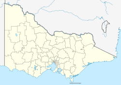
YGLG
Location in Victoria
Runways
Direction LengthSurface
mft
09/27Gravel
18/36Asphalt
Reference [1] YGLG – Perth  (PDF). AIP En Route Supplement from Airservices Australia , effective 2023-11-30

Geelong Airport( IATA : GEX, ICAO : YGLG) was a small airfield specifically for light aircraft located in Mount Duneed, Victoria, Australia. It was primarily used for scenic flights and private aircraft, and was located in the local government area of the City of Greater Geelong.

The airport contained two gravel/tarmac runways: north/south and east/west. Though commercial airlines had attempted to fly services to Geelong in the past, they chose to use the more developed airport at Avalon, located to the north side of Melbourne. Operations from Avalon also proved to be unsuccessful. Other airports in the area are at Barwon Heads ( ICAO : YBRS), the Torquay Airport and the Tiger Moth World at 325 Blackgate Rd.

The site is also used to record wind and weather measurements for the area. [2] Geelong airport was sold to property developers to allow for the expansion of the urban sprawl of Geelong. The airport closed on 31 December 2011. [3]

Since 2011 closure and later redevelopment, only the former office building and a hangar remained. While the hangar has been retained for future use, the office building, although repainted, was allowed to decay and became a target for vandalism. On 10 September 2022, a suspicious fire damaged the office building beyond repair. It was demolished a month later.

The former Geelong Airport office in October 2021 Geelong airport office.jpg
The former Geelong Airport office in October 2021
The former Geelong Airport office under demolition in October 2022. Geelongairportdemolition.jpg
The former Geelong Airport office under demolition in October 2022.
The former Geelong Airport hangar building in October 2021. Geelongairporthangar.jpg
The former Geelong Airport hangar building in October 2021.

See also

Related Research Articles

<span class="mw-page-title-main">Geelong</span> City in Victoria, Australia

Geelong is a port city in Victoria, Australia, located at the eastern end of Corio Bay and the left bank of Barwon River, about 65 km (40 mi) southwest of Melbourne.

<span class="mw-page-title-main">Greater Moncton Roméo LeBlanc International Airport</span> International airport serving Moncton, New Brunswick, Canada

Greater Moncton Roméo LeBlanc International Airport or Moncton/Greater Moncton Roméo LeBlanc International Airport is located in the city of Dieppe 4 nautical miles east northeast of downtown Moncton, New Brunswick, Canada. Originally named Greater Moncton International Airport, the airport was renamed in 2016, in honour of former Governor General Roméo LeBlanc.

<span class="mw-page-title-main">Avalon, Victoria</span> Town in Victoria, Australia

Avalon is a locality situated north east of Geelong, Victoria. Its local government area is the City of Greater Geelong and its Ward is Windermere. It is located on the northern shore of Corio Bay to the southwest of the state's capital city of Melbourne.

<span class="mw-page-title-main">Gold Coast Airport</span> Airport

Gold Coast Airport is an international Australian airport located at the southern end of the Gold Coast and approximately 90 km (56 mi) south of Brisbane, within the South East Queensland agglomeration. The entrance to the airport is situated in the suburb of Bilinga near Coolangatta. The main runway itself cuts through the state borders of Queensland and New South Wales. During summer, these states are in two different time zones. The Gold Coast Airport operates on Queensland Time.

<span class="mw-page-title-main">Avalon Airport</span> International airport Greater Geelong, Victoria, Australia

Avalon Airport is an international capable airport, while currently domestic airport, located in Avalon in the City of Greater Geelong in Victoria, Australia. While located outside the Melbourne metropolitan area, it is the second busiest of the four airports serving the state capital in passenger traffic. It is located 15 km (9 mi) north-east of the Geelong CBD and 50 kilometres (31 mi) south-west of the Melbourne CBD. The airport is operated by Avalon Airport Australia Pty Ltd, a subsidiary of Linfox.

Lara is a town in Victoria, 18 km north-east of the Geelong CBD, inland from the Princes Freeway to Melbourne. Its population at the 2021 census was 19,014.

<span class="mw-page-title-main">Essendon Airport</span> Municipal airport serving Melbourne, Victoria, Australia

Essendon Fields Airport, colloquially known by its former name Essendon Airport, is a 305 ha public airport serving scheduled commercial, corporate-jet, charter and general aviation flights. It is located next to the intersection of the Tullamarine and Calder Freeways, in the north western suburb of Essendon Fields of Melbourne, Victoria, Australia. The airport is the closest to Melbourne's City Centre, approximately an 11 km (6.8 mi) drive north-west from it and 8 km (5.0 mi) south-east from Melbourne–Tullamarine Airport. In 1970, Tullamarine Airport replaced Essendon as Melbourne's main airport.

Mount Duneed is a suburb of Geelong, Victoria, Australia. It is divided between the City of Greater Geelong and Surf Coast Shire local government areas. Mount Duneed itself is an extinct volcano and the remains of the crater can be seen in the Mount Duneed Recreation Reserve.

Melton Airfield is a small grass strip airfield located approximately 5 km (3.1 mi) north of the city centre of Melton in the City of Melton, Victoria, Australia.

Taunton Municipal Airport, also known as King Field, is a public use airport located three nautical miles (6 km) east of the central business district of Taunton, a city in Bristol County, Massachusetts. It is located in the East Taunton neighborhood of the city. The city-owned airport is maintained and operated by the Taunton Airport Commission. According to the FAA's National Plan of Integrated Airport Systems for 2009–2013, it is categorized as a general aviation airport.

<span class="mw-page-title-main">City Airport & Manchester Heliport</span> Airport near Manchester, England

Barton Aerodrome is an airport in Barton-upon-Irwell, Greater Manchester, England, 5 nautical miles west of Manchester. Formerly known as City Airport and City Airport Manchester, It is known by the Civil Aviation Authority (CAA) as Manchester/Barton and rebranded as Manchester Barton Aerodrome on 3rd April 2023.

<span class="mw-page-title-main">Ballina Byron Gateway Airport</span> Airport in Ballina, New South Wales

Ballina Byron Gateway Airport is a regional airport located at Ballina, New South Wales, Australia. It is owned and operated by Ballina Shire Council. It opened in October 1986. It serves Ballina and the nearby town of Byron Bay, a 20-minute drive north. Ballina Byron Airport handled 650,323 passengers between March 2022 and March 2023 making it the 16th busiest airport in Australia.

<span class="mw-page-title-main">Flinders Island Airport</span> Airport in Whitemark, Tasmania, Australia

Flinders Island Airport is a small regional airport located 2 nautical miles northwest of Whitemark on Flinders Island off the north-east coast of Tasmania, Australia. The airport is owned and operated by the Flinders Council. The airport site has a total area of approximately 134 hectares. Access to the airport is off Palana Road. The primary aviation facilities at Flinders Island Airport consist of two sealed runways, a sealed taxiway, a sealed apron, a grassed apron and a fuel storage facility. Adjacent to the sealed apron is a passenger terminal building with an associated car parking area. There is only one small hangar on the site at present. The primary use of Flinders Island Airport is for Regular Public Transport (RPT) services operated by Sharp Airlines which offers services to and from Melbourne and Launceston. The airport is also used for charter and freight services, emergency services and private/recreational flying.

Bendigo Airport, is located in East Bendigo just north of Bendigo, Victoria, Australia, just off the Midland Highway. The airport is located approximately 10 minutes away from the Bendigo CBD.

Portland Airport is located within the locality of Cashmore, 7 nautical miles northwest of Portland, Victoria, Australia. Opened in 1982, the airport is one of only three in the state outside Melbourne to receive regular passenger services, providing an important gateway for southwest Victoria. The airport is home to the Portland Aero Club and is the maintenance base of Sharp Airlines. From 2009 onwards, the Victorian Government contributed funding for works to modernize the airport, including upgrade the airport's aprons, taxiways and terminal building, completed in 2014.

<span class="mw-page-title-main">Barwon Heads Airport</span> Airport in Connewarre, Australia

Barwon Heads Airport is a small airfield specifically for light aircraft on the Bellarine Peninsula near the township of Barwon Heads, Victoria, Australia. It is primarily used for scenic flights, private aircraft and flight training.

<span class="mw-page-title-main">Porepunkah Airfield</span> Airport

Porepunkah Airfield is located in the Buckland Valley 1.5 nautical miles southwest of the township of Porepunkah, Victoria, Australia. It is home to general aviation, ultralight and weight shift aircraft, gliders and occasionally hang gliders.

<span class="mw-page-title-main">Joseph A. Hardy Connellsville Airport</span> Airport in Fayette County, Pennsylvania

Joseph A. Hardy Connellsville Airport is a public-use airport located four nautical miles southwest of Connellsville in Dunbar Township, Fayette County, Pennsylvania, United States. It is owned by the Fayette County Airport Authority and serves the south-eastern segment of the Pittsburgh metropolitan area. The airport serves the general aviation community with no scheduled commercial airline service.

<span class="mw-page-title-main">Lethbridge Airpark</span> Airport in Lethbridge

Lethbridge Airpark is a privately owned aerodrome located 6 km (3.7 mi) north of the rural township of Lethbridge between the regional cities of Geelong 35 km (22 mi) to the south and Ballarat 50 km (31 mi) to the north in Victoria, Australia. The 80 ha site caters to private and recreational pilots, and offers flight training. Current facilities at the airport include several hangars, an aircraft maintenance workshop, and basic amenities including toilets and showers.

References