Tyabb Airport | |||||||||||||||
---|---|---|---|---|---|---|---|---|---|---|---|---|---|---|---|
Summary | |||||||||||||||
Airport type | Private | ||||||||||||||
Operator | Peninsula Aero Club | ||||||||||||||
Location | Tyabb, Victoria | ||||||||||||||
Elevation AMSL | 88 ft / 27 m | ||||||||||||||
Coordinates | 38°16′0″S145°10′46″E / 38.26667°S 145.17944°E Coordinates: 38°16′0″S145°10′46″E / 38.26667°S 145.17944°E | ||||||||||||||
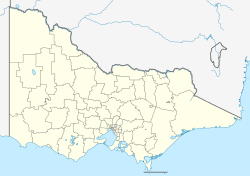
Map | |||||||||||||||
Runways | |||||||||||||||
| |||||||||||||||
Helipads | |||||||||||||||
| |||||||||||||||
Tyabb Airport( ICAO : YTYA), also called Tyabb Airfield, [2] is a small regional airport located just west of the town of Tyabb, Victoria on the Mornington Peninsula. Tyabb is the site of the Tyabb Air Show, which is held every two years. [3]
The Mornington Peninsula National Park is a national park located in the Greater Melbourne region of Victoria, Australia. The 2,686-hectare (6,640-acre) national park is situated approximately 90 kilometres (56 mi) south of Melbourne on the Mornington Peninsula.
The Mornington Peninsula is a peninsula located south of Melbourne, Victoria, Australia. It is surrounded by Port Phillip to the west, Western Port to the east and Bass Strait to the south, and is connected to the mainland in the north. Geographically, the peninsula begins its protrusion from the mainland in the area between Pearcedale and an area north of Frankston. The area was originally home to the Mayone-bulluk and Boonwurrung-Balluk clans and formed part of the Boonwurrung nation's territory prior to European settlement.
Pearcedale is a township and coastal rural locality in Victoria, Australia, 49 km south-east of Melbourne's Central Business District, located within the City of Casey and the Shire of Mornington Peninsula local government areas. Pearcedale recorded a population of 3,867 at the 2021 census.
Bittern is a town on the Mornington Peninsula in Melbourne, Victoria, Australia, 61 km (38 mi) south-east of Melbourne's Central Business District, located within the Shire of Mornington Peninsula local government area. Bittern recorded a population of 4,276 at the 2021 census.
Crib Point is a town on the Mornington Peninsula in Melbourne, Victoria, Australia, 64 km (40 mi) south-east of Melbourne's Central Business District, located within the Shire of Mornington Peninsula local government area. Crib Point recorded a population of 3,343 at the 2021 census.
Hastings is a town on the Mornington Peninsula in Melbourne, Victoria, Australia, 58 km (36 mi) south-east of Melbourne's Central Business District, located within the Shire of Mornington Peninsula local government area. Hastings recorded a population of 10,369 at the 2021 census.
Moorooduc is a rural township on the Mornington Peninsula in Melbourne, Victoria, Australia, 54 km (34 mi) south-east of Melbourne's central business district, located within the Shire of Mornington Peninsula local government area. Moorooduc recorded a population of 1,004 at the 2021 census.
Mornington is a suburb on the Mornington Peninsula in Melbourne, Victoria, Australia, 46 km (29 mi) south-east of Melbourne's Central Business District, and the most populous town in the Shire of Mornington Peninsula local government area. Mornington recorded a population of 25,759 at the 2021 census.
Somerville is a suburb on the Mornington Peninsula in Melbourne, Victoria, Australia, 49 km (30 mi) south-east of Melbourne's Central Business District, located within the Shire of Mornington Peninsula local government area. Somerville recorded a population of 11,767 at the 2021 census.
Tyabb is a township and semi rural locality on the Mornington Peninsula in Melbourne, Victoria, Australia, 53 km (33 mi) south-east of Melbourne's central business district, located within the Shire of Mornington Peninsula local government area. Tyabb recorded a population of 3,449 at the 2021 census.
Tyabb railway station is located on the Stony Point line in Victoria, Australia. It serves the town of Tyabb, and it opened on 10 September 1889.
The Mornington Peninsula Freeway is a freeway in Melbourne, Victoria, Australia, that provides a link from south-eastern suburban Melbourne to the Mornington Peninsula. Whilst the entire freeway from Dingley Village to Rosebud is declared by VicRoads as the Mornington Peninsula Freeway, the section between EastLink in Carrum Downs and Moorooduc Highway in Moorooduc is locally and commonly known as Peninsula Link. The entire freeway corridor bears the designation M11.
The Mornington Peninsula Nepean Football League is an Australian rules football competition, governed by the AFL South East. The MPNFL contains teams near the south eastern region of Melbourne, Victoria, Australia. At the end of the 2017 season, the competition was restructured from a geographical to a divisional structure, with promotion/ relegation. It contains two divisions with 22 teams in all, 10 in Division 1 and 12 in Division 2.
The County of Mornington is one of the 37 counties of Victoria which are part of the cadastral divisions of Australia, used for land titles. It is located to the south-east of Melbourne, including the Mornington Peninsula, French Island and Phillip Island. The county was proclaimed in 1849.
The electoral district of Mornington is an electoral district of the Victorian Legislative Assembly. The electorate can be described as outer metropolitan and rural, including animal farming, grape production and wineries. The district is 155 square kilometres in area.
The Shire of Hastings was a local government area about 60 kilometres (37 mi) south-southeast of Melbourne, the state capital of Victoria, Australia, encompassing the eastern extremity of the Mornington Peninsula. The shire covered an area of 304.6 square kilometres (117.6 sq mi), and existed from 1960 until 1994.
The Western Port Bay Trail is a shared use path for cyclists and pedestrians which follows the coastline of Western Port Bay through several towns on the eastern side of the Mornington Peninsula in Melbourne, Victoria, Australia. The trail begins in Somerville, travelling south through the towns of Tyabb, Hastings, Bittern, Somers and ending in the town of Balnarring. Construction of the trail began in 1994, initially only as a 9 km path connecting the towns of Somerville, Tyabb and Hastings.
Mornington Secondary College is a secondary school in Mornington, Victoria, Australia serving the communities of Somerville, Tyabb, Moorooduc, Mount Martha, and Mornington on the Mornington Peninsula and offers the Hands On Learning, The Victoria Police Youth Corp and Drum Corp, and many other extra-curricular programs to its students. MSC strives to achieve the best for students.
RPP FM is a community radio station in the Mornington Peninsula region of Victoria, Australia. The radio station was established in 1984 to provide a local community radio service to the region.
On 28 March, 2021, 46 civil light aircraft flew in a massed formation over RAAF Point Cook, in Victoria, Australia, to commemorate the centenary of the Royal Australian Air Force. The RAAF Centenary Air Armada was organised by members of the Royal Victorian Aero Club, the Peninsula Aero Club, and the Lilydale Flying Club.