
The Hume Highway, including the sections now known as the Hume Freeway and the Hume Motorway, is one of Australia's major inter-city national highways, running for 840 kilometres (520 mi) between Melbourne in the southwest and Sydney in the northeast. Upgrading of the route from Sydney's outskirts to Melbourne's outskirts to dual carriageway was completed on 7 August 2013.

Shepparton is a city located on the floodplain of the Goulburn River in northern Victoria, Australia, approximately 181 kilometres (112 mi) north-northeast of Melbourne. As of the 2021 census, the estimated population of Shepparton, including the adjacent town of Mooroopna, was 53,841.

Tocumwal is a town in the southern Riverina region of New South Wales, Australia, in the Berrigan Shire local government area. The town, 270 kilometres (170 mi) north of the city of Melbourne, lies on the northern bank of the Murray River, which forms the border with Victoria.

Mooroopna is a town located 181 kilometres (112 mi) north of Melbourne, Victoria, Australia. It is on the banks of the Goulburn River opposite the larger town of Shepparton. The Midland Highway crosses the river between the two towns. On the 30th June 2022, Mooroopna had a population of 8,921.

Essendon Fields Airport, colloquially known by its former name Essendon Airport, is a 305 ha public airport serving scheduled commercial, corporate-jet, charter and general aviation flights. It is located next to the intersection of the Tullamarine and Calder Freeways, in the north western suburb of Essendon Fields of Melbourne, Victoria, Australia. The airport is the closest to Melbourne's City Centre, approximately an 11 km (6.8 mi) drive north-west from it and 8 km (5.0 mi) south-east from Melbourne–Tullamarine Airport. In 1970, Tullamarine Airport replaced Essendon as Melbourne's main airport.

Goulburn Valley Highway is a highway located in Victoria, Australia, linking Tocumwal on the Murray River through North Central Victoria to Eildon. The section north of the Hume Freeway is part of the Melbourne to Brisbane National Highway and is the main link between these two cities, as well as a major link between Victoria and inland New South Wales. It is also the most direct route between Melbourne and the major regional centre of Shepparton in Victoria.

Strahan Airport is an airport located 2 nautical miles west of Strahan, Tasmania, Australia. It is the main airport for the West Coast of Tasmania, and is owned and maintained by the West Coast Council. The need for an airport in the area was suggested in the 1950s, and suggestions for upgrades have occurred over time.

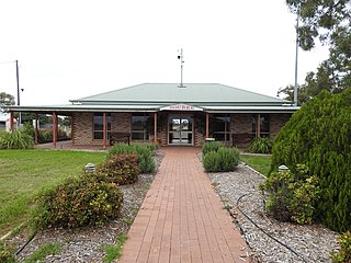
Nagambie is a town in the Goulburn Valley region of Victoria, Australia. The city is on the Goulburn Valley Freeway north of Seymour and in the Shire of Strathbogie. As of 2021 census, Nagambie had a population of 2,254.

Bairnsdale Airport is located 4 nautical miles south west of Bairnsdale, Victoria, Australia, off the Princes Highway.
Echuca Airport is located 1.5 nautical miles south of Echuca, Victoria, Australia.

Bundaberg Airport is a regional airport serving Bundaberg, a city in the Australian state of Queensland. It is located 2.5 nautical miles southwest of the city centre, on North Childers Road and Takalvan Street. The airport is owned and operated by the Bundaberg Regional Council. It is also known as Bundaberg Regional Airport.
Bourke Airport is an airport located 4 nautical miles north of Bourke, New South Wales, Australia. The airport is located at an elevation of 352 ft (107 m) above sea level. It has two runways: 05/23, an asphalt runway 1,830 m (6,004 ft) long, and 18/36, a grass runway 1,000 m (3,281 ft) long.
Mudgee Airport is a regional airport located 3 nautical miles north northeast of Mudgee, New South Wales, Australia. The airport is frequently used for technical training. FlyPelican operates a flight to Sydney, making it the only commercial airline serving Mudgee.

The Shire of Nathalia was a local government area on the Murray River in the Goulburn Valley region, about 220 kilometres (137 mi) north of Melbourne, the state capital of Victoria, Australia. The shire covered an area of 1,238.97 square kilometres (478.4 sq mi), and existed from 1879 until 1994.

The Shire of Numurkah was a local government area on the Murray River in the Goulburn Valley region, about 210 kilometres (130 mi) north of Melbourne, the state capital of Victoria, Australia. The shire covered an area of 820 square kilometres (316.6 sq mi), and existed from 1957 until 1994.

The Shire of Shepparton was a local government area in the Goulburn Valley region, about 180 kilometres (112 mi) north of Melbourne, the state capital of Victoria, Australia. The shire covered an area of 927.49 square kilometres (358.1 sq mi), and existed from 1884 until 1994. From 1927 onwards, Shepparton itself was managed by a separate entity, ultimately known as the City of Shepparton.

The City of Shepparton was a local government area in the Goulburn Valley region, about 180 kilometres (112 mi) north of Melbourne, the state capital of Victoria, Australia. The city covered an area of 26.71 square kilometres (10.3 sq mi), and existed from 1927 until 1994. It excluded areas such as Mooroopna and Kialla, which are now considered to be suburbs.
Gunnedah Airport is a small airport located 1 nautical mile north of Gunnedah, New South Wales, Australia.

Keith Noel Everal ("Bill") Bradfield, FIEAust, also known as K. N. E. Bradfield, was an Australian civil and aviation engineer, public servant and diplomat, who served two terms as Australia's Permanent Representative to the International Civil Aviation Organization. Bradfield is one of four Australian recipients of the ICAO Edward Warner Award, civil aviation's highest honour.
The Goulburn Valley Football Association (GVFA) is an Australian rules football competition that was first established in 1888 in the Goulburn Valley of Victoria, Australia, with the foundation clubs being Cobram, Muckatah, Nathalia, Numurkah, Wunghnu and Yarroweyah.

