Tory Creek is a stream in Carroll and Floyd counties, Virginia, in the United States. [1]
Carroll County is a United States county located in the southwestern part of the Commonwealth of Virginia. Roughly one fifth of the county lies in the Virginia Piedmont region, while the rest is part of the Appalachian Mountains. The Carroll county seat and largest town is Hillsville.
Floyd County is a county located in the Commonwealth of Virginia. As of the 2010 census, the population was 15,279. Its county seat is Floyd.
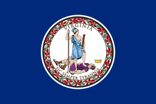
Virginia, officially the Commonwealth of Virginia, is a state in the Southeastern and Mid-Atlantic regions of the United States located between the Atlantic Coast and the Appalachian Mountains. Virginia is nicknamed the "Old Dominion" due to its status as the first English colonial possession established in mainland North America and "Mother of Presidents" because eight U.S. presidents were born there, more than any other state. The geography and climate of the Commonwealth are shaped by the Blue Ridge Mountains and the Chesapeake Bay, which provide habitat for much of its flora and fauna. The capital of the Commonwealth is Richmond; Virginia Beach is the most populous city, and Fairfax County is the most populous political subdivision. The Commonwealth's estimated population as of 2017 is over 8.4 million.
Tories who camped along Tory Creek after the Revolutionary War caused the name to be selected. [2]

Loyalists were American colonists who stayed loyal to the British Crown during the American Revolutionary War, often called Tories, Royalists, or King's Men at the time. They were opposed by the Patriots, who supported the revolution, and called them "persons inimical to the liberties of America". Prominent Loyalists repeatedly assured the British government that many thousands of them would spring to arms and fight for the crown. The British government acted in expectation of that, especially in the southern campaigns in 1780-81. In practice, the number of Loyalists in military service was far lower than expected since Britain could not effectively protect them except in those areas where Britain had military control. The British were often suspicious of them, not knowing whom they could fully trust in such a conflicted situation; they were often looked down upon. Patriots watched suspected Loyalists very closely and would not tolerate any organized Loyalist opposition. Many outspoken or militarily active Loyalists were forced to flee, especially to their stronghold of New York City. William Franklin, the royal governor of New Jersey and son of Patriot leader Benjamin Franklin, became the leader of the Loyalists after his release from a Patriot prison in 1778. He worked to build Loyalist military units to fight in the war, but the number of volunteers was much fewer than London expected.
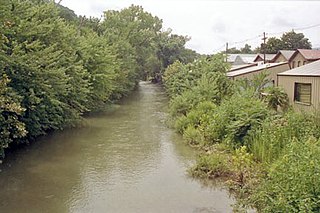
New Creek is an 18.4-mile-long (29.6 km) stream in eastern West Virginia. It is the third major West Virginia tributary to the North Branch Potomac River. Via the Potomac, it is part of the watershed of Chesapeake Bay.
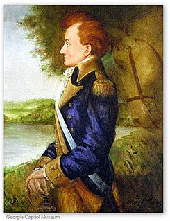
Stephen Heard was the president of Georgia, a position that was, out of necessity, named from the Georgia House of Representatives and was later known as Governor. He served in this position from May 24, 1780 until August 18, 1781. One record lists Heard as resigning as president in 1782.
Odd is an unincorporated community in Raleigh County, West Virginia, United States. It is located along Tommy Creek.
Lunice Creek is a 7.3-mile-long (11.7 km) tributary of the South Branch Potomac River, belonging to the Potomac River and Chesapeake Bay watersheds. The creek is located in Grant County, West Virginia. Lunice Creek is created by its North and South Forks and empties into the South Branch at Petersburg.
Sleepy Creek is an unincorporated community in Morgan County, West Virginia on the Potomac River at the mouth of Sleepy Creek. By 1860, Sleepy Creek had a post office and functioned as an important station on the Baltimore and Ohio Railroad.
Bunker Hill is an unincorporated community in Berkeley County, West Virginia, USA, located in the lower Shenandoah Valley on Winchester Pike at its junction with County Route 26 south of Martinsburg. It is the site of the confluence of Torytown Run and Mill Creek, a tributary of Opequon Creek which flows into Winchester, Virginia. According to the 2000 census, the Bunker Hill community has a population of 5,319.
Tuscarora Creek in Berkeley County, West Virginia is an 11.4-mile-long (18.3 km) tributary of Opequon Creek, which drains into the Potomac River in the Chesapeake Bay watershed.
Abram Creek is a 19.4-mile-long (31.2 km) tributary stream of the North Branch Potomac River in Grant and Mineral counties in West Virginia's Eastern Panhandle.
Sandyville is an unincorporated community in north central Jackson County, West Virginia, United States. It lies close to the left fork of Sandy Creek, nestled in the hills between Ravenswood and Ripley. It has a population of 1,721 and an average household income of $41,122.
Quick is a small unincorporated community in Kanawha County, West Virginia, United States. It is located along Indian Creek Road. The community is where Whitoak Fork and Blue Creek come together and meet. It is also where the abandoned railroad that follows Blue Creek joins the road, and follows it all the way to the community of Hitop, along Pond Fork. Its post office is closed.
Becky Creek Wildlife Management Area is located on 1,930 acres (780 ha) south of Huttonsville in Randolph County, West Virginia. The terrain at Becky Creek is steep, and is covered with second-growth hardwood forest. Camping is permitted in the designated area. Camping is also available at nearby Kumbrabow State Forest.
Belva is an unincorporated community and census-designated place in west Nicholas County and north Fayette County, West Virginia, United States; while the CDP only includes the Nicholas County portion, the Fayette County portion is considered part of the community. The town is situated at the bottomland surrounding the convergence of Bells Creek with Twentymile Creek and, subsequently, Twenty Mile Creek with the Gauley River. Belva is also the location of the convergence of two state highways: West Virginia Route 16 and West Virginia Route 39.
Soak Creek is an unincorporated community in Raleigh County, West Virginia, United States.
Big Creek is a census-designated place (CDP) in Logan County, West Virginia, United States. Big Creek is located on West Virginia Route 10 2.5 miles (4.0 km) northwest of Chapmanville. Big Creek has a post office with ZIP code 25505. As of the 2010 census, its population was 237.
Peach Creek is an unincorporated community in Logan County, West Virginia, United States. Peach Creek is located on the east bank of the Guyandotte River across from West Logan. Peach Creek has a post office with ZIP code 25639.
Patterson Creek is a 51.2-mile-long (82.4 km) tributary of the North Branch Potomac River in West Virginia's Eastern Panhandle, in the United States. It enters the North Branch east of Cumberland, Maryland, with its headwaters located in Grant County, West Virginia. Patterson Creek is the watershed for two-thirds of Mineral County.
Beckwith is an unincorporated community in Fayette County, West Virginia, United States. Beckwith is located on West Virginia Route 16 and Laurel Creek 4.1 miles (6.6 km) northwest of Fayetteville. Beckwith had a post office, which closed on October 3, 1998. The community has the name of P. D. Beckwith.
Stone Creek is an unincorporated community in Lee County, Virginia, United States.
Laurel Creek is an unincorporated community and coal town in Fayette County, West Virginia, United States.
Tory Creek may refer to:
| This article related to a river in Virginia is a stub. You can help Wikipedia by expanding it. |