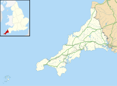
Chûn Castle is a large Iron Age hillfort (ringfort) near Penzance in Cornwall, England, United Kingdom. The fort was built about 2,500 years ago, and fell into disuse until the early centuries AD when it was possibly re-occupied to protect the nearby tin mines. It stands beside a prehistoric trackway that was formerly known as the Old St Ives Road and the Tinners’ Way. The name Chûn derives from Cornish: Chi an Woon. The area is now sometimes known as Chûn Downs. Nearby is Chûn Quoit.

Penzance is a town, civil parish and port in the Penwith district of Cornwall, England, United Kingdom. It is the westernmost major town in Cornwall and is about 64 miles (103 km) west-southwest of Plymouth and 255 miles (410 km) west-southwest of London. Situated in the shelter of Mount's Bay, the town faces south-east onto the English Channel, is bordered to the west by the fishing port of Newlyn, to the north by the civil parish of Madron and to the east by the civil parish of Ludgvan. The civil parish includes the town of Newlyn and the villages of Mousehole, Paul, Gulval, and Heamoor. Granted various royal charters from 1512 onwards and incorporated on 9 May 1614, it has a population of 21,200.
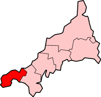
Penwith is an area of Cornwall, England, located on the peninsula of the same name. It is also the name of a former local government district, whose council was based in Penzance. The area is named after one of the ancient administrative hundreds of Cornwall which derives from two Cornish words, penn meaning 'headland' and wydh meaning 'at the end'.

Mousehole is a village and fishing port in Cornwall, England, UK. It is approximately 2.5 miles (4 km) south of Penzance on the shore of Mount's Bay. The village is in the civil parish of Penzance. An islet called St Clement's Isle lies about 350 metres (380 yd) offshore from the harbour entrance.

Madron is a civil parish and village in west Cornwall, England, United Kingdom. Madron is named after Saint Madern's Church. Its annual Trafalgar Service commemorating the death of Vice Admiral Horatio Nelson was started on 27 October 1946, following a local tradition that his death was first announced on British soil in the Union Hotel, Penzance.
Carnyorth is a hamlet in west Cornwall, England, United Kingdom. It is approximately one mile (1.6 km) south of Pendeen and six miles (10 km) northwest of Penzance. It is in the civil parish of St Just in Penwith
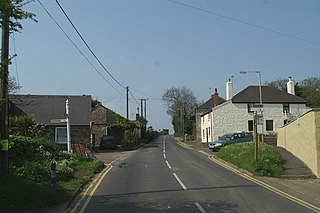
Drift is a village on the A30 road in west Cornwall, England, United Kingdom. The village is in the civil parish of Sancreed and is approximately two miles (3 km) west of Penzance and six miles (9 km) from Land's End.
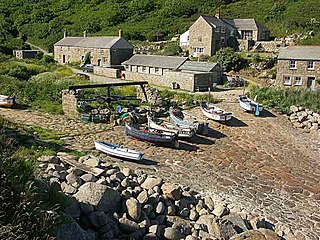
Penberth is a valley, coastal village and cove on the Penwith peninsula in Cornwall, England. It is approximately 7 miles (11 km) southwest of Penzance. Most of the village is within the parish of St Buryan and the boundary with St Levan follows the Penberth river.

Nancledra or Nancledrea is a village in west Cornwall, England, UK. It is three miles (5 km) south of St Ives and four miles (6.5 km) north-northeast of Penzance. Nancledra is a small village with a population of around 150. The village is in Towednack civil parish in the former mining area of Penwith peninsula.

Penwith Hundred was one of ten ancient administrative hundreds of the county of Cornwall, England, UK. The ancient hundred of Penwith was larger than the local government district of Penwith (1974–2009) which took its name. Daphne du Maurier in Vanishing Cornwall suggests that the name, Penwith, has three renderings, "the last promontory," "promontory on the left, and "the headland of slaughter," thus suggesting that this area might have been the site of prehistoric invasions of sea-borne fighters, or perhaps tribal battles. The eastern part became part of Kerrier District.
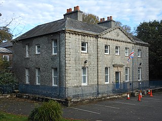
Castle Horneck is a Grade II* listed building, and refurbished Georgian mansion to the west of the Cornish town of Penzance. It is currently owned by the Youth Hostels Association (YHA) and has been used as a youth hostel since 1950.

Gwavas is a residential council estate on the southern outskirts of the town of Newlyn in west Cornwall, England, United Kingdom. It is situated immediately west of Gwavas Road and takes its name from nearby Gwavas Farm.
Treneere is a residential council estate on the outskirts of Penzance, Cornwall. It was built in the 1930s in an effort to clear inner city slums, meaning the majority of residents have been poor for generations. Most of the housing within this area is owned and operated by Penwith Housing Association. Treneere falls within the Penzance East Ward of Cornwall Council.

Gurnard's Head is a prominent headland on the north coast of the Penwith peninsula in Cornwall, England. The name is supposed to reflect that the rocky peninsula resembles the head of the gurnard fish.

Truro and Penwith College is a further education college in Cornwall, England.
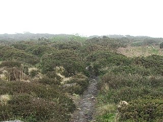
Caer Bran Hill Fort is an archaeological site near Sancreed and Carn Euny Iron Age village, on the Penwith peninsula in Cornwall.

Botallack is a village in west Cornwall, England, United Kingdom. It lies along the B3306 road which connects St Ives in the east to the A30 road, near Land's End. The village is included in the St Just in Penwith division on Cornwall Council. The original 1970s BBC television series Poldark was filmed partly in Botallack, using Manor Farm as Nampara. The Manor House, part of the Tregothnan estate, is a Grade II* listed building, dating from the 17th century.

West Cornwall's Coast FM is a local radio station for West Cornwall. It contains a combination of local news, weather, music and talk. The station launched from its studios in Penzance on 5 November 2016 as a re-brand of Penwith Radio.

The Market Building in Penzance is a Grade I listed building situated at the top of Market Jew Street, Penzance.

Chyandour Brook is a small river (brook) in west Cornwall, England. Rising in Boskednan in the civil parish of Madron, Chyandour Brook drains into Mount's Bay in the English Channel at Chyandour, Penzance.

