Hantsavichy District is an administrative subdivision, a raion of Brest Region, in Belarus.

Kaiserin-Augusta-Straße is a Berlin U-Bahn station located on the U 6. Opened in 1966 by R. G. Rümmler, it has direct access to a department store.

Moran Station is the southern terminus of Seoul Subway Line 8. It is also a station on the Bundang Line.

Doliny is a village in the administrative district of Gmina Złoczew, within Sieradz County, Łódź Voivodeship, in central Poland. It lies approximately 5 kilometres (3 mi) south-east of Złoczew, 25 km (16 mi) south of Sieradz, and 72 km (45 mi) south-west of the regional capital Łódź.
Grójec Wielki-Leśniczówka is a village in the administrative district of Gmina Złoczew, within Sieradz County, Łódź Voivodeship, in central Poland.

Bobrowa is a village in the administrative district of Gmina Żyraków, within Dębica County, Subcarpathian Voivodeship, in south-eastern Poland. It lies approximately 5 kilometres (3 mi) north-east of Żyraków, 8 km (5 mi) north of Dębica, and 42 km (26 mi) west of the regional capital Rzeszów.
Strzemieczne-Sędki is a village in the administrative district of Gmina Sypniewo, within Maków County, Masovian Voivodeship, in east-central Poland.

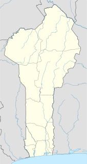
Ouaké is a town, arrondissement, and commune in the Donga Department of western Benin. The commune covers an area of 663 square kilometres and as of 2002 had a population of 45,836 people.

The canton of Sault is a French former administrative division in the department of Vaucluse and region Provence-Alpes-Côte d'Azur. It was disbanded following the French canton reorganisation which came into effect in March 2015. It consisted of 5 communes, which joined the canton of Pernes-les-Fontaines in 2015.

Dąbrowa is a village in the administrative district of Gmina Sompolno, within Konin County, Greater Poland Voivodeship, in west-central Poland. It lies approximately 4 kilometres (2 mi) south of Sompolno, 24 km (15 mi) north-east of Konin, and 107 km (66 mi) east of the regional capital Poznań.
Katarzynowo is a village in the administrative district of Gmina Wierzbinek, within Konin County, Greater Poland Voivodeship, in west-central Poland.

Dzięgiel is a settlement in the administrative district of Gmina Konarzyny, within Chojnice County, Pomeranian Voivodeship, in northern Poland. It lies approximately 8 kilometres (5 mi) north-east of Konarzyny, 22 km (14 mi) north of Chojnice, and 96 km (60 mi) south-west of the regional capital Gdańsk.

Sławosze is a village in the administrative district of Gmina Barciany, within Kętrzyn County, Warmian-Masurian Voivodeship, in northern Poland, close to the border with the Kaliningrad Oblast of Russia. It lies approximately 11 kilometres (7 mi) north of Barciany, 25 km (16 mi) north of Kętrzyn, and 82 km (51 mi) north-east of the regional capital Olsztyn.
Kołowinek is a village in the administrative district of Gmina Piecki, within Mrągowo County, Warmian-Masurian Voivodeship, in northern Poland.

Biển Bạch Đông is a commune (xã) and village in Thới Bình District, Cà Mau Province, in Vietnam.
Phỉ Điền is a commune (xã) and village in Lục Ngạn District, Bắc Giang Province, in northeastern Vietnam.

Reņģe Manor, also called Ruba Manor, is a manor house for the von Nolcken family that was built between 1881 and 1882 in the historical region of Zemgale, in Latvia. It is located about 2.5 km west of both the village of Ruba and the railroad bridge where the Glūda–Reņģe Railway crosses the Vadakste River along the border of Latvia and Lithuania. The building currently houses the Ruba primary school.

Draginac is a village in the municipality of Loznica, Serbia. According to the 2002 census, the village has a population of 324 people.

Krivus Island is the mostly ice-covered island on the east side of Johannessen Harbour in the Pitt group of Biscoe Islands, Antarctica. The feature extends 920 m in north-south direction and 1.06 km in east-west direction.

Kemere Bridge is a historical bridge in Turkey.


