Downley is a village and civil parish in Buckinghamshire, England, which was included in Wycombe district before its abolition. It is high in the Chiltern Hills, overlooking the town of High Wycombe, although today it is almost indistinguishable from the urban spread of the latter town.

Milton Abbas is a village and civil parish in Dorset, England, lying around 5 miles southwest of Blandford Forum. In the 2011 Census the civil parish had a population of 755.

A manse is a clergy house inhabited by, or formerly inhabited by, a minister, usually used in the context of Presbyterian, Methodist, Baptist and other Christian traditions.

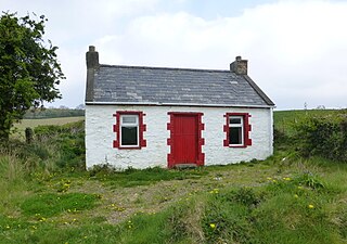
A cottage, during England's feudal period, was the holding by a cottager of a small house with enough garden to feed a family and in return for the cottage, the cottager had to provide some form of service to the manorial lord. However, in time cottage just became the general term for a small house. In modern usage, a cottage is usually a modest, often cosy dwelling, typically in a rural or semi-rural location and not necessarily in England. The cottage orné, often quite large and grand residences built by the nobility, dates back to a movement of "rustic" stylised cottages of the late 18th and early 19th century during the Romantic movement.

Crossmyloof is an area on the south side of Glasgow situated between the districts of Pollokshields, Strathbungo and Shawlands in Scotland.

Cotter, cottier, cottar, Kosatter or Kötter is the German or Scots term for a peasant farmer. Cotters occupied cottages and cultivated small land lots. The word cotter is often employed to translate the cotarius recorded in the Domesday Book, a social class whose exact status has been the subject of some discussion among historians, and is still a matter of doubt. According to Domesday, the cotarii were comparatively few, numbering fewer than seven thousand people. They were scattered unevenly throughout England, located principally in the counties of Southern England. They either cultivated a small plot of land or worked on the holdings of the villani. Like the villani, among whom they were frequently classed, their economic condition may be described as free in relation to everyone except their lord.

East Runton is a small village in Norfolk, England situated close to the North Sea. It was once a traditional fishing village outside Cromer but is now a popular holiday destination for camping and caravan holidays. The village is within the parish of Runton that also includes West Runton. The village is 1.3 miles (2.1 km) west of Cromer, 1.7 miles (2.7 km) east of West Runton, 2.7 miles (4.3 km) east of Sheringham and 21.7 miles (34.9 km) north of Norwich. The village lies on the A149 coast road but most of the dwellings can be found just south of the road, nestled around the two village greens. The population in the 2001 census was shown as 1,633 in 784 households. At the 2011 census the population was included in the civil parish of Runton. The parish area is 544 hectares.

Framsden is a village and civil parish located around 10 miles (16 km) north of Ipswich and 3 miles (5 km) south of the small market town of Debenham in the English county of Suffolk. The total population of Framsden in the census of 2001 was 299, with 125 households, 52 people under 16 years, 201 of working age and 46 over 65 years, increasing to a population of 357 in 137 households at the 2011 Census.

Glen Lyon is a glen in the Perth and Kinross region of Scotland. It is the longest enclosed glen in Scotland and runs for 34 miles from Loch Lyon in the west to the village of Fortingall in the east.
Cunninghamhead is a hamlet on the Annick Water in the Parish of Dreghorn, North Ayrshire, Scotland. The area was part of the old Cunninghamhead estate, and once contained several watermills.

Torphichen is a historic small village located north of Bathgate in West Lothian, Scotland. The village is approximately 18 miles (29 km) west of Edinburgh, 7 miles (11 km) south-east of Falkirk and 4 miles (6.4 km) south-west of Linlithgow. The village had a population of 570 in the and a population of 710 in 2016. Torphichen's placename may be Gaelic in origin, e.g., "Tóir Féichín", Tor Fithichean, or partly from Brythonic "tre fychan" or small hill.
Sorbie is a small village in Wigtownshire, Machars, within the administration area of Dumfries and Galloway Council, Scotland.

Innerwick is a coastal civil parish and small village, which lies in the east of East Lothian, five miles from Dunbar and approximately 32 miles from Edinburgh.

Thorverton is a civil parish and village in Devon, England, about a mile west of the River Exe and 8 miles (13 km) north of Exeter. It is almost centrally located between Exeter and the towns of Tiverton, Cullompton and Crediton, and contains the hamlets of Yellowford and Raddon. The parish is surrounded, clockwise from the north, by the parishes of Bickleigh, Rewe, Nether Exe, Brampford Speke, Upton Pyne, Shobrooke, Stockleigh Pomeroy and Cadbury. Most of the eastern boundary of the parish is formed by the River Exe and the land rises westwards to 800 feet (240 m) at the border with Cadbury.

Nash is a village and community to the south of the city of Newport, South Wales, in the Lliswerry ward.

Minard Castle is a 19th-century castellated mansion on the north-western shore of Loch Fyne Argyll and Bute, on the west coast of Scotland, in the parish of Kilmichael Glassary.
Southwaite railway station in Hesket parish, was situated on the Lancaster and Carlisle Railway between Carlisle and Penrith. It served the village of Southwaite, Cumbria, England. The station opened in 1846, and closed on 7 April 1952.

Hessilhead hamlet or Haselet is a small settlement or clachan in North Ayrshire, Scotland. It is situated to the east of the town of Beith and stands on the course of the Dusk Water that once drove the local mill. Hazlehead or Hasslehead are also previously used names for the estate that the hamlet was originally a part of.

Minard is a remote village on the western shore of Loch Fyne, situated between Inveraray and Lochgilphead. Minard is 13+1⁄2 miles (21.7 km) southwest of Inveraray, and is located at the northwestern corner of Achagoyle Bay. Minard is a linear village with lochside bungalows which has seen extensive building. Along the A83 road to the south is a school, church, village hall and several older cottages break up the linear aspect.


