Related Research Articles

The Irish National Land League was an Irish political organisation of the late 19th century which sought to help poor tenant farmers. Its primary aim was to abolish landlordism in Ireland and enable tenant farmers to own the land they worked on. The period of the Land League's agitation is known as the Land War. Historian R. F. Foster argues that in the countryside the Land League "reinforced the politicization of rural Catholic nationalist Ireland, partly by defining that identity against urbanization, landlordism, Englishness and—implicitly—Protestantism." Foster adds that about a third of the activists were Catholic priests, and Archbishop Thomas Croke was one of its most influential champions.

The Galway-Mayo Institute of Technology was an institute of technology, located in Galway, Ireland. In April 2022, it was formally dissolved, and its functions were transferred to Atlantic Technological University (ATU). Now a constituent institute of ATU, it has facilities in the west of Ireland. GMIT's campuses are located in Galway City, Castlebar, Letterfrack and Mountbellew. GMIT won The Sunday Times Institute of Technology of the Year award in 2004, 2007, 2015 and 2022. GMIT also has a number of specialist research centres and two Innovation Hubs.

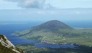
Connemara is a region on the Atlantic coast of western County Galway, in the west of Ireland. The area has a strong association with traditional Irish culture and contains much of the Connacht Irish-speaking Gaeltacht, which is a key part of the identity of the region and is the largest Gaeltacht in the country. Historically, Connemara was part of the territory of Iar Connacht. Geographically, it has many mountains, peninsulas, coves, islands and small lakes. Connemara National Park is in the northwest. It is mostly rural and its largest settlement is Clifden.

Clifden is a coastal town in County Galway, Ireland, in the region of Connemara, located on the Owenglin River where it flows into Clifden Bay. As the largest town in the region, it is often referred to as "the Capital of Connemara". Frequented by tourists, Clifden is linked to Galway city by the N59.

O'Flaherty is an Irish Gaelic clan based most prominently in what is today County Galway. The clan name originated in the 10th century as a derivative of its founder Flaithbheartach mac Eimhin. They descend in the paternal line from the Connachta's Uí Briúin Seóla. They were originally kings of Maigh Seóla and Muintir Murchada and as members of the Uí Briúin were kinsmen of the Ó Conchubhair and Mac Diarmada amongst others. After their king Cathal mac Tigernán lost out to Áed in Gai Bernaig in the 11th century, the family were pushed further west to Iar Connacht, a territory associated with Connemara today. They continued to rule this land until the 16th century. The name has been alternatively rendered into English in various forms, such as Flaherty, Faherty, Laverty, Flaverty, Lahiff, and Flahive.
Leenaun, also Leenane, is a village and 1,845 acre townland in County Galway, Ireland, on the southern shore of Killary Harbour and the northern edge of Connemara.
Ballyconneely is a village and small ribbon development in west Connemara, County Galway Ireland.

Letterfrack or Letterfrac is a small village in the Connemara area of County Galway, Ireland. It was founded by Quakers in the mid-19th century. The village is south-east of Renvyle peninsula and 15 kilometres north-east of Clifden on Barnaderg Bay and lies at the head of Ballinakill harbour. Letterfrack contains the visitors centre for Connemara National Park.
Roundstone is a village on the west coast of Ireland, in the Connemara region of County Galway. Lying opposite the island of Inishnee on Roundstone Bay, by road it is 76.3 kilometres (47.4 mi) northwest of Galway and 18 kilometres (11 mi) southeast of Clifden. Known as a haven for people in the creative arts, it hosts an annual regatta in July.

Maam Cross is a crossroads in Connemara, County Galway, Ireland. It lies within the townland of Shindilla, at the junction of the N59 from Galway to Clifden and the R336 from Galway to the Maam Valley which runs from Maum or Maam to Leenaun or Leenane.
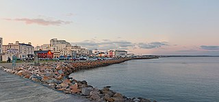
Salthill is a seaside area in the City of Galway in the west of Ireland. Lying within the townland of Lenaboy, it attracts many tourists all year round. There is a 2 km long promenade, locally known as the Prom, overlooking Galway Bay with bars, restaurants and hotels.
The murders of John Lydon and his son Martin Lydon occurred in Letterfrack, County Galway, Ireland during the Irish Land War.

Toombeola is a townland in the historical barony of Ballynahinch in Connemara, County Galway, Ireland. It is located near the Atlantic Coast, 44 miles (71 km) west of Galway City, 4 miles (6.4 km) east of Roundstone, and 10 miles (16 km) south east of Clifden. As of the 2011 census, Toombeola townland had a population of 18 people.

Clifden Castle is a ruined manor house west of the town of Clifden in the Connemara region of County Galway, Ireland. It was built c. 1818 for John D'Arcy, the local landowner, in the Gothic Revival style. It fell into disrepair after becoming uninhabited in 1894. In 1935, ownership passed to a group of tenants, who were to own it jointly, and it quickly became a ruin.
Letter Hill is a large hill near the coast to the north-west of Letterfrack in County Galway, Ireland. It is 356 m (1,168 ft) high and been listed as a Special Area of Conservation.

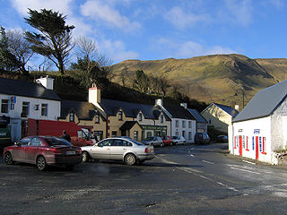
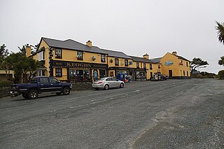
Tully Cross is a small village located on the Renvyle Peninsula in north-west Connemara, in County Galway, Ireland. It is actually situated in the townland of Gorteenclough. The village lies close to the sea and is on the Wild Atlantic Way coastal route.

Renvyle or Rinvyle is a peninsula and electoral division in North-West Connemara in County Galway, close to the border with County Mayo in Ireland.

The Galway to Clifden Railway or Connemara Railway was a railway line opened in Ireland by the Midland Great Western Railway (MGWR) in 1895. It led from Galway to Clifden, the capital of the sparsely populated Connemara region in western County Galway. It was closed by the MGWR's successor, the Great Southern Railways (GSR) in 1935.
Atlantic Technological University is a technological university in the west and north-west of Ireland. It was formally established on 1 April 2022 as a merger of three existing institutes of technology (ITs) – Galway-Mayo IT, IT Sligo, and Letterkenny IT – into a single university, the fourth such TU in Ireland.

Caroline Blake born Caroline Johanna Burke was an Irish landlord and hotelier. She became responsible for land and its tenants in County Galway. The Land League encouraged her tenents to not pay their rents and this reduced her income. Her poor treatment led to well-wishers creating a "Blake Fund" which allowed her to create the hotel.
References
- ↑ "Tully in Connemara Galway | Top Attractions in Tully and Places to see". Galway Tourism. Retrieved 19 January 2021.
- 1 2 3 4 "Blake, Caroline | Dictionary of Irish Biography". www.dib.ie. Retrieved 13 October 2022.
- ↑ O’Gorman, Ronnie (6 November 2008). "The last stand of 'spirited' Caroline Blake". Galway Advertiser. Retrieved 13 October 2022.
53°35′46″N9°58′30″W / 53.596°N 9.975°W
| | This article related to the geography of County Galway, Ireland is a stub. You can help Wikipedia by expanding it. |