
USS Block Island (CVE-21/AVG-21/ACV-21) was a Bogue-class escort carrier for the United States Navy during World War II. She was the first of two escort carriers named after Block Island Sound off Rhode Island and was the only American carrier sunk in the Atlantic during the war.

The Prince Charles Mountains are a major group of mountains in Mac. Robertson Land in Antarctica, including the Athos Range, the Porthos Range, and the Aramis Range. The highest peak is Mount Menzies, with a height of 3,228 m (10,591 ft). Other prominent peaks are Mount Izabelle and Mount Stinear. These mountains, together with other scattered peaks, form an arc about 420 km (260 mi) long, extending from the vicinity of Mount Starlight in the north to Goodspeed Nunataks in the south.

Flateyri is a village situated in Iceland's Westfjords. It is part of the municipality of Ísafjarðarbær and has a population of approximately 200, making it the largest settlement in Önundarfjörður.
Cabo San Pío at 55°3′S66°31′W, the southernmost tip of mainland Isla Grande de Tierra del Fuego as well as of Argentina, except for the small islet Islote Blanco that lies about 1.5 kilometres (0.93 mi) off the coast in SW direction.

Fuensalida is a municipality located in the province of Toledo, Castile-La Mancha, Spain. According to the 2012 census (INE), the municipality has a population of 11278 inhabitants.

Herrera de Valdecañas is a municipality located in the province of Palencia, Castile and León, Spain. According to the 2004 census (INE), the municipality has a population of 180 inhabitants.

Monasterio de la Sierra is a municipality and town located in the province of Burgos, Castile and León, Spain. According to the 2004 census (INE), the municipality has a population of 43 inhabitants.

Córrego Fundo is a Brazilian municipality located in the center of the state of Minas Gerais. Its population as of 2020 was 6,382 people living in a total area of 105 km². The city belongs to the meso-region of Oeste de Minas and to the micro-region of Formiga. It became a municipality in 1995.
Uniflor is a municipality in the state of Paraná in the Southern Region of Brazil.
Guapirama is a municipality in the state of Paraná in the Southern Region of Brazil.

Patquía is a municipality and village in La Rioja Province in northwestern Argentina.
Las Mojarras is a village and municipality in Catamarca Province in northwestern Argentina.
Clausen Glacier is a narrow glacier draining northward from the summit of Mount Takahe in Marie Byrd Land. The terminus of the glacier is just west of Knezevich Rock. It was mapped by the United States Geological Survey from surveys and from U.S. Navy aerial photos, 1959–66, and named by the Advisory Committee on Antarctic Names for Henrik B. Clausen of the University of Bern, Switzerland, United States Antarctic Research Program glaciologist at Byrd Station, 1969–70.
The Gustav Bull Mountains are a small group of bare, rugged mountain peaks and nunataks, lying 4 miles (6 km) inland from the coast and 10 nautical miles (19 km) southwest of Scullin Monolith in Mac. Robertson Land, Antarctica.
Eden Glacier is a glacier 5 nautical miles (9 km) long, which flows in a southerly direction into the head of Cabinet Inlet, northwest of Lyttelton Ridge, on the east coast of Graham Land. It was charted by the Falkland Islands Dependencies Survey (FIDS) and photographed from the air by the Ronne Antarctic Research Expedition in 1947. It was named by the FIDS for Rt. Hon. Robert Anthony Eden, M.P., then British Secretary of State for Foreign Affairs and member of the War Cabinet.
Mezzo Buttress is a rocky buttress at the head of Barilari Bay just east of Lawrie Glacier, on the west coast of Graham Land, Antarctica. It was charted by the British Graham Land Expedition under John Rymill, 1934–37, and was so named by the UK Antarctic Place-Names Committee in 1959 because the face of this buttress is conspicuously divided diagonally, half being composed of black rock and the other half of red rock, "mezzo" being an Italian word meaning "half".
Hill Glacier is a broad glacier that drains the west-central part of Spaatz Island, Antarctica, at the south side of Ronne Entrance. It was mapped by the United States Geological Survey (USGS) from surveys and U.S. Navy aerial photographs, 1961–66, and was named by the Advisory Committee on Antarctic Names for Lennie J. Hill, a USGS topographic engineer who was a member of the Marie Byrd Land Survey Party, 1967–68.
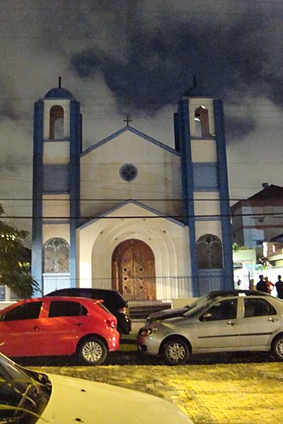
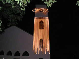
Partenon is a neighbourhood in the city of Porto Alegre, the state capital of Rio Grande do Sul, Brazil. It was created by Law 2022 from December 7, 1959.

The Altiplano–Puna volcanic complex, also known as APVC, is a complex of volcanic systems in the Puna of the Andes. It is located in the Altiplano area, a highland bounded by the Bolivian Cordillera Real in the east and by the main chain of the Andes, the Western Cordillera, in the west. It results from the subduction of the Nazca Plate beneath the South American Plate. Melts caused by subduction have generated the volcanoes of the Andean Volcanic Belt including the APVC. The volcanic province is located between 21° S–24° S latitude. The APVC spans the countries of Argentina, Bolivia and Chile.