The ecological footprint is a method promoted by the Global Footprint Network to measure human demand on natural capital, i.e. the quantity of nature it takes to support people and their economies. It tracks this demand through an ecological accounting system. The accounts contrast the biologically productive area people use for their consumption to the biologically productive area available within a region, nation, or the world. In short, it is a measure of human impact on the environment and whether that impact is sustainable.

In scientific ecology, climax community or climatic climax community is a historic term for a community of plants, animals, and fungi which, through the process of ecological succession in the development of vegetation in an area over time, have reached a steady state. This equilibrium was thought to occur because the climax community is composed of species best adapted to average conditions in that area. The term is sometimes also applied in soil development. Nevertheless, it has been found that a "steady state" is more apparent than real, particularly across long timescales. Notwithstanding, it remains a useful concept.

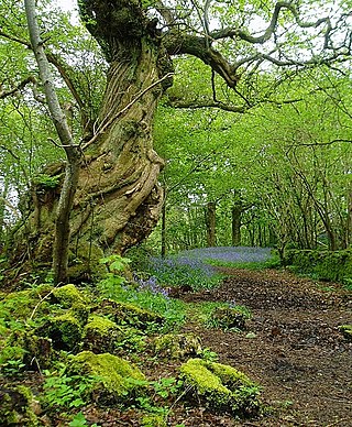
In the United Kingdom, ancient woodland is that which has existed continuously since 1600 in England, Wales and Northern Ireland. Planting of woodland was uncommon before those dates, so a wood present in 1600 is likely to have developed naturally.
The diversity of species and genes in ecological communities affects the functioning of these communities. These ecological effects of biodiversity in turn are affected by both climate change through enhanced greenhouse gases, aerosols and loss of land cover, and biological diversity, causing a rapid loss of biodiversity and extinctions of species and local populations. The current rate of extinction is sometimes considered a mass extinction, with current species extinction rates on the order of 100 to 1000 times as high as in the past.

A bioindicator is any species or group of species whose function, population, or status can reveal the qualitative status of the environment. The most common indicator species are animals. For example, copepods and other small water crustaceans that are present in many water bodies can be monitored for changes that may indicate a problem within their ecosystem. Bioindicators can tell us about the cumulative effects of different pollutants in the ecosystem and about how long a problem may have been present, which physical and chemical testing cannot.
Spatial ecology studies the ultimate distributional or spatial unit occupied by a species. In a particular habitat shared by several species, each of the species is usually confined to its own microhabitat or spatial niche because two species in the same general territory cannot usually occupy the same ecological niche for any significant length of time.
Frederic Edward Clements was an American plant ecologist and pioneer in the study of plant ecology and vegetation succession.
Indicator value is a term that has been used in the ecology of plants for two different indices. The older usage of the term refers to Ellenberg's indicator values from 1974, which are based on a simple ordinal classification of plants according to the position of their realized ecological niche along an environmental gradient. Since 1997, the term has also been used to refer to Dufrêne & Legendre's indicator value, which is a quantitative index measuring the statistical alliance of a species to any one of the classes in a classification of sites.
Phytogeography or botanical geography is the branch of biogeography that is concerned with the geographic distribution of plant species and their influence on the earth's surface. Phytogeography is concerned with all aspects of plant distribution, from the controls on the distribution of individual species ranges to the factors that govern the composition of entire communities and floras. Geobotany, by contrast, focuses on the geographic space's influence on plants.
Ecological indicators are used to communicate information about ecosystems and the impact human activity has on ecosystems to groups such as the public or government policy makers. Ecosystems are complex and ecological indicators can help describe them in simpler terms that can be understood and used by non-scientists to make management decisions. For example, the number of different beetle taxa found in a field can be used as an indicator of biodiversity.
Material flow analysis (MFA), also referred to as substance flow analysis (SFA), is an analytical method to quantify flows and stocks of materials or substances in a well-defined system. MFA is an important tool to study the bio-physical aspects of human activity on different spatial and temporal scales. It is considered a core method of industrial ecology or anthropogenic, urban, social and industrial metabolism. MFA is used to study material, substance, or product flows across different industrial sectors or within ecosystems. MFA can also be applied to a single industrial installation, for example, for tracking nutrient flows through a waste water treatment plant. When combined with an assessment of the costs associated with material flows this business-oriented application of MFA is called material flow cost accounting. MFA is an important tool to study the circular economy and to devise material flow management. Since the 1990s, the number of publications related to material flow analysis has grown steadily. Peer-reviewed journals that publish MFA-related work include the Journal of Industrial Ecology, Ecological Economics, Environmental Science and Technology, and Resources, Conservation, and Recycling.
Gap analysis is a tool used in wildlife conservation to identify gaps in conservation lands or other wildlands where significant plant and animal species and their habitat or important ecological features occur.

In ecology, local abundance is the relative representation of a species in a particular ecosystem. It is usually measured as the number of individuals found per sample. The ratio of abundance of one species to one or multiple other species living in an ecosystem is referred to as relative species abundances. Both indicators are relevant for computing biodiversity.
An index of biological integrity (IBI), also called an index of biotic integrity, is a scientific tool typically used to identify and classify water pollution problems, although there have been some efforts to apply the idea to terrestrial environments. An IBI associates anthropogenic influences on a water body with biological activity in the water body, and is formulated using data developed from biosurveys. Biological integrity is associated with how "pristine" an environment is and its function relative to the potential or original state of an ecosystem before human alterations were imposed. Biological integrity is built on the assumption that a decline in the values of an ecosystem's functions are primarily caused by human activity or alterations. The more an environment and its original processes are altered, then by definition, the less biological integrity it holds for the community as a whole. If these processes were to change over time naturally, without human influence, the integrity of the ecosystem would remain intact. Similar to the concept of ecosystem health, the integrity of the ecosystem relies heavily on the processes that occur within it because those determine which organisms can inhabit an area and the complexities of their interactions. Deciding which of the many possible states or conditions of an ecosystem is appropriate or desirable is a political or policy decision.

A biosurvey, or biological survey, is a scientific study of organisms to assess the condition of an ecological resource, such as a water body.

Species distribution modelling (SDM), also known as environmental(or ecological) niche modelling (ENM), habitat modelling, predictive habitat distribution modelling, and range mapping uses computer algorithms to predict the distribution of a species across geographic space and time using environmental data. The environmental data are most often climate data (e.g. temperature, precipitation), but can include other variables such as soil type, water depth, and land cover. SDMs are used in several research areas in conservation biology, ecology and evolution. These models can be used to understand how environmental conditions influence the occurrence or abundance of a species, and for predictive purposes (ecological forecasting). Predictions from an SDM may be of a species’ future distribution under climate change, a species’ past distribution in order to assess evolutionary relationships, or the potential future distribution of an invasive species. Predictions of current and/or future habitat suitability can be useful for management applications (e.g. reintroduction or translocation of vulnerable species, reserve placement in anticipation of climate change).

The abundances of plant species are often measured by plant cover, which is the relative area covered by different plant species in a small plot. Plant cover is not biased by the size and distributions of individuals, and is an important and often measured characteristic of the composition of plant communities.
Ecological assessment (EA) implies the monitoring of ecological resources, to discover the current and changing conditions. EAs are required components of most hazardous waste site investigations. Such assessments, in conjunction with contamination and human health risk assessments, help to evaluate the environmental hazards posed by contaminated sites and to determine remediation requirements.
Bruce Pettit McCune is an American lichenologist, botanist, plant ecologist, and software developer for analysis of ecological data.


