
The Military Sealift Command (MSC) is an organization that controls the replenishment and military transport ships of the United States Navy. Military Sealift Command has the responsibility for providing sealift and ocean transportation for all US military services as well as for other government agencies. It first came into existence on 9 July 1949 when the Military Sea Transportation Service (MSTS) became solely responsible for the Department of Defense's ocean transport needs. The MSTS was renamed the Military Sealift Command in 1970.
The Naval Oceanographic Office (NAVOCEANO), located at John C. Stennis Space Center in south Mississippi, is an echelon IV component of the Naval Meteorology and Oceanography Command (NMOC) and comprises approximately 1,000 civilian, military and contract personnel responsible for providing oceanographic products and services to all elements within the Department of Defense.
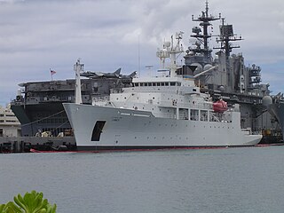
USNS Sumner (T-AGS-61) is a Pathfinder-class oceanographic survey ship that became operational in 1997. It is the fourth United States Navy ship named Sumner, in this case for Thomas Hubbard Sumner, an American sea captain who discovered the principles of celestial navigation by circle of equal altitude. These ships are crewed by a small crew of civilian mariners, supporting an even smaller contingent of United States Navy personnel.

The Pathfinder-class survey ships are owned by the United States Navy and operated by Military Sealift Command for the Naval Oceanographic Office ("NAVOCEANO"). They have mostly civilian crews, including scientists from NAVOCEANO.

USNS Pathfinder is a United States Navy oceanographic survey ship, and the lead vessel of her class. Her mission is to collect acoustical, biological, physical, and geophysical surveys of the world's oceans. This data has many uses, but a primary focus is characterizing the ocean environment in order to improve the U.S. Navy's undersea warfare capabilities.

NOAAS Thomas Jefferson is a National Oceanic and Atmospheric Administration (NOAA) hydrographic survey vessel in service since 2003. The ship was built for the United States Navy as USNS Littlehales (T-AGS-52) serving as one of two new coastal hydrographic survey vessels from 1992 until transfer to NOAA in 2003 when it was named after Founding Father and third U.S. president, Thomas Jefferson.
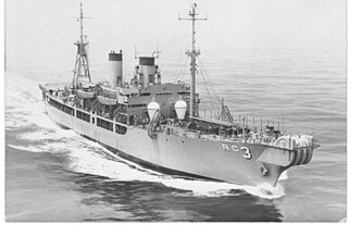
USS Aeolus (ARC-3) began service as USS Turandot (AKA-47), an Artemis-class attack cargo ship built by the Walsh-Kaiser Co., Inc. of Providence, Rhode Island. In 1954 she was converted into a cable repair ship to support Project Caesar, the unclassified name for installation of the Sound Surveillance System SOSUS. Aeolus was the first of two ships, the other being USS Thor (ARC-4), to be converted into cable ships. Aeolus performed cable duties for nearly thirty years, from 1955 to 1973 as a commissioned ship and from 1973 until 1985 as the civilian crewed USNS Aeolus (T-ARC-3) of the Military Sealift Command (MSC). The ship was retired in 1985 and sunk as an artificial reef in 1988.

USNS Wyman (T-AGS-34) was an oceanographic survey vessel laid down on 18 July 1968 by the Defoe Shipbuilding Company of Bay City, Michigan. Launched on 30 October 1969, sponsored by Mrs. Francis J. Blouin, wife of the Deputy Chief of Naval Operations, Vice Admiral Francis J. Blouin; she was accepted by the Military Sealift Command (MSC) on 19 November 1971 at the Boston Naval Shipyard.
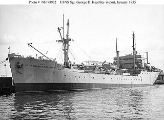
USNS Sgt. George D. Keathley, was a World War II United States cargo vessel that was used for troop transport and later converted to a survey vessel. She was laid down and launched as MS Alexander R. Nininger, Jr., then renamed MS Acorn Knot. She was put into US Army service as USAT Acorn Knot, then renamed USAT Sgt. George D. Keathley. She was transferred to the US Navy and became USNS Sgt. George D. Keathley (T-APC-117), but was later re-designated T-AGS-35. She was leased to the Republic of China, where she served as Chu Hwa (AGS-564). Both Nininger and Keathley were posthumous Medal of Honor recipients.
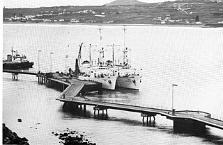
USNS Sands (T-AGOR-6) was a Robert D. Conrad-class oceanographic research ship operated by the Military Sealift Command (MSC) for the Naval Oceanographic Office from 1965 to 1973. During that period she provided ocean-bottom information and underwater test data to the U.S. Navy and other U.S. agencies. The ship was the second naval vessel to be named for Rear Admiral Benjamin F. Sands and his son Rear Admiral James H. Sands, the first being the destroyer Sands (DD-243). The ship operated in the Atlantic on oceanographic and geophysical assignments for the Oceanographic Office and other agencies.
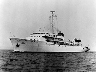
USNS Silas Bent (T-AGS-26) was a Silas Bent class survey ship acquired by the United States Navy in 1964 and delivered to the Military Sealift Command in 1965. Silas Bent spent her career in the Pacific Ocean performing oceanographic surveys. The ship was equipped with the Oceanographic Data Acquisition System (ODAS) as were the later oceanographic survey ships USNS Kane (T-AGS-27) and USNS Wilkes (T-AGS-33).

USNS S. P. Lee was laid down on 27 June 1966 by the Defoe Shipbuilding Co., Bay City, Michigan as yard hull number 441. The ship, sponsored by Mrs. David Scull, great-granddaughter of Admiral Lee, was launched on 19 October 1967 and delivered to the navy on 2 December 1968.

USNS Waters (T-AGS-45) is a United States Navy vessel tasked with supporting submarine navigation-system testing and providing ballistic missile flight test support services. In 2011, it was homeported in Port Canaveral, Florida.

USNS Marie Tharp (T-AGS-66) is a Pathfinder-class oceanographic survey ship operated by the Military Sealift Command of the United States Navy. The seventh ship in her class, Marie Tharp is named for oceanographer Marie Tharp; the ship was renamed in 2023 from Maury.

Zera Luther Tanner, sometimes spelled Zero, was an American naval officer, inventor, and oceanographer. Tanner invented a depth sounding system, wrote several books on hydrography and retired as a commander of the United States Navy in 1897.
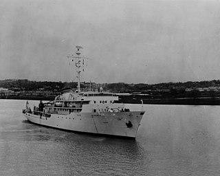
USNS Kane (T-AGS-27) was a Silas Bent-class survey ship acquired by the United States Navy and delivered to Military Sealift Command in 1967. Kane spent her career performing oceanographic surveys. The ship was equipped with the Oceanographic Data Acquisition System (ODAS) as were oceanographic survey ships USNS Silas Bent (T-AGS-26) and USNS Wilkes (T-AGS-33).
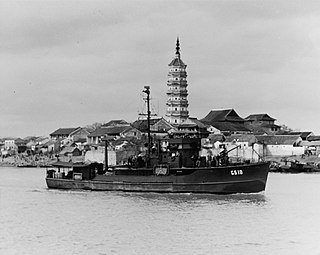
USS John Blish was a Patrol Craft Sweeper (PCS) of the PCS-1376-Class, five of which were converted to small hydrographic survey vessels designated AGS and later coastal survey vessels, AGSc, that conducted hydrographic surveys for the United States Navy during and immediately after the Second World War. The small PCS type vessels assigned to the United States Navy Hydrographic Office missions conducted pre invasion surveys, sometimes under fire, with the survey crews erecting signals for survey and later navigation, laying buoys and placing lights.

USNS Chauvenet (T-AGS-29) was a multi-function survey ship laid down on 24 May 1967, at Upper Clyde Shipbuilding Corp., Glasgow, Scotland. The ship was the second survey ship, Chauvenet (AGS-11) being the first, named for William Chauvenet (1820-1870). He was instrumental in the founding of the United States Naval Academy at Annapolis, MD. The mathematics department of the US Naval Academy in Annapolis was founded by Chauvenet and is housed in Chauvenet Hall. Chauvenet was launched on 13 May 1968, delivered to the US Navy, 13 November 1970 and placed in service with the Military Sealift Command (MSC) as USNS Chauvenet (T-AGS-29). The ship conducted coastal hydrographic and topographic surveys under the technical direction of the Oceanographer of the Navy through the U.S. Naval Oceanographic Office (NAVOCEANO). The ship was assigned to the Pacific for surveys, sister ship Harkness (T-AGS-32) was assigned Atlantic duties, doing so until inactivated in November 1992.


