Related Research Articles
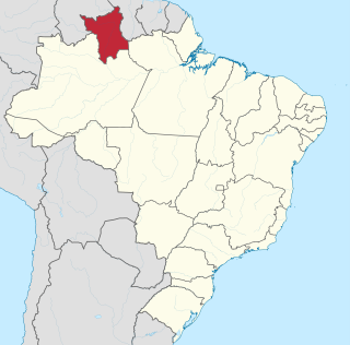
Roraima is one of the 26 states of Brazil. Located in the country's North Region, it is the northernmost and most geographically and logistically isolated state in Brazil. It is bordered by the state of Pará to the southeast, Amazonas to the south and west, Venezuela to the north and northwest, and Guyana to the east.

A tepui, or tepuy, is a table-top mountain or mesa found in South America, especially in Venezuela and western Guyana. The word tepui means "house of the gods" in the native tongue of the Pemon, the indigenous people who inhabit the Gran Sabana.
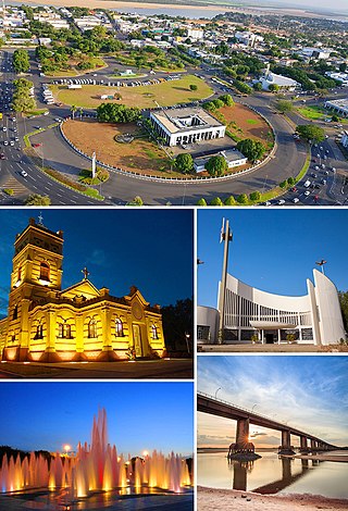
Boa Vista is the capital of the Brazilian state of Roraima. Situated on the western bank of the Branco River, the city lies 220 km (140 mi) from Brazil's border with Venezuela. It is the only Brazilian state capital located entirely north of the equator.
This is a list of the extreme points of The Americas, the points that are farther north, south, east or west than any other location on the continent. The continent's southernmost point is often said to be Cape Horn, which is the southernmost point of the Chilean islands. The Americas cross 134° of longitude east to west and 124° of latitude north to south.
La Gran Sabana is a region in southeastern Venezuela, part of the Guianan savanna ecoregion.
The Pacaraima or Pakaraima Mountains are a mountain range primarily in southwestern Guyana, and into northern Brazil and eastern Venezuela.

The Ireng River forms part of Guyana's western border with Brazil. It flows through the valleys of the Pakaraima Mountains for most of its length. It is the only major river in Guyana which flows from North to South, up to its confluence into the Takutu River. It is one of the northernmost tributaries of the Amazon river system.
The Arraia River is a river of Roraima state in northern Brazil.
The Auari River is a river of Roraima state in northern Brazil.
The Caju River is a river of Roraima state in northern Brazil.
The Caroaebe River is a river of Roraima state in northern Brazil, near the equator.
The Furo Santa Rosa is a river of Roraima state in northern Brazil. It is an anabranch - a diversionary channel - of the Uraricoera River; together they bound the Ilha de Maracá.
The Paricarana River is a river of Roraima state in northern Brazil.
The Parimé River is a river of Roraima state in northern Brazil.
The Surumu River is a river of Roraima state in northern Brazil.
The Traida River is a river of Roraima state in northern Brazil.
The Uauaris River is a river which runs within the Roraima state in northern Brazil.

Mount Roraima National Park is a national park in the state of Roraima, northern Brazil.
The Ailã River is a river of Roraima state in northern Brazil. It is located in Monte Caburaí, in the municipality of Uiramutã. Its source is the northernmost point of Brazil.
References
Coordinates: 3°00′N63°40′W / 3.000°N 63.667°W