This page is based on this
Wikipedia article Text is available under the
CC BY-SA 4.0 license; additional terms may apply.
Images, videos and audio are available under their respective licenses.
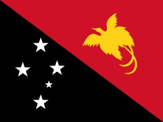
Papua New Guinea, officially the Independent State of Papua New Guinea, is an Oceanian country that occupies the eastern half of the island of New Guinea and its offshore islands in Melanesia, a region of the southwestern Pacific Ocean north of Australia. Its capital, located along its southeastern coast, is Port Moresby. The western half of New Guinea forms the Indonesian provinces of Papua and West Papua.

A valley is a low area between hills or mountains typically with a river running through it. In geology, a valley or dale is a depression that is longer than it is wide. The terms U-shaped and V-shaped are descriptive terms of geography to characterize the form of valleys. Most valleys belong to one of these two main types or a mixture of them, at least with respect to the cross section of the slopes or hillsides.

The Dani people, also spelled Ndani, and sometimes conflated with the Lani group to the west, are a people from the central highlands of western New Guinea.
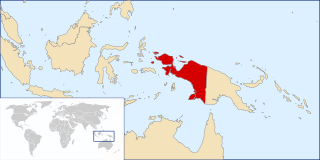
Western New Guinea, also known as Papua, is the Indonesian part of the island of New Guinea. Since the island is also named as Papua, the region is sometimes called West Papua. Lying to the west of the independent state of Papua New Guinea, it is the only Indonesian territory to be situated in Oceania. The territory is mostly in the Southern Hemisphere and also includes nearby islands, including the Schouten and Raja Ampat archipelagoes. The region is predominantly covered with ancient rainforest where numerous traditional tribes live such as the Dani of the Baliem Valley, although a large proportion of the population live in or near coastal areas, with the largest city being Jayapura.
Kara or KARA may refer to:

Morobe Province is a province on the northern coast of Papua New Guinea. The provincial capital, and largest city, is Lae. The province covers 33,705 km², with a population of 674,810, and since the division of Southern Highlands Province in May 2012 it is the most populous province. It includes the Huon Peninsula, the Markham River, and delta, and coastal territories along the Huon Gulf. The province has nine administrative districts, and 101 languages are spoken, including Kâte and Yabim. English and Tok Pisin are common languages in the urban areas, and in some areas forms of Pidgin German are mixed with the native language.
The Markham Valley is a geographical area in Papua New Guinea. The name "Markham" commemorates Sir Clements Markham, Secretary of the British Royal Geographical Society - Captain John Moresby of the Royal Navy named the Markham River after Sir Clements in the course of his voyage of exploration in HMS Basilisk in 1873.
The valley contains two districts of Morobe Province: Huon Gulf district on the east and Markham district on the west. The inhabitants of the valley are of Polynesian descent and live in large villages under a chieftain political system.
Umba Valley is a geographic area in Tanzania and the world's only source of Umba sapphires.
Umba sapphire is a unique type of sapphire discovered in 1962 in the Gerevi Hills, north of the Umba River in the Umba Valley of Tanzania. Umba sapphires exhibit coloration not common to sapphires sourced from other parts of the world, and are recovered from the alluvial deposits of the Umba River.
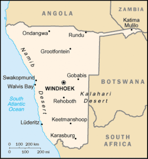
A salient is an elongated protrusion of a geopolitical entity, such as a subnational entity or a sovereign state.
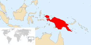
New Guinea is a large island separated by a shallow sea from the rest of the Australian continent. It is the world's second-largest island, after Greenland, covering a land area of 785,753 km2 (303,381 sq mi), and the largest wholly or partly within the Southern Hemisphere and Oceania.

The Papua New Guinea national rugby sevens team competes in the Oceania Sevens, where they finished third in 2009, and fourth in 2010, 2015 and 2016.

Etesiolaus catori, the small green sapphire or Cator's sapphire, is a butterfly in the family Lycaenidae. It is found in Guinea, Sierra Leone, Liberia, Ivory Coast, Ghana, Nigeria, Cameroon, the Central African Republic, the Democratic Republic of the Congo, Uganda, Kenya, Tanzania and Zambia. The habitat consists of forests.
Enga Sign Language is an apparent village sign language among the Tato Enga people in Enga province, Papua New Guinea. It was reported in 1980 in three articles by Adam Kendon, based on ethnographic films of three signers in the upper valley of the Lagaip River, but with reports of wider use in the surrounding region. Its current status is unknown, as no more recent information is available.