
Waseca County is a county in the U.S. state of Minnesota. As of the 2010 United States Census, the population was 19,136. Its county seat is Waseca.

Todd County is a county in the East Central part of the U.S. state of Minnesota. As of the 2010 United States Census, the population was 24,895. Its county seat is Long Prairie.

Steele County is a county in the U.S. state of Minnesota. As of the 2010 United States Census, the population was 36,576. Its county seat is Owatonna.

Scott County is a county in the U.S. state of Minnesota. As of the 2010 census, the population was 129,928. Its county seat is Shakopee. Shakopee is also the largest city in Scott County, the twenty-third-largest city in Minnesota, and the sixteenth-largest Twin Cities suburb. The county was organized in 1853 and named in honor of General Winfield Scott. Scott County is part of the Minneapolis-St. Paul-Bloomington, MN-WI Metropolitan Statistical Area. It is a member of the Metropolitan Council, and shares many of the council's concerns about responsible growth management, advocating for progressive development concepts such as clustering, open-space design, and the preservation of open space and rural/agricultural land.

Rice County is a county located in the south central portion of the U.S. state of Minnesota. As of the 2010 census, the population was 64,142. Its county seat is Faribault.

Le Sueur County is a county located in the south central portion of the U.S. state of Minnesota. As of the 2010 United States Census, the population was 27,703. Its county seat is Le Center.

Detroit Township is a township in Becker County, Minnesota, United States. The population was 2,033 as of the 2010 census.
O'Brien Township is a township in Beltrami County, Minnesota, United States. The population was 56 as of the 2000 census.
Canosia Township is a township in Saint Louis County, Minnesota, United States. Canosia is a name derived from the Algonquian language meaning "pike fish". The population was 2,158 at the 2010 census.
Gnesen Township is a township in Saint Louis County, Minnesota, United States. The population was 1,683 at the 2010 census.
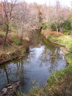
Rice Creek is a tributary of the Mississippi River in the northern suburbs of the Minneapolis–St. Paul metropolitan area of Minnesota in the United States. It is approximately 28 miles (45 km) long and drains a watershed of 201 square miles (520 km2).

Rice Lake is a ghost town in Dodge and Steele counties in the U.S. state of Minnesota. It is located east of Owatonna, and just north of Rice Lake State Park. The nearest community is the city of Claremont, to the southeast. The Dodge County portion lies in the southwest corner of Ellington Township, while the Steele County portion lies in the southeast corner of Merton Township.
East Lake is an unincorporated community in Spalding Township, Aitkin County, Minnesota, United States.
Rice Lake is a lake in Hubbard County, in the U.S. state of Minnesota.
Rice Lake is a lake in Mille Lacs County, in the U.S. state of Minnesota.
Rice Lake is a lake in Pope County, in the U.S. state of Minnesota.
Rice Lake is a lake in Rice County, in the U.S. state of Minnesota.
Rice Lake is a lake in Wadena County, in the U.S. state of Minnesota.
Rice Lake is a lake in Washington County, in the U.S. state of Minnesota.
