United States Army Reserve Center, Rio Vista

Last updated

United States Army Reserve Center, Rio Vista is a former United States Army Reserve center located in Rio Vista, Solano County, California. It was established in 1911 as the U.S. Engineers Storehouse, Rio Vista. It went through ten different names in its 81-year history, finally becoming the United States Army Reserve Center, Rio Vista California. It was closed in 1992 as a result of a BRAC recommendation. [1]

United States Army Reserve reserve force of the United States Army

The United States Army Reserve (USAR) is a reserve force of the United States Army. Together, the Army Reserve and the Army National Guard constitute the Army element of the Reserve components of the United States Armed Forces.

Rio Vista, California City in California, United States

Rio Vista is a city located in the eastern end of Solano County, California, in the San Francisco Bay Area‍—‌either in the East Bay or the North Bay, depending on what definition is used‍—‌on the Sacramento River, in the Sacramento River Delta region. The population was 7,360 at the 2010 census.

Solano County, California County in California, United States

Solano County is a county located in the U.S. state of California. As of the 2010 census, the population was 413,344. The county seat is Fairfield.

The base is located on a 28-acre (11 ha) property south of town, on the west bank of the Sacramento River. It was acquired on July 21, 1911 by the U.S. Army Corps of Engineers to support the work of the Corps in dredging, clearing, and surveying the Sacramento River. The Corps had been working on the river since 1875, deepening it, straightening it, and removing obstacles such as trees, shoals, and even a 100-acre island which they completely eliminated. The goals of this work were to prevent flooding, make the river more navigable, and reclaim farmland. The base was used to house, store, or moor equipment, including the large suction barges used for these purposes. [2]
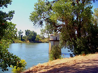
Sacramento River river in Northern and Central California, USA

The Sacramento River is the principal river of Northern California in the United States, and is the largest river in California. Rising in the Klamath Mountains, the river flows south for 400 miles (640 km) before reaching the Sacramento–San Joaquin River Delta and San Francisco Bay. The river drains about 26,500 square miles (69,000 km2) in 19 California counties, mostly within the fertile agricultural region bounded by the Coast Ranges and Sierra Nevada known as the Sacramento Valley, but also extending as far as the volcanic plateaus of Northeastern California. Historically, its watershed has reached as far north as south-central Oregon where the now, primarily, endorheic (closed) Goose Lake rarely experiences southerly outflow into the Pit River, the most northerly tributary of the Sacramento.

The facility expanded over the next several decades, with additional buildings and even a marine railway. During World War II the function of the base shifted to focus on harbor serving vessels such as floating cranes, barges, tugs and small freighters. For this reason the base was reassigned to the U.S. Army Transportation Corps in 1952 with the primary function of storing and maintaining Army harbor craft. The facility's name was changed several times during the 1950s and 1960s. It reached peak activity in 1963 when it was reported to have 300 civilian employees and 350 vessels. [2]

In 1963 a 4-acre (1.6 ha) parcel at the southern end of the facility was transferred to the U.S. Coast Guard to construct a Coast Guard station which is still in operation. [3]

Activity at the base increased during the Vietnam War. In 1967 the base, now called the Rio Vista Marine Storage Activity, was placed under the command of Sharpe Army Depot. Its primary function was to prepare amphibious vehicles for shipment to Vietnam. Also in 1967 the base was unexpectedly pressed into local service when a freighter struck a local bridge and cut it in half. For the next several weeks while the bridge was being repaired, an Army LCM amphibious vehicle from the base was used as a "foot ferry", transporting residents back and forth across the river to attend school, go to work, and attend to other needs on the other side of the river. [4]

Vietnam War 1955–1975 conflict in Vietnam

The Vietnam War, also known as the Second Indochina War, and in Vietnam as the Resistance War Against America or simply the American War, was a conflict in Vietnam, Laos, and Cambodia from 1 November 1955 to the fall of Saigon on 30 April 1975. It was the second of the Indochina Wars and was officially fought between North Vietnam and South Vietnam. North Vietnam was supported by the Soviet Union, China, and other communist allies; South Vietnam was supported by the United States, South Korea, the Philippines, Australia, Thailand and other anti-communist allies. The war, considered a Cold War-era proxy war by some, lasted 19 years, with direct U.S. involvement ending in 1973, and included the Laotian Civil War and the Cambodian Civil War, which ended with all three countries becoming communist in 1975.

In 1974 the base was renamed Rio Vista Storage Activity Site and control was transferred to the Presidio of San Francisco. Its mission was changed to Logistics Over The Shore (LOTS) operations training. In 1971 the USAT Resolute, a 338-foot (103 m) cargo and training ship, was moved to the Rio Vista facility.

Presidio of San Francisco Neighborhood in San Francisco, California, United States

The Presidio of San Francisco is a park and former U.S. Army military fort on the northern tip of the San Francisco Peninsula in San Francisco, California, and is part of the Golden Gate National Recreation Area.

USS <i>Pembina</i> (AK-200)

USS Pembina (AK-200) – later known as USNS Pembina (T-AK-200) -- was an Alamosa-class cargo ship that was constructed for the U.S. Navy during the closing period of World War II. She supported the end-of-war Navy effort and was subsequently placed in service with the US Army under the Shipping Control Authority for the Japanese Merchant Marine with a Japanese crew in Yokosuka, Japan.

In 1980 the facility was transferred to the U.S. Army Reserve and renamed the Rio Vista United States Army Reserve Center (Rio Vista USAR Center). It was primarily used for training purposes by engineering and transportation units.

In 1992 the facility was closed and all equipment was removed. The city of Rio Vista purchased the property from the federal government in 2003. [4] It remains empty, but the city has proposed a redevelopment plan for the property. [5] Two of the proposed uses are a research and monitoring station to study the river and the Delta, and a fish refuge and fish hatchery. [6] Other proposed new uses include hiking and picnic areas, a boat dock, hotels, and a conference center. [7]

Related Research Articles

The military defense of Puerto Rico is the responsibility of the United States as part of the Treaty of Paris. Locally, Puerto Rico has its own National Guard, the Puerto Rico National Guard, and its own state defense force, the Puerto Rico State Guard, which, by local law, is under the authority of the Puerto Rico National Guard. The commander-in-chief of both forces is the governor of Puerto Rico, currently Wanda Vázquez Garced, who delegates her authority to the Puerto Rico Adjutant General, currently Brigadier General Isabelo Rivera The Adjutant General, in turn, delegates the authority over the State Guard to another officer but retains the authority over the Puerto Rico National Guard as a whole. At the national level, the commander-in-chief is the President of the United States, currently Donald Trump.

Fort Knox US Army post in Kentucky, United States

Fort Knox is a United States Army post in Kentucky, south of Louisville and north of Elizabethtown. It is also adjacent to the United States Bullion Depository, which is used to house a large portion of the United States' official gold reserves. The 109,000 acre base covers parts of Bullitt, Hardin, and Meade counties. It currently holds the Army Human Resources Center of Excellence to include the Army Human Resources Command. It is named in honor of Henry Knox, Chief of Artillery in the American Revolutionary War and first United States Secretary of War.

Fort Lewis military facility in Washington, USA

Fort Lewis is a United States military facility located 9.1 miles (14.6 km) south-southwest of Tacoma, Washington, under the jurisdiction of the United States Army Joint Base Garrison, Joint Base Lewis–McChord. It was merged with the United States Air Force's McChord Air Force Base on February 1, 2010 into a Joint Base as a result of 2005 Base Realignment and Closure Commission recommendations.

Fort Buchanan, Puerto Rico United States Army installation in Puerto Rico

United States Army Garrison Fort Buchanan, Puerto Rico, is a United States Army installation in Puerto Rico. It is located in the metropolitan area of the capital, San Juan.

Rickenbacker International Airport airport

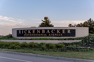
Rickenbacker International Airport is a civil-military public airport 10 miles (16 km) south of downtown Columbus, near Lockbourne in southern Franklin County, Ohio, United States. The south end of the airport extends into Pickaway County. The base was named for flying ace and Columbus native Eddie Rickenbacker. It is managed by the Columbus Regional Airport Authority, which also operates John Glenn Columbus International Airport and Bolton Field. Rickenbacker International is primarily a cargo airport for the city of Columbus, although since 2012 it has served an increasing number of passenger flights as well as charter carriers.

Fort McPherson Former U.S. Army base in Atlanta, Georgia, USA

Fort McPherson was a U.S. Army military base located in Atlanta, Georgia, bordering the northern edge of the city of East Point, Georgia. It was the headquarters for the U.S. Army Installation Management Command, Southeast Region; the U.S. Army Forces Command; the U.S. Army Reserve Command; the U.S. Army Central.

Base Realignment and Closure (BRAC) is a process by a United States federal government commission to increase United States Department of Defense efficiency by planning the end of the Cold War realignment and closure of military installations. More than 350 installations have been closed in five BRAC rounds: 1988, 1991, 1993, 1995, and 2005.

An exchange is a type of retail store found on United States military installations worldwide. Originally akin to trading posts, they now resemble contemporary department stores or strip malls.

Parks Reserve Forces Training Area

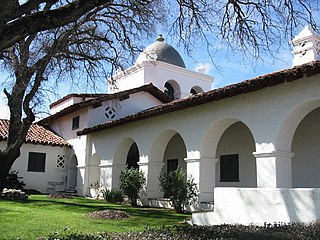
Parks Reserve Forces Training Area (PRFTA), commonly known as Camp Parks, is a United States Army facility located in Dublin, California that is currently a semi-active mobilization and training center for U.S. Army Reserve personnel to be used in case of war or natural disaster.

Fort Hunter Liggett

Fort Hunter Liggett, named after General Hunter Liggett in 1941, is a United States Army fort in southern Monterey County, California, about 250 miles (400 km) north of Los Angeles and 150 miles (240 km) south of San Francisco. The fort is primarily used as a training facility, where activities such as field maneuvers and live fire exercises are performed. It is roughly 25 miles northwest of Camp Roberts, California.

Naval Support Activity New Orleans United States Navy installation

Naval Support Activity New Orleans was a United States Navy installation until September 2011. During its time in operation, it was the largest military installation in greater New Orleans. It hosts activities for other branches of service and federal agencies.

Grand Prairie Armed Forces Reserve Complex

The Grand Prairie Armed Forces Reserve Complex is a former United States Navy Naval Air Station located on Mountain Creek Lake in southwest Dallas. The installation was originally established as an Army Aviation center, and eventually became home to aviation assets from all the military services. The facility was decommissioned as a naval air station in December 1998 pursuant to BRAC action and the extant Naval Air Reserve, Marine Air Reserve and Texas Air National Guard flying units relocating to the nearby former Carswell AFB, which was concurrently transferred to U.S. Navy custody via the Base Realignment and Closure Commission action and renamed Naval Air Station Joint Reserve Base Fort Worth / Carswell Field.

Yakima Training Center

The Yakima Training Center (YTC) is a United States Army training center, used for maneuver training, Land Warrior system testing and as a live fire exercise area. It is located in the south central portion of the U.S. state of Washington, bounded on the west by Interstate 82, on the south by the city of Yakima, on the north by the city of Ellensburg and Interstate 90, and on the east by the Columbia River. It is a part of Joint Base Lewis-McChord. It comprises 327,000 acres of land, most of which consists of shrub-steppe, making it one of the largest areas of shrub-steppe habitat remaining in Washington state. The terrain is undulating and dominated by three east-west parallel ridges, the Saddle Mountains, Manastash Ridge, and Umtanum Ridge anticlines, which are part of the Yakima Fold Belt near the western edge of the Columbia River Plateau. Vegetation consists of sagebrush, bitterbrush, and bunch grass. Vagabond Army Airfield and Selah Airstrip are located on the Yakima Training Center. The training center is also used by the Japan Ground Self-Defense Force for exercises.

Charleston, South Carolina metropolitan area human settlement in United States of America

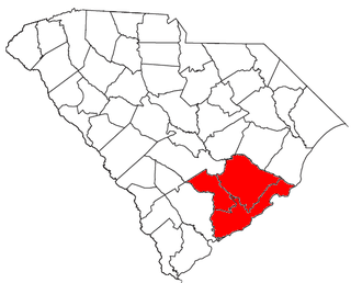
The Charleston metropolitan area is an area centered on Charleston, South Carolina. The U.S. Office of Management and Budget designates the area as the Charleston–North Charleston, SC Metropolitan Statistical Area, a metropolitan statistical area used for statistical purposes only by the United States Census Bureau and other federal agencies. The OMB defines the area as comprising Berkeley, Charleston and Dorchester counties, an area with 664,607 in the 2010 census. Principal cities include Charleston, North Charleston, and Summerville. The area is commonly referred to as the Tri-County Area or the Lowcountry, though the latter term has historically referred to South Carolina coast in general.

Naval Support Activity Mid-South

Naval Support Activity Mid-South, in Millington, Tennessee, is a base of the United States Navy. A part of the Navy Region Southeast and the Navy Installations Command, NSA Mid-South serves as the Navy’s Human Resources Center of Excellence. The base is host to several commands and other military tenants: Navy Personnel Command, Navy Recruiting Command, the Navy Manpower Analysis Center, a Marine reserve Company - Bridge Company C and the US Army Corps of Engineers Finance Center. More than 7,500 military, civilian, and contract personnel are assigned/work on base.

Charles M. Price Support Center was a United States Army base located in Granite City, Illinois, across the Mississippi River directly to the east of St. Louis.

Naval Support Activity Charleston base of the United States Navy located on the west bank of the Cooper River in South Carolina

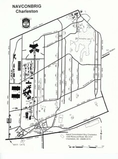
Naval Support Activity Charleston, originally designated Naval Weapons Station Charleston, is a base of the United States Navy located on the west bank of the Cooper River, in the cities of Goose Creek and Hanahan South Carolina. The base encompasses more than 17,000 acres (69 km²) of land with 10,000 acres (40 km²) of forest and wetlands, 16-plus miles of waterfront, four deep-water piers, 38.2 miles (61.5 km) of railroad and 292 miles (470 km) of road. The current workforce numbers more than 11,000 with an additional 3,600 people in on-base family housing.

References

  1. Pezzaglia, Phil (May 4, 2011). "Exploring Rio Vista's Past: Local Military Installations Part III". River News Herald. Retrieved 6 August 2014.
  2. 1 2 Pezzaglia, Phil (April 20, 2011). "Exploring Rio Vista's Past: Local Military Installations, Part I". River News Herald. Retrieved 6 August 2014.
  3. "US Coast Guard Station Rio Vista". Unit Pages. military.com. Retrieved 6 August 2014.
  4. 1 2 Pezzaglia, Phil (27 April 2011). "Exploring Rio Vista's Past: Local Military Installations, Part II". River News Herald. Archived from the original on 8 August 2014. Retrieved 6 August 2014.
  5. "Rio Vista Army Base". City of Rio Vista. Retrieved 6 August 2014.
  6. Coglianese, Marci (May 11, 2011). "City to Host Workshop on Rio Vista Army Reserve Center". River News Herald. Retrieved 6 August 2014.
  7. Ah San, Heather (May 7, 2013). "Rio Vista Army base to shed its name, image". Daily Republic. Retrieved 6 August 2014.

Coordinates: 38°8′45.33″N121°41′38.67″W / 38.1459250°N 121.6940750°W / 38.1459250; -121.6940750