| Upukerora River | |
|---|---|
 | |
| Location | |
| Country | New Zealand |
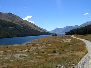
The Upukerora River is a river in New Zealand, flowing into Lake Te Anau north of Te Anau township.
| Upukerora River | |
|---|---|
| | |
| Location | |
| Country | New Zealand |
The Upukerora River is a river in New Zealand, flowing into Lake Te Anau north of Te Anau township.

Fiordland is a geographical region of New Zealand in the south-western corner of the South Island, comprising the westernmost third of Southland. Most of Fiordland is dominated by the steep sides of the snow-capped Southern Alps, deep lakes, and its steep, glacier-carved and now ocean-flooded western valleys. The name "Fiordland" comes from a variant spelling of the Scandinavian word for this type of steep valley, "fjord". The area of Fiordland is dominated by, and very roughly coterminous with, Fiordland National Park, New Zealand's largest National Park.

Lake Manapouri is located in the South Island of New Zealand. The lake is situated within the Fiordland National Park and the wider region of Te Wahipounamu South West New Zealand World Heritage Area.

Lake Te Anau is in the southwestern corner of the South Island of New Zealand. The lake covers an area of 344 km2 (133 sq mi), making it the second-largest lake by surface area in New Zealand and the largest in the South Island. It is the second largest lake in Australasia by fresh water volume. The main body of the lake runs north-south, and is 65 km in length. Three large fiords form arms to the lake on its western flank: North Fiord, Middle Fiord and South Fiord. These are the only inland fiords that New Zealand has, the other 14 are out on the coast. Several small islands lie in the entrance to Middle Fiord, which forks partway along its length into northwest and southwest arms. The surface of the lake is at an altitude of 210 m. It has a maximum depth of 425 m, so much of its bed lies below sea level, with the deepest part of the lake being 215 metres below sea level.

Te Anau is a town in the Southland region of the South Island of New Zealand. In Māori, Te-Anau means the Place of the Swirling Waters. It is on the eastern shore of Lake Te Anau in Fiordland. Te Anau is 155 kilometres north of Invercargill and 171 kilometres to the southwest of Queenstown. Manapouri lies 21 kilometres to the south. Te Anau lies at the southern end of the Milford Road, 117 kilometres to the south of Milford Sound.
Mavora Lakes is a protected area in the South Island of New Zealand consisting of two lakes: North Mavora and South Mavora. The lakes are drained by the Mararoa River. The area is managed by the Department of Conservation, and is part of Te Wahipounamu, a World Heritage Area.
The Aparima River, earlier known as Jacob's River, is one of the southward-flowing braided rivers of Southland, New Zealand.

The Te Ana-au caves are a culturally and ecologically important system of limestone caves on the western shore of Lake Te Anau, in the southwest of New Zealand. They were re-discovered in 1948 by Lawson Burrows, who found the upper entry after three years of searching, following clues in old Māori legends. It later became a major tourist attraction for the area, as the part of the caverns close to the lake shore is home to glowworms. The unofficial name used by the national caving association is Aurora. The caves are geologically young and hence there is only one tiny stalactite.

The Waiau River is the largest river in the Southland region of New Zealand. 'Waiau' translates to 'River of Swirling Currents'. It is the outflow of Lake Te Anau, flowing from it into Lake Manapouri 10 kilometres (6 mi) to the south, and from there flows south for 70 kilometres (43 mi) before reaching the Foveaux Strait 8 kilometres (5 mi) south of Tuatapere. It also takes water from Lake Monowai.

The Kepler Track is a 60 km (37 mi) circular hiking track which travels through the landscape of the South Island of New Zealand and is situated near the town of Te Anau. The track passes through many landscapes of the Fiordland National Park such as rocky mountain ridges, tall mossy forests, lake shores, deep gorges, rare wetlands and rivers. Like the mountains it traverses, the track is named after Johannes Kepler. The track is one of the New Zealand Great Walks and is administered by the Department of Conservation (DOC).
The Kepler Challenge Mountain Run is the premier mountain running event in New Zealand and follows the 60 km Kepler Track through the Fiordland National Park. It has been held annually since 1988, and draws competitors from throughout New Zealand and around the world. Around 450 runners enter the event with nearly all completing the demanding course.
Lake Gunn is a lake in the South Island of New Zealand, located at 44°53′S168°05′E.

The Southern Scenic Route is a tourist highway in New Zealand linking Queenstown, Fiordland, Te Anau and the iconic Milford Road to Dunedin via, Riverton, Invercargill and The Catlins. An Australian travel magazine labelled it "one of the world's great undiscovered drives" in 2008.

State Highway 94 is a New Zealand state highway connecting the large Southland town of Gore with one of New Zealand's most popular destinations, Milford Sound. It also passes the significant townships of Lumsden and Te Anau as well going through the Homer Tunnel. The road also goes through Fiordland and crosses the Main Divide of the Southern Alps.
Aurora Cave is a limestone cave, part of the Te Ana-au Caves in Fiordland, in the South Island of New Zealand on the western side of a deep glacial trough containing Lake Te Anau. Aurora Cave is separated by a sump from Te Ana-au Cave. The cave has been formed by the Tunnel Burn, which drains from Lake Orbell in the Takahe valley. Aurora Cave is 267 metres deep and 6 km. long. Around 1988, a subfossil of an extinct species of frog were discovered. It was named the Aurora frog.

The Kepler Mire, or Dismal Swamp east of Lake Manapouri, is the largest wetland in the Te Anau basin complex in New Zealand, covering more than 900 ha. Like the neighbouring mountain range, it is named in honour of astronomer Johannes Kepler.
Wallace County was one of the counties of New Zealand in the South Island. For a time, James Mackintosh was chairman of the Wallace County. Wallace County was abolished in 1989 and amalgamated into Southland District. The towns of Riverton, Otautau, Ohai, Nightcaps, Tuatapere, Mossburn, Manapouri and Te Anau were in Wallace County.
Te Anau Airport, Manapouri serves the towns of Te Anau and Manapouri. It is not to be confused with the former and now closed Te Anau Aerodrome located just south of that town.
Te Houhou / George Sound is a fiord of the South Island of New Zealand. It is one of the fiords that form the coast of Fiordland.

The Takitimu Mountains extend in a north–south direction southeast of Te Anau and Manapouri. The mountain range is about 30 kilometres (19 mi) long and contains several peaks of around 1,600 metres (5,200 ft) height, with the Brunel Peaks reaching 1,650 metres (5,410 ft).
45°23′46″S167°44′29″E / 45.396°S 167.7413°E