This article needs additional citations for verification . (December 2015) (Learn how and when to remove this template message) |
Coordinates: 48°59′48″N102°44′09″E / 48.99667°N 102.73583°E
A geographic coordinate system is a coordinate system that enables every location on Earth to be specified by a set of numbers, letters or symbols. The coordinates are often chosen such that one of the numbers represents a vertical position and two or three of the numbers represent a horizontal position; alternatively, a geographic position may be expressed in a combined three-dimensional Cartesian vector. A common choice of coordinates is latitude, longitude and elevation. To specify a location on a plane requires a map projection.
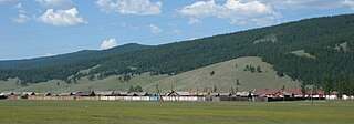
The Uran Togoo - Tulga Uul Natural Monument (Mongolian : Уран Тогоо - Тулга уулын дурсгалт газар [1] ) is a national protected area in the Bulgan Province of Mongolia. It is located about 60 km directly west of Bulgan city around the extinct volcanoes Uran Togoo, Tulga, Togoo, and Jalavch Uul.
The Mongolian language is the official language of Mongolia and both the most widely-spoken and best-known member of the Mongolic language family. The number of speakers across all its dialects may be 5.2 million, including the vast majority of the residents of Mongolia and many of the Mongolian residents of the Inner Mongolia Autonomous Region. In Mongolia, the Khalkha dialect, written in Cyrillic, is predominant, while in Inner Mongolia, the language is dialectally more diverse and is written in the traditional Mongolian script. In the discussion of grammar to follow, the variety of Mongolian treated is Standard Khalkha Mongolian, but much of what is to be said is also valid for vernacular (spoken) Khalkha and for other Mongolian dialects, especially Chakhar.
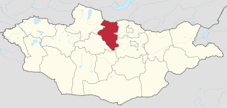
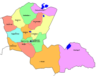
Bulgan is one of the 21 aimags (provinces) of Mongolia, located in northern Mongolia. Its capital is also named Bulgan.
Bulgan is a town, administrative centre of Bulgan province of Mongolia. Bulgan sum has a population of 11,984, 12,323 (2008), town proper has a population of 11,198 (2008). It is located at the site of the former Daichin Wangiin Khüree monastery at an elevation of 1,208 metres (3,963 ft) and 468 kilometres (291 mi) from Ulaanbaatar.
All four mountain names allude to their volcanic past with designations borrowed from around the fireplace. The Uran Togoo and Togoo mountains are named for their bowl shape, the Tulga mountain for its three mounds reminding of the traditional iron tripod kettle support. Jalavch is a term for a small pot. [2]
The area is situated in the Khutag-Öndör district of Bulgan Province. A smaller area was initially protected in 1965 by State Great Khural Resolution No. 17. In 1995, it was designated as a monument by Parliament Resolution No. 26 with an area of 5,800 hectares.
Khutag-Öndör is a sum (district) of Bulgan Province in northern Mongolia.
The State Great Khural is the unicameral parliament of Mongolia. It is located in the Government Palace.
Articles related to Mongolia include:
The Arkhangai Province or Arkhangai Aimag is one of the 21 aimags of Mongolia. It is located slightly west of the country's center, on the northern slopes of the Khangai Mountains.It is composed of 19 soums.
Darkhan-Uul is one of the 21 aimags (provinces) of Mongolia. It is located in the north of the country.
Dornod is the easternmost of the 21 aimags (provinces) of Mongolia. Its capital is Choibalsan.
Bayan may refer to:
Mogod is a sum (district) of Bulgan Province in northern Mongolia.
Saikhan is a sum (district) of Bulgan Province in northern Mongolia. Judoka Naidangiin Tüvshinbayar, Mongolia's first Olympic gold medalist, hails from Saikhan.
Ulaan-Uul is a sum of Khövsgöl aimag. The area is close to 10,000 km². In 2000, Ulaan-Uul had a population of 3,726 people, mainly Darkhad. The sum center, officially named Tögöl, is located 171 km north-north-west of Mörön and 942 km from Ulaanbaatar.
Bayantooroi is a settlement in the Tsogt sum (district) of Govi-Altai Province in western Mongolia.
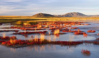
Uvs Lake Basin is an endorheic basin located on the territorial border of Mongolia and Tuva, a republic of the Russian Federation. The basin is part of the Central Asian Internal Drainage Basin and is named after Uvs Lake, a large saline lake situated in the western part of its drainage basin. Uvs Lake is a shallow lake with an area of 3,350 km2 (1,290 sq mi). Its entire basin, which includes several smaller lakes, is 70,000 km2 (27,000 sq mi).
Saikhan-Ovoo is an urban-type settlement or village in Saikhan sum (district) of Bulgan Province in northern Mongolia.
Tsambagarav is a mountain between Khovd Province and Bayan-Olgii Province in western Mongolia, it is a mountain of the Altai Mountains range. It has two peaks, its highest peak "Tsast Uul" has an elevation of 4,193 metres (13,757 ft) and another peak same named "Tsambagarav" (48.655196,90.847063). The mountain is the stand-alone eternally snow-capped mountain of the Mongol Altai and the regional sacred mountain in Mongolia.
The Mongolia–Russia border is the international border between the Russian Federation and Mongolia. It is virtually all land. The total length of the border is 3485 km. The boundary is the third longest border between Russia and another country, behind the Kazakhstan-Russia border and the China-Russia border.
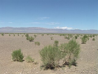
The wildlife of Mongolia consists of unique flora and fauna in eight habitats dictated by the diverse and harsh climatic conditions found in the country. These habitats are flood plains, forests, tundra, taiga forests in the north, salty marshes, fresh-water sources, desert steppes at the centre, and semi deserts, as well as the famous Gobi desert in the south, the fourth largest desert in the world.
Uran is a city in India. Uran also means uranium or uranus in several languages and may refer to:
Bogd Khan Uul Biosphere Reserve is a nature reserve in Mongolia, situated to the south of Ulan-Bator. It is in the southern part of the forest steppe zone and is in the Khentii Mountains area. It includes Bogd Khan Mountain, and was designated as a UNESCO Biosphere Reserve in 1996.
Khanuy-Gol is a volcanic field in Mongolia. Khanuy-Gol is located in the northern Hangai range, north of the settlement of Bulgan.
The geology of Mongolia is made up a complicated array of microcontinents and island chains accreted together over the past half billion years, producing varied terrain and tectonics.
This Mongolia location article is a stub. You can help Wikipedia by expanding it. |