Usk Castle | |
---|---|
Castell Brynbuga | |
Usk, Monmouthshire, United Kingdom | |
Coordinates | 51°42′18″N2°54′12″W / 51.7051°N 2.9033°W |
Type | Castle |
Site information | |
Condition | Ruined |
Site history | |
Built | 1120 |
Demolished | 1536 (partially) |
Events | Battle of Usk |
Listed Building – Grade I | |
Official name | Usk Castle and precincts |
Designated | 16 February 1953 |
Reference no. | 2127 |
Usk Castle (Welsh : Castell Brynbuga) is a castle site in the town of Usk in central Monmouthshire, south east Wales, United Kingdom. It was listed Grade I on 16 February 1953. Within the castle, and incorporating parts of its gatehouse, stands Castle House, a Grade I listed building in its own right.
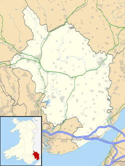
Usk Castle is located immediately to the north of the present day town on a hill overlooking the streets and main Twyn square.
Usk castle and town was probably laid out and established in 1120, after some of the other Norman settlements and castles of the region, such as Monmouth Castle and Abergavenny Castle. However, the site had a history of previous military, strategic, and local significance, for it was here that the Romans had established their early Legionary fortress before relocating it south to Caerleon. Usk is first mentioned in 1138 in the context of it being captured by the Welsh. It passed back into Norman hands, only to be captured by the Welsh again in 1174, as was Abergavenny, when turmoil again developed into open conflict in this area of the Welsh Marches. [1] [2]
The Normans had to control and subjugate the region, and brought in Marcher Lord Richard Fitz Gilbert de Clare who sought to strengthen the castle's defences against Welsh attack, but he was ambushed and killed north of Abergavenny in 1136. The Welsh duly captured Usk castle again in 1184. Gilbert de Clare, 7th Earl of Hertford, another holder of Usk castle, was killed at the Battle of Bannockburn. [2] [1] Adam of Usk was born at the castle.
After the rebellion of Owain Glyndŵr (1400–1405), the castle passed to the Duchy of Lancaster and, with stability restored, no further redevelopment or refortification was undertaken and the castle was allowed gradually to decay. It survived the English Civil War with only some slighting, and was eventually redeveloped when the gatehouse was adapted to a house in the 1680s.
Today, the remains are quite substantial and include some interesting elements such as the dovecote tower. Among the more unusual features of the gardens are the site of a small narrow-gauge railway used for earth moving during excavations at the castle in the 1930s, [3] and two Elia naval mines dating from World War II and now disarmed and set on plinths as garden ornaments. [4] [5]
Although a private residence of the Humphreys family, events are held throughout the summer months. The castle gardens are open to visitors on three days each week. [6] The Early Medieval re-enactment group Regia Anglorum borrowed the Castle for its Autumn training from 2009-2017. [7] The castle is a Grade I listed building and a scheduled monument. [1] [2] Castle House is also Grade I listed. [8]
Ewenny Priory, in Ewenny in the Vale of Glamorgan, Wales, was a monastery of the Benedictine order, founded in the 12th century. The priory was unusual in having extensive military-style defences and in its state of preservation; the architectural historian John Newman described it as “the most complete and impressive Norman ecclesiastical building in Glamorgan”. Following the Dissolution of the Monasteries, parts of the priory were converted into a private house by Sir Edward Carne, a lawyer and diplomat. This Elizabethan house was demolished between 1803 and 1805 and replaced by a Georgian mansion, Ewenny Priory House. The house is still owned by the Turbervill family, descendants of Sir Edward. The priory is not open to the public apart from the Church of St Michael, the western part of the priory building, which continues to serve as the parish church for the village. The priory is in the care of Cadw and is a Grade I listed building.
Monmouthshire is a county in the south east of Wales. It borders Powys to the north; the English counties of Herefordshire and Gloucestershire to the north and east; the Severn Estuary to the south, and Torfaen, Newport and Blaenau Gwent to the west. The largest town is Abergavenny, and the administrative centre is Usk.
Raglan (; is a village and community in Monmouthshire, south-east Wales, United Kingdom. It is located some 9 miles south-west of Monmouth, midway between Monmouth and Abergavenny on the A40 road very near to the junction with the A449 road. It is the location of Raglan Castle, built for William ap Thomas and now maintained by Cadw. The community includes the villages of Llandenny and Pen-y-clawdd. Raglan itself has a population of 1,183.
Abergavenny Castle is a ruined castle in the market town of Abergavenny, Monmouthshire, Wales, established by the Norman lord Hamelin de Balun c. 1087. It was the site of a massacre of Welsh noblemen in 1175, and was attacked during the early 15th-century Glyndŵr Rising. William Camden, the 16th-century antiquary, said that the castle "has been oftner stain'd with the infamy of treachery, than any other castle in Wales."
Llanfair Kilgeddin is a small village in Monmouthshire, south east Wales, lying within the administrative community of Llanover. It is located four miles north west of Usk and six miles south east of Abergavenny on the B4598 road. The River Usk passes close by.
Monmouth Cap is a hamlet in the north of the county of Monmouthshire, Wales. It stands to the north of the village of Grosmont, and to the south of the village of Pontrilas, just over the border in England.
Clytha Park, Clytha, Monmouthshire, is a 19th-century Neoclassical country house, "the finest early nineteenth century Greek Revival house in the county." The wider estate encompasses Monmouthshire's "two outstanding examples of late eighteenth century Gothic", the gates to the park and Clytha Castle. The owners were the Jones family, later Herbert, of Treowen and Llanarth Court. It is a Grade I listed building.
Dingestow Court, at Dingestow, Monmouthshire, Wales, is a Victorian country house with earlier origins and later additions. The architectural historian John Newman describes it as "one of the county's major houses" and Cadw notes its "entertaining confection of styles". The court is a Grade II* listed building.
Castle House in Usk, Monmouthshire, Wales, originally formed the gatehouse to Usk Castle. Much altered in the eighteenth and nineteenth centuries, it is now a private home and a Grade I listed building.
Monmouthshire is a county and principal area of Wales. It borders Torfaen and Newport to the west; Herefordshire and Gloucestershire to the east; and Powys to the north. The largest town is Abergavenny, with the other major towns being Chepstow, Monmouth, and Usk. The county is 850 km2 in extent, with a population of 95,200 as of 2020. The present county was formed under the Local Government (Wales) Act 1994, which came into effect in 1996, and comprises some sixty percent of the historic county. Between 1974 and 1996, the county was known by the ancient title of Gwent, recalling the medieval Welsh kingdom. In his essay on local government in the fifth and final volume of the Gwent County History, Robert McCloy suggests that the governance of "no county in the United Kingdom in the twentieth century was so transformed as that of Monmouthshire".
Monmouthshire is a county of Wales. It borders Torfaen and Newport to the west; Herefordshire and Gloucestershire to the east; and Powys to the north. The largest town is Abergavenny, with the other major towns being Chepstow, Monmouth, and Usk. The county is 850 km2 in extent, with a population of 95,200 as of 2020. The present county was formed under the Local Government (Wales) Act 1994, which came into effect in 1996, and comprises some sixty percent of the historic county. Between 1974 and 1996, the county was known by the ancient title of Gwent, recalling the medieval Welsh kingdom. In his essay on local government in the fifth and final volume of the Gwent County History, Robert McCloy suggests that the governance of "no county in the United Kingdom in the twentieth century was so transformed as that of Monmouthshire".
Tregrug Castle or Llangibby Castle is a ruin in Monmouthshire, Wales, located about 1 mile (1.5 km) to the north of the village of Llangybi, close to the settlement of Tregrug.
Perth-hir House, Rockfield, Monmouthshire, Wales, was a major residence of the Herbert family. It stood at a bend of the River Monnow, to the north-west of the village. At its height in the 16th century, the mansion, entered by two drawbridges over a moat, comprised a great hall and a number of secondary structures. Subsequently in the ownership of the Powells, and then the Lorimers, the house became a centre of Catholic recusancy following the English Reformation. By the 19th century, the house had declined to the status of a farmhouse and it was largely demolished in around 1830. Its ruins, and the site which contains considerable remnants of a Tudor garden, are a scheduled monument.
Monmouthshire is a county of Wales. It borders Torfaen and Newport to the west; Herefordshire and Gloucestershire to the east; and Powys to the north. The largest town is Abergavenny, with other large settlements being Chepstow, Monmouth, and Usk. The present county was formed under the Local Government (Wales) Act 1994, which came into effect in 1996. It has an area of 850 km2 (330 sq mi), with a population of 93,200 as of 2021. Monmouthshire comprises some sixty per cent of the historic county, and was known as Gwent between 1974 and 1996.
Caerphilly County Borough is a county borough in south-east Wales. It covers an area of 227 km2 (88 sq mi). In 2021 the population was approximately 176,000.
The Vale of Glamorgan is a county borough in south-east Wales. It covers an area of 331 km2 (128 sq mi) and in 2021 the population was approximately 132,500.
The City and County of Swansea is a principal area in south Wales. It covers an area of 380 km2 (150 sq mi) and in 2021 the population was approximately 237,800.
Carmarthenshire is a county in the south-west of Wales. It covers an area of 2,370 km2 (920 sq mi). In 2021 the population was approximately 188,200.
Pembrokeshire is a county in the south-west of Wales. It covers an area of 1,619 km2 (625 sq mi). In 2021 the population was approximately 123,700.
Newport is a city and county borough in the south of Wales. It covers an area of 190 km2 (73 sq mi) and in 2021 the population was approximately 159,700.