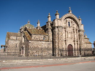
Lampa province is a province of the Puno Region in Peru. Its population is about 40,856. The capital is Lampa.

The General Sánchez Cerro Province is the smallest of three provinces in the Moquegua Region of Peru. The capital of the province is Omate. The province was named after the former Peruvian army officer and president Luis Miguel Sánchez Cerro.

Ichuña District is one of eleven districts of the General Sánchez Cerro Province in Peru.

Santa Lucía District is one of ten districts of the province Lampa in Peru.
Pukara means a ruin of the fortifications made by the natives of the central Andean cultures.
Ch'iyar Jaqhi may refer to:

Uturunqani is a 5,092-metre-high (16,706 ft) mountain in the Andes of Peru. It is situated in the Puno Region, Lampa Province, Santa Lucía District. Uturunqani lies west and northwest of the lakes Ananta and Suyt'uqucha and southeast of the mountain Mamañawi. A little lake named Suraqucha (Soracocha) lies at its southeastern slope.

Mamañawi is a mountain in the Andes of Peru, about 5,100-metre (16,732 ft) high. It is situated in the Puno Region, Lampa Province, Santa Lucía. Mamañawi lies northwest of the mountain Uturunqani and southeast of Pukapunchu.

Wallqani is a 5,334-metre-high (17,500 ft) mountain in the Andes of southern Peru. It is located at the border of the Moquegua Region, General Sánchez Cerro Province, Ichuña District, and the Puno Region, Puno Province, Pichacani District. It lies northeast of Jukumarini Lake and the mountains Larama Quta and Jaqhi Jaqhini. The Larama Quta River originates south of the mountain. It flows to the south.

Janq'u Saxa is a mountain in the Andes of southern Peru, about 4,825 metres (15,830 ft) high. It is located in the Moquegua Region, General Sánchez Cerro Province, Ichuña District, and the Puno Region, Puno Province, Pichacani District, northeast of Jukumarini Lake. Janq'u Saxa lies south of the mountain Wallqani, southwest of Wilaqullu and southeast of Larama Quta. It is situated at the Larama Quta River which originates northwest of the mountain. It is a tributary of Jukumarini Lake.

Chuqipata is a mountain in the Andes of southern Peru, about 5,050 metres (16,568 ft) high. It is situated on the border of the Moquegua Region, General Sánchez Cerro Province, Ichuña District, and the Puno Region, Puno Province, in the districts Pichacani and San Antonio. It lies northwest of the mountain Churi Wiqu, northeast of Millu and southeast of Tankani.

Churi Wiqu is a mountain in the Andes of southern Peru, about 5,000 metres (16,404 ft) high. It is situated on the border of the Moquegua Region, General Sánchez Cerro Province, Ichuña District, and the Puno Region, Puno Province, Pichacani District. It lies southeast of the mountains Tankani and Chuqipata.

Millu is a mountain in the Andes of southern Peru, about 5,225 metres (17,142 ft) high. It is located on the border of the Moquegua Region, General Sánchez Cerro Province, Ichuña District, and the Puno Region, Puno Province, San Antonio District. It lies southwest of the mountain Chuqipata.

Pura Purani is a mountain in the Andes of southern Peru, about 5,000 metres (16,404 ft) high. It is located on the border of the Moquegua Region, General Sánchez Cerro Province, Ichuña District, and the Puno Region, Puno Province, San Antonio District. It lies west of Chuqipata and northwest of Millu.

Uturunqani is a mountain in the Andes of southern Peru, about 4,800 metres (15,748 ft) high. It is located in the Moquegua Region, General Sánchez Cerro Province, Ichuña District.

Ch'iyar Jaqhi is a mountain in the Andes of southern Peru, about 5,000 m (16,000 ft) high. It is located on the border of the Moquegua Region, General Sánchez Cerro Province, Ichuña District, and the Puno Region, Puno Province, Pichacani District. Ch'iyar Jaqhi lies southeast of Qayqu.


