Related Research Articles

Minas Gerais is a state in Southeastern Brazil. It ranks as the second most populous, the third by gross domestic product (GDP), and the fourth largest by area in the country. The state's capital and largest city, Belo Horizonte, is a major urban and finance center in Latin America, and the sixth largest municipality in Brazil and its metropolitan area is the third largest in Brazil with just over 5.8 million inhabitants, after those of São Paulo and Rio de Janeiro. Nine Brazilian presidents were born in Minas Gerais, the most of any state. The state has 10.1% of the Brazilian population and is responsible for 8.7% of the Brazilian GDP.
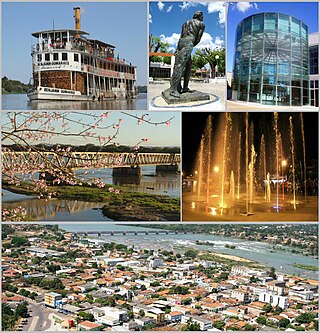
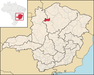
Pirapora is a municipality in northcentral Minas Gerais in Brazil. The population is 56,640 in an area of 550 km². The name Pirapora comes from the Tupi words for "fish" + "jump", referring to the piracema season when a mass migration of fishes ascends the São Francisco River to spawn.

Almenara, is a municipality in the northeast of the Brazilian state of Minas Gerais. Situated on the Jequitinhonha River it is the largest city in that river valley. Its 2020 population was estimated at 42,143 and the municipal area was 2,301 km².

Ubaí is a municipality in the north of the Brazilian state of Minas Gerais. As of 2020 the population was 12,599 in a total area of 821 km². It became a municipality in 1962.

The Maxakalían languages were first classified into the Jê languages. It was only in 1931 that Čestmír Loukotka separated them from the Jê family. Alfred Métraux and Curt Nimuendajú considered the Maxakalían family isolated from others. John Alden Mason suggests a connection with the Macro-Jê stock, confirmed by Aryon Rodrigues.

The Mantiqueira Mountains are a mountain range in Southeastern Brazil, with parts in the states of São Paulo, Minas Gerais and Rio de Janeiro. It rises abruptly from the northwestern bank of the Paraíba do Sul River and extends northeastward for approximately 320 km (200 mi), reaching a height of 2,798 m (9,180 ft) at Pedra da Mina. The mountains, which eventually merge with the Serra do Espinhaço, were originally forest-covered, except for the peaks that rise above the tree line. They provide charcoal and pasture for cattle; on the lower slopes there are several health and tourist resorts, such as Campos do Jordão, Brazil's highest city. The name Mantiqueira derives from a Tupi word meaning "mountains that cry", denoting the large number of springs and streams found there.

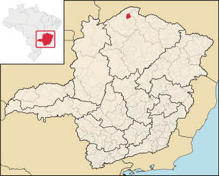
Unaí is a municipality in the Northern Region of Minas Gerais, in the Brazilian state of Minas Gerais, in the Southeast Region of Brazil. It is located 590 km from the capital of Minas Gerais and 164 km from the federal capital. Unaí is the main municipality of its micro-region of the same name and, together with Paracatu, the most important city of the said mesoregion of Minas Gerais. Due to its geopolitical location, because it is geographically and politically linked to Brasilia and politically to Belo Horizonte, the municipality has a strong economic dynamism for a municipality that still carries the typically mineiro custom.

Purian is a pair of extinct languages of eastern Brazil:
Pará de Minas is a Brazilian municipality located in the state of Minas Gerais.
Felisburgo is a Brazilian municipality located in the northeast of the state of Minas Gerais.
Jequitinhonha is a Brazilian municipality located in the northeast of the state of Minas Gerais.

Joaíma is a Brazilian municipality located in the northeast of the state of Minas Gerais.
Miravânia is a municipality in the north of the state of Minas Gerais in Brazil. As of 2020 the population was 4,914 in an area of 603 km². It is located on the left bank of the São Francisco River. It is connected by dirt road to São João das Missões by paved BR-135. The distance is 112 km. Neighboring municipalities are: Montalvânia, Manga, Cônego Marinho, and São João das Missões.

Pedras de Maria da Cruz is a municipality in the north of the state of Minas Gerais in Brazil. As of 2020 the population was 12,212 in an area of 1,520 km². The elevation of the municipal seat is 476 meters. It became a municipality in 1993. The postal code (CEP) is 39492-000 and it belonged to the statistical microregion of Januária

Ibiaí is a Brazilian municipality located in the north of the state of Minas Gerais. In 2020 the population was 8,437 in a total area of 870 km². It became a municipality in 1963.

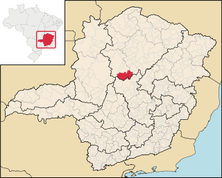
Jequitaí is a Brazilian municipality located in the north of the state of Minas Gerais. In 2020 the population was 7,468 in a total area of 1,268 km2. It became a municipality in 1948.
São Romão is a Brazilian municipality located in the north of the state of Minas Gerais. In 2020 the population was 12,529 in a total area of 2,432 km². It became a municipality in 1943.
Lassance is a Brazilian municipality located in the north of the state of Minas Gerais. In 2020 the population was 6,503 in a total area of 3,213 km². It became a municipality in 1953.

União de Minas is a municipality in the west of the Brazilian state of Minas Gerais.
References
- Map from Ministry of Transport
- Rand McNally, The New International Atlas, 1993.