
South Africa is divided into nine provinces. On the eve of the 1994 general election, South Africa's former homelands, known as Bantustans, were reintegrated into the country, and the four provinces were increased to nine. The borders of Natal and the Orange Free State were retained, while the Cape Province and Transvaal were divided into three provinces each, plus North West Province which straddles the border of and contains territory from both these two former provinces. The twelfth, thirteenth and sixteenth amendments to the Constitution of South Africa changed the borders of seven of the provinces.

South Africa occupies the southern tip of Africa, its coastline stretching more than 2,850 kilometres from the desert border with Namibia on the Atlantic (western) coast southwards around the tip of Africa and then northeast to the border with Mozambique on the Indian (eastern) coast. The low-lying coastal zone is narrow for much of that distance, soon giving way to a mountainous escarpment that separates the coast from the high inland plateau. In some places, notably the province of KwaZulu-Natal in the east, a greater distance separates the coast from the escarpment. Although much of the country is classified as semi-arid, it has considerable variation in climate as well as topography. The total land area is 1,220,813 km2 (471,359 sq mi). It has the 23rd largest Exclusive Economic Zone of 1,535,538 km2 (592,875 sq mi).

KwaZulu-Natal is a province of South Africa that was created in 1994 when the government merged the Zulu bantustan of KwaZulu and Natal Province.

Ladysmith is a city in the Uthukela District of KwaZulu-Natal, South Africa. It lies 230 kilometres (140 mi) north-west of Durban and 365 kilometres (227 mi) south-east of Johannesburg. Important industries in the area include food processing, textiles, and tyre production. Ladysmith is the seat for both the Alfred Duma Local Municipality and Uthukela District Municipality.

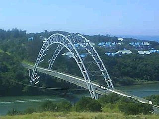
The Tugela River is the largest river in KwaZulu-Natal Province, South Africa. With a total length of 560 km (350 mi), and a drop of 1 370 metres in the lower 480 km, it is one of the most important rivers of the country.

The N3 is a national route in South Africa that connects Johannesburg and Durban, respectively South Africa's largest and third-largest cities. Johannesburg is the financial and commercial heartland of South Africa, while Durban is South Africa's key port and one of the busiest ports in the Southern Hemisphere and is also a holiday destination. Durban is the port through which Johannesburg imports and exports most of its goods. As a result, the N3 is a very busy highway and has a high volume of traffic.
KwaDukuza, previously known as Stanger, is a town in KwaZulu-Natal, South Africa. In 2006, the municipal name was changed to KwaDukuza, but the Zulu people in the area called it "Dukuza" well before then.

Port Shepstone is a large town situated on the mouth of the Mzimkhulu River, the largest river on the KwaZulu-Natal South Coast of South Africa. It is located halfway between Hibberdene and Margate and is positioned 120 km south of Durban. It serves as the administrative, educational, industrial and commercial centre for southern Natal.
Port Edward is a small resort town situated on the south coast of KwaZulu-Natal in South Africa and lies on the border between KwaZulu-Natal and the Eastern Cape. It is situated on the R61 road between Port Shepstone and Lusikisiki.

Amanzimtoti, locally nicknamed Toti, and officially renamed to eManzimtoti, is a coastal town just south of Durban in KwaZulu-Natal, South Africa. Situated along the Sapphire Coast, the town is well known for its warm climate and numerous beaches, and is a popular tourist destination, particularly with surfers.
Umtentweni, also officially known as eMthenteni, is a small coastal resort on the South Coast of KwaZulu-Natal, South Africa, between the Mzimkulu River (the great home of all rivers) and the Mtentweni River. It forms part of the coastal town of Port Shepstone in the Ray Nkonyeni Local Municipality, KwaZulu-Natal, South Africa. It is a relatively clean and quiet residential resort; it has become an attractive destination for people aiming to get away from city life. Most of the village is filled with complexes, flats, bed and breakfasts and suburban-style houses. Twenty years ago the whole of Umtentweni consisted of a lot of greenery and wildlife. All this has changed due to the growing popularity of this small resort and the constant clearing for new housing.
Pinetown is a city that forms part of the eThekwini Metropolitan Municipality, based just inland from Durban in KwaZulu-Natal, South Africa. The town is situated 16 km north-west of Durban and 64 km south-east of Pietermaritzburg.

The R34 is a long provincial route in South Africa that connects Vryburg with Richards Bay via Kroonstad and Newcastle. It passes through three provinces, North West, the Free State and KwaZulu-Natal.

The N2 is a national route in South Africa that runs from Cape Town through George, Gqeberha, East London, Mthatha, Port Shepstone and Durban to Ermelo. It is the main highway along the Indian Ocean coast of the country. Its current length of 2,255 kilometres (1,401 mi) makes it the longest numbered route in South Africa.

Sani Pass is a mountain pass located in the West of KwaZulu-Natal, South Africa on the road between Himeville, KwaZulu-Natal and Mokhotlong, Lesotho. The pass traverses the Great Escarpment of southern Africa in its highest region, the Drakensberg Mountains, which reach an elevation of over 3,000 meters.
Geluksburg is a small village in the Northern of Drakensberg in the KwaZulu Natal province in South Africa, located approximately 24 km from Bergville, close to Green Point and to the Free State border between the Oliviershoek and Van Reenen Mountain passes. The village lies 6 km below the base of the Tintwa mountains of Tintwa Village.

Bezuidenhouts Pass is a mountain pass located in the northern part of KwaZulu-Natal province of South Africa on the road between Harrismith and Bergville.
De Beer's Pass is located in the KwaZulu-Natal province of South Africa. It is situated on an unmarked road between Ladysmith and Harrismith in the neighbouring Free State province.
Impendle is a town in Umgungundlovu District Municipality in the KwaZulu-Natal province of South Africa.

Van Reenen is a settlement in Uthukela District Municipality in the KwaZulu-Natal province of South Africa. It is located on the N3 national road at the top of Van Reenen's Pass on the Great Escarpment of the Drakensberg. The town is named after Frans van Reenen, original owner of the farm where Van Reenen was established and planner of the route of the Van Reenen's Pass.

