Evje og Hornnes is a municipality in Aust-Agder county, Norway. It is located in the traditional district of Setesdal. The administrative centre of the municipality is the village of Evje. Other villages in the municipality include Åneland, Dåsnesmoen, Flatebygd, Gautestad, Hornnes, Kjetså, and Øvre Dåsvatn. Evje og Hornnes was created as a new municipality on 1 January 1960 after the merger of the two older municipalities of Evje and Hornnes. The Norwegian National Road 9 runs north-south through the municipality, along the river Otra.

Bygland is a municipality in Aust-Agder county, Norway. It is located in the traditional district of Setesdal. The administrative centre of the municipality is the village of Bygland. Other villages in the municipality include Åraksbø, Austad, Byglandsfjord, Grendi, Langeid, Lauvdal, Litveit, Longerak, Moi, Ose, Sandnes, Skåmedal, and Tveit. The Norwegian National Road 9 runs through the municipality, following the river Otra where most of the population of Bygland lives.

The Otra is the largest river in the Sørlandet region of Norway. It begins in Setesdalsheiene mountains at the lake Breidvatnet in Bykle municipality in Aust-Agder county, just south of the border with Vinje municipality in Telemark county. The river then flows south through Bykle, Valle, Bygland, Evje og Hornnes, and Iveland municipalities in Aust-Agder before passing into Vest-Agder county and flowing through Vennesla and Kristiansand municipalities. The river empties into the Skagerrak in the center of the city of Kristiansand on the southern coast of Norway.

Ogge is a lake in the municipalities of Birkenes and Iveland in Aust-Agder county, Norway. It is located about 40 kilometres (25 mi) north of the city of Kristiansand, just east of the villages of Vatnestrøm and Oggevatn. The 6.71-square-kilometre (2.59 sq mi) lake includes about 360 islands and reefs. The overall length of the lake is approximately 16 kilometres (9.9 mi). The Sørlandsbanen railway line and the Norwegian County Road 405 both run along the west side of the lake.
Ormsavatnet is a lake in the municipality of Bykle in Aust-Agder county, Norway. The 3.11-square-kilometre (1.20 sq mi) lake flows into the Vatndalsvatnet via a dam and canal. The lake is located in the Setesdalsheiene mountains near the lakes Store Urevatn, Holmevatnet, and Hartevatnet. The nearest village area is Hovden, about 14 kilometres (8.7 mi) to the northeast. The mountain Kaldafjellet lies about 5 kilometres (3.1 mi) to the west of the lake.

Rosskreppfjorden is a lake in Norway. The 29.51-square-kilometre (11.39 sq mi) lake lies on the border between the municipalities of Valle and Sirdal. The lake is part of the Kvina river system and has a hydroelectric power plant in a dam on the south end of the lake. The dam keeps the lake at an elevation of about 929 to 890 metres above sea level.

Kilefjorden is a lake on the border of Aust-Agder and Vest-Agder counties in Norway. The lake is located on the border of the municipalities of Evje og Hornnes and Iveland and Vennesla. The lake is part of the river Otra. The lake is located about 6 kilometres (3.7 mi) west of the village of Birketveit in Iveland, about 2.5 kilometres (1.6 mi) north of the village of Hægeland in Vennesla, and about 15 kilometres (9.3 mi) south of the village of Hornnes in Evje og Hornnes.
Hartevatnet or Hartevatn is a lake in the municipality of Bykle in Aust-Agder county, Norway. It is located along the river Otra, on the south side of the village of Hovden. The lake is a good fishing spot and it contains lots of brown trout. The Norwegian National Road 9 runs along the eastern shore of the lake. The lake Skyvatn lies about 6 kilometres (3.7 mi) to the northwest and the lake Holmavatnet lies about 13 kilometres (8.1 mi) to the northwest.
Herefossfjorden is a lake in the municipality of Birkenes in Aust-Agder county, Norway. The 3.7-square-kilometre (1.4 sq mi) lake is about 9 kilometres (5.6 mi) long and it is part of the Tovdalselva river. The Gauslåfjorden and Uldalsåna lakes flow into Herefossfjorden near the village of Herefoss at the northern end of the lake. The Uldalsåna lake is held back by a dam and the Gauslåfjorden flows over a waterfall into the Herefossfjorden. The Norwegian National Road 41 runs along the eastern shore. The village of Herefoss lies on the northern edge of the lake and the village of Søre Herefoss lies at the southern end of the fjord. The old municipality of Herefoss existed from 1838 until 1967 and it included all the land surrounding the lake.
Holmavatnet is a lake the Setesdalsheiene mountains of Southern Norway. It is located on the border of the municipalities of Suldal, Vinje, and a small part in Bykle. The southeastern corner of the lake is in Bykle, and it is the northernmost part of all of Aust-Agder county. The lake Skyvatn is located about 5 kilometres (3.1 mi) to the south of the lake.
Holmevatnet or Holmevatn is a lake in the Setesdalsheiene area of Norway. It is located in the mountains on the border of the municipalities of Bykle in Aust-Agder county and Suldal in Rogaland county. The 4.76-square-kilometre (1.84 sq mi) lake lies just west of the lake Store Urevatn and to the northeast of the lake Blåsjø. The nearest villages are Berdalen in Bykle, about 20 kilometres (12 mi) to the east and Suldalsosen, about 30 kilometres (19 mi) to the west. The mountain Kaldafjellet lies about 6 kilometres (3.7 mi) north of the lake.
Botnsvatnet or Botsvatnet is a lake in the municipality of Valle in Aust-Agder county, Norway. The 5.61-square-kilometre (2.17 sq mi) lake is located just north of the lakes Rosskreppfjorden and Kolsvatnet and the mountain Urddalsknuten, and it lies to the southeast of the mountain Bergeheii. The village of Valle is located about 14 kilometres (8.7 mi) to the east of the lake. The lake sits at an elevation of 1,020 metres (3,350 ft) above sea level.
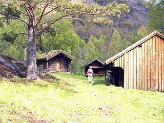
Hornnes og Iveland is a former municipality in Aust-Agder county, Norway. The 640-square-kilometre (250 sq mi) municipality included all of the present-day municipality of Iveland and the western half of the present-day municipality of Evje og Hornnes in the Setesdal region. The administrative centre was the village of Hornnes where the Hornnes Church is located. The other church in the municipality was the Iveland Church in the village of Birketveit.
Bakken is a village in Iveland municipality in Aust-Agder county, Norway. The village is located about 1.5 kilometres (0.93 mi) north of the village of Skaiå and about 6 kilometres (3.7 mi) south of the municipal centre of Birketveit.

Birketveit is the administrative centre of Iveland municipality in Aust-Agder county, Norway. The village is located about 8 kilometres (5.0 mi) north of the villages of Skaiå and Bakken and about 12 kilometres (7.5 mi) to the west of the village of Vatnestrøm. The Iveland Church is located on the south end of the village. The small lake Birketveitstjønna lies on the west side of the village. The municipal government building is located here and it houses a small mineral/mining museum. There is also a municipal sports hall in Birketveit.
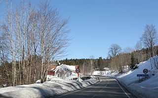
Oggevatn is a village in Birkenes municipality in Aust-Agder county, Norway. The village is located on the western shore of the large lake Ogge, just north of the municipal border with Iveland. The Sørlandsbanen railway line runs through the village. The village of Vatnestrøm lies about 5 kilometres (3.1 mi) southwest of Oggevatn.
Skaiå is a village in Iveland municipality in Aust-Agder county, Norway. The village is located about 900 metres (3,000 ft) northeast of the river Otra, and it is about 1.5 kilometres (0.93 mi) south of the village of Bakken.
Søre Herefoss is a village in Birkenes municipality in Aust-Agder county, Norway. The village is located on the southeastern shore of the lake Herefossfjorden, at the junction of the Norwegian National Road 41 and the Norwegian County Road 404. The village of Herefoss lies about 7 kilometres (4.3 mi) to the north, the village of Sennumstad lies about 5.5 kilometres (3.4 mi) to the south, and the town of Grimstad lies about 30 kilometres (19 mi) to the southeast.

Iveland Church is a parish church in Iveland municipality in Aust-Agder county, Norway. It is located in the village of Birketveit. The church is part of the Iveland parish in the Otredal deanery in the Diocese of Agder og Telemark. The white, wooden church was built in a cruciform style in 1837 using plans drawn up by the architect Hans Linstow. The construction was led by Anders Thorsen Syrtveit. The church seats about 350 people.


