Mullaitivu is the main town of Mullaitivu District, situated on the north-eastern coast of Northern Province, Sri Lanka. A largely fishing settlement, the town in the early twentieth century grew as an anchoring harbour of the small sailing vessels transporting goods between Colombo and Jaffna. The town has a District Secretary's office, many other government institutions and schools located in and around the area.
Chunnakam is a town, located 9.7 km (6.0 mi) north of Jaffna. It is one of the important commercial centres in Jaffna. The original name of the town was Mayilani. In northern Sri Lanka, Chunnakam is only second to Jaffna in terms of population density and commercial activities in and around its neighbourhoods.
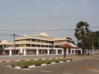
Ambepussa is a town in the Kegalle District, Sabaragamuwa Province, Sri Lanka.
The Northern Theatre of Eelam War IV refers to the fighting that took place in the northern province of Sri Lanka between July 2006 and May 18, 2009.
Manipay or Maanippaai is an affluent town in the northern Jaffna District of Sri Lanka. The original name of Manipay is Periyapulam. It was a mission location when the American Ceylon Mission (ACM) came to Sri Lanka in the 19th century. Dr. Samuel Fisk Green founded the Green Memorial Hospital in 1864 in this village. It was also known as Manipai. There are number of schools in the village, some of which were founded by ACM. The 104-year-old Manipay Hindu College and the 53-year-old Manipay Hindu Ladies College, both High Schools, are prominent. The village also contains Hindu temples and churches. The Manipay Maruthady Pillaiyar Temple stands out.
Polgahawela is a town located in north western Sri Lanka. It is most notable for being a major railway junction.
Kuruwita is a town in the Ratnapura District of Sabaragamuwa Province of Sri Lanka. It is 87 km from Colombo. It used to be served by the 2 ft 6 in narrow gauge Sabaragamuwa Railway, a branch of the national railway system. And known for the nearby waterfall called Bopath Ella.

Meemure is a village with a population of about 420 people living in it It is located near the border between Kandy District and Matale District in the Knuckles Mountain Range. Meemure is one of the most remote villages in Sri Lanka with the only access via a 14 km (8.7 mi) trail from the town of Loolwatte. There is no cellular service available in the village, but a CDMA telephone service is available. There is no direct mail delivery to the village; a villager journeys each day to Thapal Junction to exchange incoming and outgoing postal mail with a postman.

Aluthgama is a coastal town in Kalutara District in the Western Province of Sri Lanka. It is approximately 63.5 kilometres (39.5 mi) south of Colombo and 68 kilometres (42 mi) north of Galle. Aluthgama is situated on the northern bank of the Bentota Ganga (River) mouth.
Medawachchiya is a town in the Anuradhapura District, North Central Province of Sri Lanka. Situated 27 km from Anuradhapura, on the A9 Jaffna - Kandy main road, it is 229 km from Colombo. Medawachchiya is also the point from which the A14 main road to Mannar and Talaimannar starts. Medawachchiya is a significant railway junction on Sri Lanka Railways' northern network. Medawachchiya is the junction between the Northern Line and the Mannar Line.

Beragala is a small town in Sri Lanka. It is located in Badulla District of Uva Province, Sri Lanka. It is located 183 km (114 mi) away from Colombo along the A4 Highway. The area is known for its natural environment, as well as for landslides.
Taddamalai is a small town in Sri Lanka. It is located within Northern Province.
Udayarsamalankulam is a small town in Sri Lanka. It is located within Northern Province.
Valalai is a small town in Sri Lanka. It is located within Northern Province.
Valvetty, is a small town in Jaffna District in the northeast region of the Jaffna Peninsula in Northern Province, Sri Lanka. It is located south of the larger town of Valvettithurai, and northeast of the small town of Udupiddy.
Veddaiyadaippu is a small town in Sri Lanka. It is located within Northern Province.

Sapugodawela is a village in Sri Lanka. It is located within Southern Province. It is 52km away from the provincial capital of the southern district Galle and 133km away from Sri Lanka's capital Colombo.
Talagune is a village in Sri Lanka. It is located in Central Province. The village has a nice view with surrounded mountains, Terraced paddy fields and a nice water fall named Allegala.
Malagala is a small village near Padukka Town in the Colombo District, Western Province. Malagala, which is a part of the Avissawella electorate is situated 42.3 kilometers north west of Colombo, the commercial capital of Sri Lanka. Malagala is near the Kaluthara District boundary.
Baddegama is a main town in Galle District, Southern Province, Sri Lanka. Baddegama is accessible from the E01 Southern Expressway, and is located 1.8 km (1.1 mi) from the Baddegama Expressway Inter Exchange and 102 km (63 mi) from Colombo.
