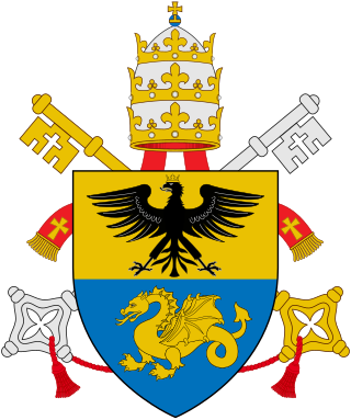
Pope Paul V, born Camillo Borghese, was head of the Catholic Church and ruler of the Papal States from 16 May 1605 to his death, in January 1621. In 1611, he honored Galileo Galilei as a member of the papal Accademia dei Lincei and supported his discoveries. In 1616, Pope Paul V instructed Cardinal Robert Bellarmine to inform Galileo that the Copernican theory could not be taught as fact, but Bellarmine's certificate allowed Galileo to continue his studies in search for evidence and use the geocentric model as a theoretical device. That same year Paul V assured Galileo that he was safe from persecution so long as he, the Pope, should live. Bellarmine's certificate was used by Galileo for his defense at the trial of 1633.

Raymondville is a city in and the county seat of Willacy County, Texas, United States. The population was 10,236 at the 2020 census. It may be included as part of the Brownsville–Harlingen–Raymondville and the Matamoros–Brownsville metropolitan areas.

Paolo Sarpi was a Venetian historian, prelate, scientist, canon lawyer, polymath and statesman active on behalf of the Venetian Republic during the period of its successful defiance of the papal interdict (1605–1607) and its war (1615–1617) with Austria over the Uskok pirates. His writings, frankly polemical and highly critical of the Catholic Church and its Scholastic tradition, "inspired both Hobbes and Edward Gibbon in their own historical debunkings of priestcraft." Sarpi's major work, the History of the Council of Trent (1619), was published in London in 1619; other works: a History of Ecclesiastical Benefices, History of the Interdict and his Supplement to the History of the Uskoks, appeared posthumously. Organized around single topics, they are early examples of the genre of the historical monograph.
Agnew, Michigan is a tiny unincorporated community located at 42°57′54″N86°10′36″W at the intersection of U.S. Highway 31 (US 31) and M-45 in Grand Haven Charter Township of Ottawa County in the U.S. state of Michigan.
Camillo Almici was a Catholic priest and academic of the Congregation of the Oratory.

Mariscal Cáceres Province is one of the provinces of San Martín Region, Peru. Its capital is the town Juanjui. It was created by a law of the Peruvian congress during the presidency of Manuel Prado Ugarteche.
Şəfibəyli is a village in the Goranboy Rayon of Azerbaijan. The village forms part of the municipality of Hacallı.

Khettouti Sed El Djir is a town and commune in M'Sila Province, Algeria.

Kiltsi is a small borough in Väike-Maarja Parish, Lääne-Viru County, in northeastern Estonia.
West Catasauqua is an unincorporated village in Whitehall Township in Lehigh County, Pennsylvania. Once a port and station along the busy Lehigh Canal, it is colloquially known as West Catty. It is part of the Lehigh Valley, which has a population of 861,899 and is the 68th-most populous metropolitan area in the U.S. as of the 2020 census.

Fulgenzio Micanzio was a Lombardic Servite friar and theologian. A close associate of Paolo Sarpi, he undertook correspondence for Sarpi and became his biographer. He also was a supporter of Galileo Galilei.
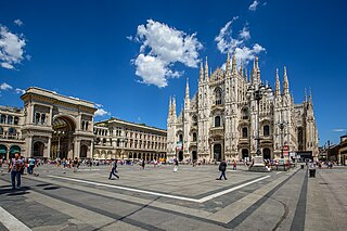
The Zone 1 of Milan, since 2016 officially Municipality 1 of Milan, is one of the 9 administrative divisions of Milan, Italy.

Filippo Ferrari was an Italian Servite friar and scholar, known as a geographer, and also noted as a hagiographer.

Yerevan Vernissage is a large open-air market in Yerevan, Armenia. The name of the market is the derived from the French word vernissage. The market lies along Aram Street and Buzand Street at a length of 350 metres (1,150 ft), connecting the Hanrapetutyun street with the Khanjyan street. The market mainly features a collection of different types of traditional Armenian art works.

Gaetano Cozzi was an Italian historian, professor at Padua University, and researcher with the Giorgio Cini Foundation and Fondazione Benetton Studi e Ricerche. He was a specialist in Venetian history, with special attention to the institutions, the relationship between law and society and the cultural environment.

Chinatown in Milan is an ethnic enclave situated in the 8th quarter of Milan (Italy), and it is an important commercial district. It is the oldest and largest Chinese community in Italy, with about 21,000 people in 2011.

Liceo Classico Paolo Sarpi is a prominent public high school in Bergamo, Lombardy, northern Italy, because of the methodology combining Ancient Greek language and culture, Latin language and culture, Scientific studies with Philosophy and History. Every year, some 100 students graduate from Sarpi, that is one of Italy's oldest humanistic, scientific and social high schools. Established in 1506 under the name of Accademia della Misericordia, the academy is named after Venetian polymath Paolo Sarpi since 1803.

La Paz is an administrative neighborhood of Madrid belonging to the district of Fuencarral-El Pardo. It is home to the largest hospital in Madrid, Hospital Universitario La Paz.

Giorgio Gori is an Italian entrepreneur, journalist, and politician. He is a member of the Democratic Party (PD) and former mayor of Bergamo.
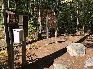
Upton-Morgan State Forest is a 21-acre (8.5 ha) state forest in Concord, New Hampshire. It has a short interpretive trail.
