Video detection and ranging (VIDAR) is a technique to measure the speed or other information of a distant vehicle using advanced stereoscopic imaging techniques. VIDAR technology has application in remote sensing, traffic enforcement.
Video detection and ranging (VIDAR) is a technique to measure the speed or other information of a distant vehicle using advanced stereoscopic imaging techniques. VIDAR technology has application in remote sensing, traffic enforcement.
One situation where VIDAR has notable non-scientific application is in traffic speed enforcement, for vehicle speed measurement, as a technology alternative to radar guns and LIDAR. [1] The technology for this application can be mounted in a gantry or roadside pole.
Unlike RADAR which relies on doppler shifts to directly measure speed or LIDAR which relies on the principle of time-of-flight to calculate speed, VIDAR measures the speed of vehicles by means of tracking an object through vision cameras. High precision speed measurement can be achieved if stereoscopic vision techniques are used.
Computer vision tasks include methods for acquiring, processing, analyzing and understanding digital images, and extraction of high-dimensional data from the real world in order to produce numerical or symbolic information, e.g. in the forms of decisions. Understanding in this context means the transformation of visual images into descriptions of the world that make sense to thought processes and can elicit appropriate action. This image understanding can be seen as the disentangling of symbolic information from image data using models constructed with the aid of geometry, physics, statistics, and learning theory.
Radar is a radiolocation system that uses radio waves to determine the distance (ranging), angle (azimuth), and radial velocity of objects relative to the site. It is used to detect and track aircraft, ships, spacecraft, guided missiles, motor vehicles, map weather formations, and terrain. A radar system consists of a transmitter producing electromagnetic waves in the radio or microwaves domain, a transmitting antenna, a receiving antenna and a receiver and processor to determine properties of the objects. Radio waves from the transmitter reflect off the objects and return to the receiver, giving information about the objects' locations and speeds.
Lidar is a method for determining ranges by targeting an object or a surface with a laser and measuring the time for the reflected light to return to the receiver. Lidar may operate in a fixed direction or it may scan multiple directions, in which case it is known as lidar scanning or 3D laser scanning, a special combination of 3-D scanning and laser scanning. Lidar has terrestrial, airborne, and mobile applications.

A Doppler radar is a specialized radar that uses the Doppler effect to produce velocity data about objects at a distance. It does this by bouncing a microwave signal off a desired target and analyzing how the object's motion has altered the frequency of the returned signal. This variation gives direct and highly accurate measurements of the radial component of a target's velocity relative to the radar. The term applies to radar systems in many domains like aviation, police radar detectors, navigation, meteorology, etc.

An intelligent transportation system (ITS) is an advanced application which aims to provide innovative services relating to different modes of transport and traffic management and enable users to be better informed and make safer, more coordinated, and 'smarter' use of transport networks.

This information can then be used to measure velocity or path length, or as a way to learn about the particle or medium's properties. The traveling object may be detected directly or indirectly. Time of flight technology has found valuable applications in the monitoring and characterization of material and biomaterials, hydrogels included.

A radar speed gun, also known a radar gun, speed gun, or speed trap gun, is a device used to measure the speed of moving objects. It is commonly used by police to check the speed of moving vehicles while conducting traffic enforcement, and in professional sports to measure speeds such as those of baseball pitches, tennis serves, and cricket bowls.

Imaging radar is an application of radar which is used to create two-dimensional images, typically of landscapes. Imaging radar provides its light to illuminate an area on the ground and take a picture at radio wavelengths. It uses an antenna and digital computer storage to record its images. In a radar image, one can see only the energy that was reflected back towards the radar antenna. The radar moves along a flight path and the area illuminated by the radar, or footprint, is moved along the surface in a swath, building the image as it does so.

A radar detector is an electronic device used by motorists to detect if their speed is being monitored by police or law enforcement using a radar gun. Most radar detectors are used so the driver can reduce the car's speed before being ticketed for speeding. In general sense, only emitting technologies, like doppler RADAR, or LIDAR can be detected. Visual speed estimating techniques, like ANPR or VASCAR can not be detected in daytime, but technically vulnerable to detection at night, when IR spotlight is used. There are no reports that piezo sensors can be detected. LIDAR devices require an optical-band sensor, although many modern detectors include LIDAR sensors. Most of today's radar detectors detect signals across a variety of wavelength bands: usually X, K, and Ka. In Europe the Ku band is common as well. The past success of radar detectors was based on the fact that radio-wave beams can not be narrow-enough, so the detector usually senses stray and scattered radiation, giving the driver time to slow down. Based on a focused laser-beam, LIDAR technology does not suffer this shortcoming; however it requires precise aiming. Modern police radars incorporate formidable computing power, producing a minimum number of ultra-short pulses, reusing wide beams for multi-target measurement, which renders most detectors useless. But, mobile Internet allows GPS navigation devices to map police radar locations in real-time. These devices are also often called "radar detectors", while not necessary carrying an RF sensor.
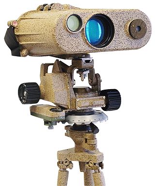
A laser rangefinder, also known as a laser telemeter, is a rangefinder that uses a laser beam to determine the distance to an object. The most common form of laser rangefinder operates on the time of flight principle by sending a laser pulse in a narrow beam towards the object and measuring the time taken by the pulse to be reflected off the target and returned to the sender. Due to the high speed of light, this technique is not appropriate for high precision sub-millimeter measurements, where triangulation and other techniques are often used. It is a type of scannerless lidar.

VASCAR is a type of device for calculating the speed of a moving vehicle. The first VASCAR device was created in 1966 by Arthur Marshall. It is used by police officers to enforce speed limits, and may be preferred where radar or lidar is illegal, such as some jurisdictions in Pennsylvania, or to prevent detection by those with radar detectors.
Road speed limit enforcement in Australia constitutes the actions taken by the authorities to force road users to comply with the speed limits in force on Australia's roads. Speed limit enforcement equipment such as speed cameras and other technologies such as radar and LIDAR are widely used by the authorities. In some regions, aircraft equipped with VASCAR devices are also used.
Electro-optical MASINT is a subdiscipline of Measurement and Signature Intelligence, (MASINT) and refers to intelligence gathering activities which bring together disparate elements that do not fit within the definitions of Signals Intelligence (SIGINT), Imagery Intelligence (IMINT), or Human Intelligence (HUMINT).
A time-of-flight camera, also known as time-of-flight sensor, is a range imaging camera system for measuring distances between the camera and the subject for each point of the image based on time-of-flight, the round trip time of an artificial light signal, as provided by a laser or an LED. Laser-based time-of-flight cameras are part of a broader class of scannerless LIDAR, in which the entire scene is captured with each laser pulse, as opposed to point-by-point with a laser beam such as in scanning LIDAR systems. Time-of-flight camera products for civil applications began to emerge around 2000, as the semiconductor processes allowed the production of components fast enough for such devices. The systems cover ranges of a few centimeters up to several kilometers.

A traffic count is a count of vehicular or pedestrian traffic, which is conducted along a particular road, path, or intersection. A traffic count is commonly undertaken either automatically, or manually by observers who visually count and record traffic on a hand-held electronic device or tally sheet. Traffic counts can be used by local councils to identify which routes are used most, and to either improve that road or provide an alternative if there is an excessive amount of traffic. Also, some geography fieldwork involves a traffic count. Traffic counts provide the source data used to calculate the Annual Average Daily Traffic (AADT), which is the common indicator used to represent traffic volume. Traffic counts are useful for comparing two or more roads, and can also be used alongside other methods to find out where the central business district (CBD) of a settlement is located. Traffic counts that include speeds are used in speed limit enforcement efforts, highlighting peak speeding periods to optimise speed camera use and educational efforts.

Speed limits are enforced on most public roadways by authorities, with the purpose to improve driver compliance with speed limits. Methods used include roadside speed traps set up and operated by the police and automated roadside 'speed camera' systems, which may incorporate the use of an automatic number plate recognition system. Traditionally, police officers used stopwatches to measure the time taken for a vehicle to cover a known distance. More recently, radar guns and automated in-vehicle systems have come into use.

Lidar has a wide range of applications; one use is in traffic enforcement and in particular speed limit enforcement, has been gradually replacing radar since 2000. Current devices are designed to automate the entire process of speed detection, vehicle identification, driver identification and evidentiary documentation.
Length measurement, distance measurement, or range measurement (ranging) refers to the many ways in which length, distance, or range can be measured. The most commonly used approaches are the rulers, followed by transit-time methods and the interferometer methods based upon the speed of light.
LEDDAR is a proprietary technology owned by LeddarTech. It uses the time of flight of light signals and signal processing algorithms to detect, locate, and measure objects in its field of view.

MadeInGermany was a driverless car developed by the Freie Universität Berlin and AutoNOMOS Labs in 2011.