Related Research Articles
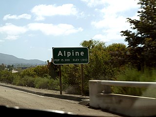
Alpine is a census-designated place (CDP) in the Cuyamaca Mountains of San Diego County, California. Alpine had a population of 14,696 at the 2020 census, up from 14,236 at the 2010 census. The town is largely surrounded by the Cleveland National Forest and borders two reservations of the Kumeyaay Nation, Viejas and Sycuan, and the rural unincorporated areas around the city of El Cajon.

Pine Valley is a community and census-designated place (CDP) in the Cuyamaca Mountains of the Mountain Empire area, in southeastern San Diego County, California. The population was 1,510 at the 2010 census, up from 1,501 at the 2000 census.
Cuyamaca is a region of eastern San Diego County. It lies east of the Capitan Grande Indian Reservation in the western Laguna Mountains, north of Descanso and south of Julian. Named for the 1845 Rancho Cuyamaca Mexican land grant, the region is now dominated by the 26,000-acre (110 km2) Cuyamaca Rancho State Park. Within the park is the prominent Cuyamaca Peak, the second-highest mountain in San Diego County at 6,512 feet (1,984.9 m).

Cuyamaca Peak is a mountain peak of the Cuyamaca Mountains range, in San Diego County, Southern California.

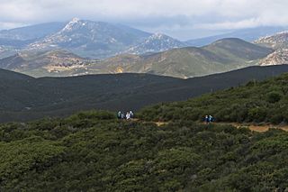
The Cuyamaca Mountains, locally the Cuyamacas, are a mountain range of the Peninsular Ranges System, in San Diego County, southern California. The mountain range runs roughly northwest to southeast. The Laguna Mountains are directly adjacent to the east, with Palomar Mountain and Hot Springs Mountain more distant to the north.

The Viejas Group of Capitan Grande Band of Mission Indians of the Viejas Reservation, also called the Viejas Band of Kumeyaay Indians, is a federally recognized tribe of Kumeyaay Indians.

The Capitan Grande Reservation is a Kumeyaay Indian reservation in San Diego County, California, jointly controlled by the Barona Group of Capitan Grande Band of Mission Indians and Viejas Group of Capitan Grande Band of Mission Indians. The reservation is uninhabited and is 15,753 acres (63.75 km2) large, located in the Cuyamaca Mountains and middle of the Cleveland National Forest and west of Cuyamaca Peak. The closest town is Alpine, California.
The Mountain Empire is a rural area in southeastern San Diego County, California. The Mountain Empire subregion consists of the backcountry communities in southeastern San Diego County. The area is also sometimes considered part of the East County region of San Diego County.
Green Valley, is a valley in the Cuyamaca Mountains in San Diego County, California. The Sweetwater River flows through Green Valley, and has its source at the top of Upper Green Valley.
Witch Creek is a stream, and a tributary of Santa Ysabel Creek, in eastern San Diego County, California.
Macho Creek is a stream in Sierra and Luna County, New Mexico. Macho Creek has its source in Sierra County at an elevation of 7,089 feet, on the north slope of Macho Peak, at 32°45′55″N107°43′03″W in the Mimbres Mountains. It runs to the southwest, subsiding into the earth, about 2 miles north of Myndus, New Mexico at an elevation of 4,180 feet.
Picacho, is a Census-designated place in Doña Ana County, New Mexico. It lies at an elevation of 3,947 feet / 1,203 meters.
Mason Valley is a valley in San Diego County, California. Mason Valley was named after a settler, James E. Mason who established a ranch in the valley in the later 19th century. The mouth of the valley is at an elevation of 1,995 feet / 608 meters, at the point where the valley narrows into a canyon where the Vallecito Wash continues as Vallecito Creek and passes between the Sawtooth Range and the Vallecito Mountains. The head of Mason Valley is at an elevation of 2550 feet at 33°01′05″N116°28′53″W at the junction of Oriflamme Canyon and Rodriguez Canyon where Vallecito Wash has its source.
Vallecito Wash is a wash part of Vallecito Creek, a tributary stream of Carrizo Creek, in San Diego County, California.
Rodriguez Canyon is a steep mountain canyon, in San Diego County, California. It has its head at 33°02′55″N116°31′43″W at an elevation of 4,120 feet in the Cuyamaca Mountains. Is mouth is at 2,549 feet, at its confluence with Oriflamme Canyon, where they form the head of Vallecito Wash, at the northwestern end of Mason Valley.
Upper Green Valley is a valley in the Cuyamaca Mountains in San Diego County, California. Its mouth lies at an elevation of 4,163 feet / 1,269 meters. Its head is at 32°59′03″N116°32′01″W, at an elevation of 4,890 feet. The Sweetwater River has its source at the top of Upper Green Valley.

Carrizo Gorge is a valley in the Jacumba Mountains, in San Diego County, California. Its mouth is at an elevation of 1,411 feet (430 m), where it widens out to become Carrizo Canyon, 1 mi (1.6 km) northeast of Palm Grove. Its head is located in the Jacumba Mountains, 1.5 mi (2.4 km) north of Round Mountain, at an elevation of 2,600 ft (790 m) at 32°39′38″N116°11′28″W.
Carrizo Canyon is a canyon in San Diego County, California. Its mouth is at an elevation of 699 feet / 213 meters. It heads at 32°44′39″N116°11′50″W in the mouth of Carrizo Gorge, at an elevation of 1,411 feet, and trends north to where it opens out in southeastern Carrizo Valley less than a mile east of Egg Mountain.
Carrizo Valley is a valley between the Vallecito Mountains and Carrizo Badlands to the north and the Tierra Blanca Mountains, Jacumba Mountains and Coyote Mountains on the south, in San Diego County, California. Its mouth is at an elevation or 623 feet / 190 meters. Its source is at an elevation of 1,315 feet at 32°58′07″N116°18′37″W at the mouth of the narrow Carrizo Canyon where Vallecito Creek passes between the Tierra Blanca Mountains and Vallecito Mountains.
Spring Creek formerly known as West Creek, and Round Valley Creek, is a stream, tributary to West Deep Creek in White Pine County, Nevada with its source in Juab County, Utah.
References
32°50′12″N116°43′03″W / 32.83667°N 116.71750°W
| | This San Diego County, California–related article is a stub. You can help Wikipedia by expanding it. |