Related Research Articles
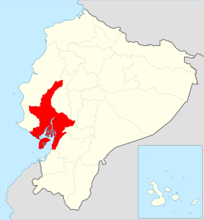
Guayas is a coastal province in Ecuador. It is bordered to the west by Manabí, Santa Elena, and the Pacific Ocean ; to the east by Los Ríos, Bolívar, Chimborazo, Cañar, and Azuay; to the north by Los Ríos and Bolívar; and to the south by El Oro and the Pacific Ocean.

El Oro is the southernmost of Ecuador's coastal provinces. It was named for its historically important gold production. Today it is one of the world's major exporters of bananas. The capital is Machala.

Los Ríos is a province in Ecuador. The capital is Babahoyo. The province was founded on October 6, 1860. Under legislative decree. Babahoyo was made its capital on September 30, 1948.

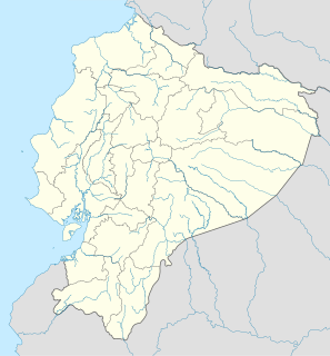
The Guayas River is a river in western Ecuador. It gives name to the Guayas Province, and it is the most important river in South America that does not flow into the Atlantic Ocean or any of its marginal seas. Its total length, including the Daule River, is 389 km. It is the national river of Ecuador, and is present on the Coat of Arms.
Daule, Guayas, Ecuador is a city located in central Guayas, Ecuador, on the Daule River. It is the seat of Daule Canton, created November 26 of 1820.

The Daule River is a river in Ecuador, in Guayas Province. At Guayaquil, it joins the Babahoyo River; from that point the confluence becomes the Guayas River.
Esmeraldas is a coastal city in northwestern Ecuador. It is the seat of the Esmeraldas Canton and capital of the Esmeraldas Province. It has an international sea port and a small airport. Esmeraldas is the major seaport of northwestern Ecuador, and it lies on the Pacific coast at the mouth of the Esmeraldas River. It is exactly at the antipodes of Padang, Indonesia. The city is the principal trading hub for the region's agricultural and lumber resources, and is the terminus of the 313-mile (504-km) Trans-Ecuadorian Pipeline from the oil fields in northeastern Ecuador.

Balsas is a canton in El Oro Province, Ecuador. Its seat is Balsas.

Catamayo Canton is a canton of Loja Province in Ecuador. Its seat is Catamayo. It is located in the north of the province, bordered by the cantons of Loja, Gonzanamá, Olmedo, and Chaguarpamba. In it is located the largest and most fertile valley of the province, and is the location of the Monterrey Sugar Cane Processing Plant, a major sugarcane operation which is a financial boon to the province and country. The town of La Toma in Catamayo is the seat of the city of Loja's airport.

Daule, also known as Villa Daule, is a canton located in the Guayas province in Ecuador. Created in 1820, it is one of the most important parts of Guayas thanks to its rice production and other products such as corn and eggs.

Pucará Canton is a canton of Ecuador, located in the Azuay Province. Its capital is the town of Pucará. Its population at the 2001 census was 20,382.
Santa Isabel Canton is a canton of Ecuador, located in the Azuay Province. Its capital is the town of Santa Isabel. Its population at the 2001 census was 18,015.
El Empalme Canton is a canton of Ecuador, located in the Guayas Province. Its capital is the town of El Empalme. Its population at the 2001 census was 64,789.
Salitre Canton is a canton of Ecuador, located in the Guayas Province. Its capital is the town of Salitre. Its population at the 2001 census was 50,379.
Santa Lucía Canton is a canton of Ecuador, located in the Guayas Province. Its capital is the town of Santa Lucía. Its population at the 2001 census was 33,868.
Simón Bolívar Canton is a canton of Ecuador, located in the Guayas Province. Its capital is the town of Simón Bolívar. Its population at the 2001 census was 20,385.

Macará Canton is a canton of Ecuador, located in the Loja Province. Its capital is the town of Macará. Its population at the 2001 census was 18,350.

Baba Canton is a canton of Ecuador, located in the Los Ríos Province. Its capital is the town of Baba. Its population at the 2001 census was 35,185.
Pueblo Viejo Canton is a canton of Ecuador, located in the Los Ríos Province. Its capital is the town of Pueblo Viejo. Its population at the 2001 census was 29,420.
Pichincha is a city in Pichincha Canton in the Manabí Province in Ecuador.
References
- Rand McNally, The New International Atlas, 1993.
- GEOnet Names Server
- Water Resources Assessment of Ecuador
Coordinates: 1°23′47″S79°43′24″W / 1.3964°S 79.7233°W

A geographic coordinate system is a coordinate system that enables every location on Earth to be specified by a set of numbers, letters or symbols. The coordinates are often chosen such that one of the numbers represents a vertical position and two or three of the numbers represent a horizontal position; alternatively, a geographic position may be expressed in a combined three-dimensional Cartesian vector. A common choice of coordinates is latitude, longitude and elevation. To specify a location on a plane requires a map projection.
| This article related to a river in Ecuador is a stub. You can help Wikipedia by expanding it. |