The Vorarlberg Rhine Valley (German: Vorarlberger Rheintal), also called the Vorarlberg Oberland and Unterland, is a section of the Alpine Rhine Valley and is divided into the Upper and Lower Rhine Valley (oberes and unteres Rheintal) based on the direction of flow of the river. The Unterland runs from the shore of Lake Constance to the Kummenberg, the Upper Rhine valley lies south of the Kummenberg. The Unterland covers the whole of the administrative district of Dornbirn and all the territories of the district of Bregenz that lie within the Rhine Valley. In this region, which includes the urban areas of Bregenz and Dornbirn, live about 180,000 people, around half the population of Vorarlberg. The "green lung" of this region is the Vorarlberg Ried, which is on the border with Switzerland and is surrounded by the settlements of Vorarlberg on three sides.
Geographically the Lower Rhine Valley also includes the municipality of Altach. Due to its historical links with the municipality of Götzis and membership of the district of Feldkirch, Altach is often considered part of the Oberland.
This Austrian location article is a stub. You can help Wikipedia by expanding it.
Vorarlberg is the westernmost state of Austria. It has the second-smallest geographical area after Vienna and, although it also has the second-smallest population, it is the state with the second-highest population density. Two thirds of the country are situated above 1,000m. It borders three countries: Germany, Switzerland, and Liechtenstein. The only Austrian state that shares a border with Vorarlberg is Tyrol, to the east.
Dornbirn is a city in the westernmost Austrian state of Vorarlberg. It is the administrative centre for the district of Dornbirn, which also includes the town of Hohenems, and the market town Lustenau.
Hohenems is a town in the Austrian state of Vorarlberg in the Dornbirn district. It lies in the middle of the Austrian part of the Rhine valley. With a population of 16,946, it is the fifth largest municipality in Vorarlberg and currently has the fastest population growth in the state. Hohenems' attractions include a Renaissance palace dating back to the 16th century, a Jewish history museum, and the old town center.
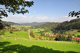
The Bregenzerwald is one of the main regions in the state of Vorarlberg (Austria). It overlaps, but is not coterminous with, the Bregenz Forest Mountains, which belong to a range of the Northern Limestone Alps, specifically the northern flysch zone. It is the drainage basin of the Bregenzer Ach river.
The Alpine Rhine Valley is a glacial alpine valley, formed by the Alpine Rhine, the part of the Rhine between the confluence of the Anterior Rhine and Posterior Rhine at Reichenau and Lake Constance. It covers three countries, with sections of the river demarcating the borders between Austria and Switzerland and between Liechtenstein and Switzerland. The full length of the Alpine Rhine is 93.5 km.
The Dornbirner Ach is a 29.9 km (18.6 mi) long stream in Vorarlberg, Austria, and a tributary of Lake Constance and the Rhine, respectively. It flows through two gorges in its upper part, the Alploch Gorge and the Rappenloch Gorge.
Au is a town in the Bregenz Forest in Vorarlberg (Austria).
The Nomenclature of Territorial Units for Statistics (NUTS) is a geocode standard for referencing the subdivisions of Austria for statistical purposes. The standard is developed and regulated by the European Union. The NUTS standard is instrumental in delivering the European Union's Structural Funds. The NUTS code for Austria is AT and a hierarchy of three levels is established by Eurostat. Below these is a further levels of geographic organisation - the local administrative unit (LAU). In Austria, the LAU 2 is municipalities.
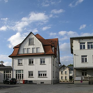
Altach is a municipality in the district of Feldkirch, in the westernmost Austrian state of Vorarlberg.
Eschnerberg, also Eschner Berg, Schellenberg, is 698 m high mountain of seven peaks in the Rhine Valley, on the borderline of Liechtenstein and the Austrian State Voralberg, close to Feldkirch.
The Töss Valley is a valley and a region of the canton of Zürich in Switzerland.
The Tyrolean Unterland is that part of the Austrian state of Tyrol east of its capital city, Innsbruck, excluding East Tyrol.
The Bregenz Forest Mountains, also the Bregenzerwald Mountains, are a range of the Northern Limestone Alps and Eastern Alps, named after the town of Bregenz. The Bregenz Forest Mountains are located entirely in the Austrian state of Vorarlberg.
The Rheintal/Walgau Autobahn (A14) is a motorway in the Austrian state of Vorarlberg.
The Rhine delta of Lake Constance is the river delta on the southeastern shore of Lake Constance, which the Rhine has formed in a former sea area. It lies mostly in the Austrian province of Vorarlberg, smaller areas are in the Swiss canton of St. Gallen. The two peninsulas in the lake are called Rheinspitz (west) and Rohrspitz (east).
Wolfurt railway station is a railway station in the municipality of Wolfurt, in the district of Bregenz, in the Austrian state of Vorarlberg. It is located on the Vorarlberg line of Austrian Federal Railways (ÖBB). Adjacent to the station is the Wolfurt Freight Centre, also known as ÖBB Terminal Wolfurt, a major goods station.
Schwarzach in Vorarlberg railway station is a railway station in the municipality of Schwarzach, in the district of Bregenz, in the Austrian state of Vorarlberg. It is located on the Vorarlberg line of Austrian Federal Railways (ÖBB).
Dornbirn railway station is a railway station in Dornbirn in the Dornbirn district of the Austrian federal state of Vorarlberg. It was opened on 1 July 1872, together with the rest of the Vorarlberg railway. The station is owned and operated by the Austrian Federal Railways (ÖBB).
Altach railway station, formerly Altach-Bauern railway station, is a railway station in Altach in the Feldkirch district of the Austrian federal state of Vorarlberg. It was opened on 1 July 1872, together with the rest of the Vorarlberg railway.
Hatlerdorf railway station is a railway station in Hatlerdorf (Dornbirn) in the Dornbirn district of the Austrian federal state of Vorarlberg. It is an intermediate station on the Vorarlberg railway.
This page is based on this Wikipedia article Text is available under the CC BY-SA 4.0 license; additional terms may apply. Images, videos and audio are available under their respective licenses.