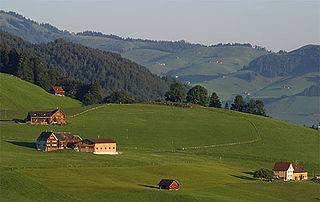
The Municipality of Kungota is a municipality in the western part of the Slovene Hills in northeastern Slovenia. Its seat is the village of Zgornja Kungota.
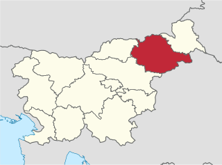
The Drava Statistical Region is a statistical region in Slovenia. The largest town in the region is Maribor. Its name comes from the Drava River and includes land on both banks along its course through Slovenia as well as the Pohorje mountains in the northeast of the region. The Drava is used for the production of hydroelectricity and the fertile land around it is used for agriculture. The share of job vacancies in all available jobs is among the highest in Slovenia and the region has a positive net migration rate but a very high natural decrease, which means an overall decrease in the population.

Ciringa is a small dispersed settlement in the Municipality of Kungota in the western part of the Slovene Hills in northeastern Slovenia, right on the border with Austria.
Gradiška is a settlement in the Municipality of Kungota in the western part of the Slovene Hills in northeastern Slovenia.
Grušena is a dispersed settlement in the hills above Jurij ob Pesnici in the Municipality of Kungota in the western part of the Slovene Hills in northeastern Slovenia.
Jedlovnik is a dispersed settlement in the hills northwest of Zgornja Kungota in the Municipality of Kungota in the western part of the Slovene Hills in northeastern Slovenia.

Jurski Vrh is a settlement in the Municipality of Kungota in the western part of the Slovene Hills in northeastern Slovenia, right on the border with Austria. It includes the hamlet of Jurij ob Pesnici, on the left bank of the Pesnica River, as well as the dispersed houses in the hills north of the village.
Kozjak nad Pesnico is a dispersed settlement in the Municipality of Kungota in the western part of the Slovenian Hills in northeastern Slovenia.
Pesnica is a dispersed settlement in the hills south of Jurij ob Pesnici in the Municipality of Kungota in the western part of the Slovene Hills in northeastern Slovenia, right on the border with Austria.
Plač is a settlement in the Municipality of Kungota in the western part of the Slovene Hills in northeastern Slovenia.
Plintovec is a settlement next to Zgornja Kungota in the Municipality of Kungota in northeastern Slovenia.
Podigrac is a dispersed settlement in the Municipality of Kungota in northeastern Slovenia, right on the border with Austria.
Rošpoh is a dispersed settlement in the western Slovene Hills in northeastern Slovenia. The hamlet of Mali Rošpoh in the northern part of the settlement lies in the Municipality of Kungota. The remaining part of the settlement belongs to the municipality of Maribor.
Slatina is a small dispersed settlement in the western Slovene Hills in the Municipality of Kungota in northeastern Slovenia, right on the border with Austria.
Slatinski Dol is a dispersed settlement in the western Slovene Hills north and west of Zgornja Kungota in the Municipality of Kungota in northeastern Slovenia.
Spodnje Vrtiče is a dispersed settlement in the western Slovene Hills north of Zgornja Kungota in the Municipality of Kungota in northeastern Slovenia.
Svečina is a settlement in the western Slovene Hills north of Plač in the Municipality of Kungota in northeastern Slovenia.

Špičnik is a dispersed settlement in the western Slovene Hills in the Municipality of Kungota in northeastern Slovenia, next to the border with Austria.
Zgornje Vrtiče is a settlement in the Municipality of Kungota in the western part of the Slovene Hills in northeastern Slovenia.