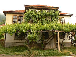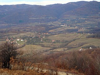
Novi Pazar is a city located in the Raška District of southwestern Serbia. As of the 2011 census, the urban area has 66,527 inhabitants, while the city administrative area has 100,410 inhabitants. The city is the cultural center of the Bosniaks in Serbia and the region of Sandžak. A multicultural area of Muslims and Orthodox Christians, many monuments of both religions, like the Altun-Alem Mosque and the Church of the Holy Apostles Peter and Paul, are found in the region which has a total of 30 protected monuments of culture.

Čapljina is a city located in Herzegovina-Neretva Canton of the Federation of Bosnia and Herzegovina, an entity of Bosnia and Herzegovina. It is located on the border with Croatia a mere 20 kilometres (12 mi) from the Adriatic Sea.

Kotor Varoš is a town and municipality located in north-western Republika Srpska, an entity of Bosnia and Herzegovina. As of 2013 census, it has a population of 19,710 inhabitants, while the town of Kotor Varoš has a population of 7,330 inhabitants.

Bujanovac is a town and municipality located in the Pčinja District of southern Serbia. Situated in the South Morava basin, it is located in the geographical area known as Preševo Valley. It is also known for its source of mineral water and spa town Bujanovačka banja.

Bosilegrad is a town and municipality located in the Pčinja District of southern Serbia. The municipality comprises an area of 571 km2 (220 sq mi). According to 2011 census, town has a population of 2,624 inhabitants, while the municipality has 8,129 inhabitants.

Jošavka Donja is a village in the municipality of Čelinac, Republika Srpska, Bosnia and Herzegovina.

Jošavka Gornja is a village in the municipality of Čelinac, Republika Srpska, Bosnia and Herzegovina.
Miljevina is a village in the municipality of Foča, Republika Srpska, an entity of Bosnia and Herzegovina.
Baljci is a village in the Municipality of Tomislavgrad, Canton 10 of the Federation of Bosnia and Herzegovina, an entity of Bosnia and Herzegovina. It belongs to the Local Community of Šujica. Until 1945, the village was administratively part of the Srez of Livno.
Oplećani or Oplećane is a village in the municipality of Tomislavgrad in Canton 10, the Federation of Bosnia and Herzegovina, Bosnia and Herzegovina.

Vrbànjci is a village in the Bosnia and Herzegovina, Republika Srpska, in the Municipality of Kotor Varoš, as well as former Municipality in Kotor Varoš former County.
Maslovare is a village in the central Bosnia, Bosnia and Herzegovina, Republika Srpska, Kotor Varoš Municipality.
Jakotina is a village in Central Bosnia, Kotor-Varoš Munuicipality, Bosnia and Herzegovina. In the Census year of 1991, 694 inhabitants lived in Jakotina.
Maljeva is populated plece in Bosnia and Herzegovina, Republika Srpska, Kotor-Varoš Municipality. In 1991, the population was 595, and the 2013 census counted 223 inhabitants.
Vranić is a settlement in the Bosnia and Herzegovina, Republika Srpska entity, Kotor Varoš Municipality.
Boljanići is a settlement in the Kotor Varoš municipality, in the Republika Srpska entity of Bosnia and Herzegovina.
Donji Korićani is populated place in Bosnia and Herzegovina, Republika Srpska, Kneževo Municipality. The village is located on a hill between Pougarje and Ilomska's branch of Korićanske stijene.

Turbe is a settlement in the Travnik municipality, Federation of Bosnia and Herzegovina, Bosnia and Herzegovina. The name is derived from Turkish türbe.

Popovac is a settlement in the Bosnia and Herzegovina, Republika Srpska entity, Čelinac Municipality. In 1991, the village had inhabitants.
Vitovlje Malo is a village in the municipality of Dobretići, Central Bosnia Canton, Bosnia and Herzegovina.


