Related Research Articles

Alkemade is a former municipality in the western Netherlands, in the province of South Holland. Before its merger with Jacobswoude, the municipality covered an area of 30.91 km2 (11.93 sq mi) of which 3.94 km2 (1.52 sq mi) is water. It had a population of 14,481 in 2004.

Ter Aar is a town and former municipality in the western Netherlands, in the province of South Holland. It is located about 6 km northeast of Alphen aan den Rijn. The town had a population of 9,007 on 1 July 2006.
Voorhout is a village and former municipality in the western Netherlands, in the province of South Holland. The former municipality covered an area of 12.59 km2 (4.86 sq mi) of which 0.33 km2 (0.13 sq mi) is covered by water, and had a population of 14,792 in 2004. Together with Sassenheim and Warmond, it became part of the Teylingen municipality on January 1, 2006. Voorhout is located in an area called the "Dune and Bulb Region".

Teylingen is a municipality in the Western Netherlands, in the province of South Holland. It was created on 1 January 2006, through the amalgamation of Sassenheim, Voorhout and Warmond. It is named after Teylingen Castle, located in Voorhout. In 2019, it had a population of 37,061.
Haarlemmerliede is a small village in the Dutch province of North Holland. It is a part of the municipality of Haarlemmermeer and lies about 4 km (2.5 mi) east of Haarlem.

's-Gravesloot is a former hamlet and municipality in the Dutch province of Utrecht. It was located between Kamerik and Woerden.
Kamerik-Houtdijken is a former municipality in the Dutch province of Utrecht. It existed from 1818 to 1857, after which it merged with 's-Gravesloot, Kamerik-Mijzijde, and Teckop, to form the new municipality of Kamerik.
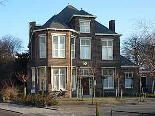
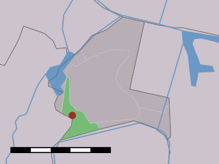
Schonauwen is a former castle in the Dutch province of Utrecht. It is located on the southern outskirts of the town of Houten, surrounded by new buildings.
Houtrijk en Polanen is a former municipality in the Dutch province of North Holland. It existed from 1817 to 1863, when it was merged with Haarlemmerliede en Spaarnwoude.
Biesland was a municipality in the Dutch province of South Holland. It was located to the east of the city of Delft.
Broek was a municipality in the Dutch province of South Holland, located west and north of Gouda. A longer name of the municipality, Broek, Bloemendaal, Broekhuizen, Thuil en het Weegje names the polders that are part of the municipality.

Groeneveld is a former municipality in the Dutch province of South Holland. It was located to the west of the city of Delft. The municipality covered the Groeneveldse Polder, northwest of De Lier, and contained no towns or villages; only the hamlet of Lierhand.

Hoog en Woud Harnasch is a former municipality in the Dutch province of South Holland. It was located to the west of the city of Delft.
Hoogeveen is a former municipality in the Dutch province of South Holland. It was located about 2 km east of the town of Nootdorp.

Lange Ruige Weide is a former municipality in the Dutch province of South Holland. It was located west of the city of Oudewater, and covered the hamlets of Langeweide and Ruigeweide.
Tempel, also known as De Tempel, is a former municipality and former manorial estate in the Dutch province of South Holland. It was located about 3 km southwest of the center of the current village of Berkel en Rodenrijs.
De Vennip is a former municipality in the Netherlands, which at the time belonged to the province of South Holland. It consisted of a small area of land east of Hillegom, and a large part of the Haarlemmermeer lake, including the island of Beinsdorp. The area of the municipality was 38.61 km2, of which only 1.18 km2 was land.
Vrijenban is a neighborhood of Delft in the Netherlands province of South Holland. It is located on the northeast boundary of the historic city center of Delft. Prior to being merged into Delft, Vrijenban used to be a municipality in its own right.

Vrijhoef en Kalverbroek is a former heerlijkheid (manor) and municipality in the Dutch province of South Holland. It was located about 3 km east of the city of Gouda, in the current municipality of Reeuwijk. The area of the former municipality is now almost completely covered by the lakes of the Reeuwijksche Plassen.
Vrijhoeven is a former hamlet and former municipality in the Dutch province of South Holland. It is located about 2 km south of the village of Ter Aar.
References
- ↑ Ad van der Meer and Onno Boonstra, "Repertorium van Nederlandse gemeenten", KNAW, 2006. "KNAW > Publicaties > Detailpagina". Archived from the original on February 20, 2007. Retrieved December 3, 2009.
- ↑ Abraham Jacob van der Aa , "Aardrijkskundig woordenboek der Nederlanden", vol. 2 (B), 1840, p. 522. "Boekhorst" .
52°11′45″N4°33′0″E / 52.19583°N 4.55000°E
| | This South Holland location article is a stub. You can help Wikipedia by expanding it. |