Vöslau Airfield

Last updated

Vöslau Airfield
Flugplatz Vöslau
Flugplatz Voslau LOAV.jpg
Summary
Airport type Public
Serves Bad Vöslau, Austria
Elevation  AMSL 764 ft / 233 m
Coordinates 47°57′52.8″N016°15′39.4″E / 47.964667°N 16.260944°E / 47.964667; 16.260944 (Vöslau Airport (Bad Vöslau)) Coordinates: 47°57′52.8″N016°15′39.4″E / 47.964667°N 16.260944°E / 47.964667; 16.260944 (Vöslau Airport (Bad Vöslau))
Website loav.at (in German)
Map
Austria adm location map.svg
Airplane silhouette.svg
LOAV
Location of Vöslau Airfield in Austria
Runways
Direction Length Surface
ft m
13/31 3,270 997 Asphalt
13/31 2,020 616 Grass
Source: Landings.com [1] [2]

Vöslau Airfield (German: Flugplatz Vöslau, ICAO : LOAV) is a public airfield located 4 kilometres (2.5 mi) east of Bad Vöslau, Lower Austria, Austria. It is also known as Flugplatz Vöslau-Kottingbrunn in German. It is used for general aviation.

ICAO airport code four-letter code designating many airports around the world

The ICAOairport code or location indicator is a four-letter code designating aerodromes around the world. These codes, as defined by the International Civil Aviation Organization and published in ICAO Document 7910: Location Indicators, are used by air traffic control and airline operations such as flight planning.

Bad Vöslau Place in Lower Austria, Austria

Bad Vöslau is a spa town in the Lower Austria federal state of Austria. It is also known as the cradle of the Austrian red wine cultivation. Population (2008): 11,190.

Lower Austria State of Austria

Lower Austria is the northeasternmost of the nine states of Austria. Since 1986, the capital of Lower Austria has been St. Polten, the most recently designated capital in Austria. Previously, Lower Austria's capital was Vienna, even though Vienna has not officially been part of Lower Austria since 1921. With a land area of 19,186 km2 (7,408 sq mi) and a population of 1.612 million people, Lower Austria is the country's largest state; it is the second most populous after the federal state of Vienna. Other main cities are Amstetten, Krems an der Donau and Wiener Neustadt.

Contents

See also

Related Research Articles

Borkum Airfield airport in Germany

Borkum Airfield is an airfield serving Borkum, an island and a municipality in the Leer district in the German state of Lower Saxony.

Bremerhaven Airport airport in Germany

Bremerhaven Airport was a regional airfield in Luneort, a district of Bremerhaven, Germany, 7.6 km (4.7 mi) from the city center. It was mainly used for general aviation and leisure flying activities. The airfield closed on 29 February 2016 and in preparation for demolition, as a new freight seaport will be built on its site. It was replaced by the new Sea-Airport Cuxhaven/Nordholz ( ) at the jointly used Nordholz Naval Airbase ( ).

Emden Airport airport in Lower Saxony, Germany

Emden Airport is an airfield serving Emden, a city in the East Frisia region of the German state of Lower Saxony.

Wels Airport airport

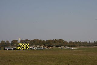
Wels Airfield is an airfield serving Wels, a city in the Austrian state of Upper Austria. It is not used for commercial scheduled services but features business and general aviation as well as private and military training flights and medical transportation.

Wiener Neustadt East Airport airport

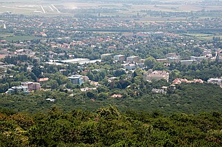
Wiener Neustadt East Airport is an airport serving Wiener Neustadt, a city in the Austrian state of Lower Austria. It is used for business and general aviation but doesn't feature commercial scheduled services, the nearest major airport is Vienna International Airport. In the 90s Tyrolean operated scheduled flights with a Dash 7 in and out of Wiener Neustadt Airport. The airport is home to Diamond Aircraft Industries

Trier-Föhren Airport general aviation airport near Trier, Germany

Trier-Föhren Airport is an airport serving Trier, a city in Rhineland-Palatinate, Germany. It located in Föhren, 8 nautical miles northeast of Trier and approximately 340 miles (547 km) southwest of Berlin. The airport supports general aviation, with no commercial airline service available. Charter services and a full selection of amenities are available.

Mainz-Finthen Airport airport in Germany

Mainz-Finthen Airport(German: Flugplatz Mainz-Finthen) is an airport in Germany, located about 3 miles southwest of Mainz; approximately 320 miles southwest of Berlin.

Wangerooge Airfield airport in Germany

Wangerooge Airfield, German: Flugplatz Wangerooge, is a small airfield in Wangerooge, Lower Saxony, Germany.

Achmer Airport airport in Germany

Achmer Airport is a regional airport located 4 km southwest of Bramsche, a town in the district of Osnabrück in Lower Saxony, Germany. It supports general aviation with no commercial airline service scheduled.

Hohenems-Dornbirn Airport airport

Hohenems-Dornbirn Airport is a public airport located 5 kilometres (3 mi) southwest of Dornbirn, Vorarlberg, Austria. It is used for general aviation as well as air police and air rescue operations.

Feldkirchen-Ossiacher See Airport airport in Austria

Feldkirchen-Ossiacher See Airport is a private use airport located near Feldkirchen, Kärnten, Austria.

Friesach-Hirth Airport airport in Austria

Friesach-Hirth Airport is a private use airport located 3 kilometres (1.9 mi) south-southeast of Friesach, Kärnten, Austria.

Hofkirchen Airport airport in Austria

Hofkirchen Airport is a private use airport located 3 kilometres (2 mi) west of Hofkirchen im Traunkreis, Oberösterreich, Austria.

Krems-Langenlois Airport airport in Austria

Krems-Langenlois Airport is a public use airport located 5 kilometres (3 mi) north-northeast of Krems, Niederösterreich, Austria.

Schärding-Suben Airport airport in Austria

Schärding-Suben Airport is a private use airport located 7 kilometres (4 mi) south of Schärding, Upper Austria, Austria.

Spitzerberg Airport private airport, sports club

Spitzerberg Airport is a private use airport in Hundsheim, Lower Austria, Austria. The airport is located at the foot of the Spitzerberg. Part of the runway is included in the Spitzerberg nature reserve.

Sankt Georgen Airport airport in Austria

Sankt Georgen Airport is a private use airport located 3 kilometres (2 mi) south of Sankt Georgen am Ybbsfelde, Lower Austria, Austria.

Leoben/Timmersdorf Airfield airfield in Austria

Leoben/Timmersdorf Airfield is a private use airfield located 1 kilometre (1 mi) west of Timmersdorf, Styria, Austria.

Dobersberg Airport airport

Dobersberg Airport is a private use airport located 2 kilometres (1.2 mi) west-northwest of Dobersberg, Lower Austria, Austria.

References

  1. Airport record for Bad Vöslau Airport at Landings.com. Retrieved 1 September 2013
  2. Google (1 September 2013). "location of Bad Vöslau Airport" (Map). Google Maps . Google. Retrieved 1 September 2013.

Commons-logo.svg Media related to Flugplatz Vöslau at Wikimedia Commons

The Aviation Safety Network (ASN) is a website that keeps track of aviation accidents, incidents, and hijackings. Their database contains details of over 10,700 reports. The ASN includes an aviation database with aviation investigations, news, photos, and statistics.

National Oceanic and Atmospheric Administration An American scientific agency within the US Department of Commerce that focuses on the oceans and the atmosphere

The National Oceanic and Atmospheric Administration is an American scientific agency within the United States Department of Commerce that focuses on the conditions of the oceans, major waterways, and the atmosphere.

National Weather Service United States weather agency

The National Weather Service (NWS) is an agency of the United States federal government that is tasked with providing weather forecasts, warnings of hazardous weather, and other weather-related products to organizations and the public for the purposes of protection, safety, and general information. It is a part of the National Oceanic and Atmospheric Administration (NOAA) branch of the Department of Commerce, and is headquartered in Silver Spring, Maryland, within the Washington metropolitan area. The agency was known as the United States Weather Bureau from 1890 until it adopted its current name in 1970.