
The Peace River is a 1,923-kilometre-long (1,195 mi) river in Canada that originates in the Rocky Mountains of northern British Columbia and flows to the northeast through northern Alberta. The Peace River joins the Athabasca River in the Peace-Athabasca Delta to form the Slave River, a tributary of the Mackenzie River. The Finlay River, the main headwater of the Peace River, is regarded as the ultimate source of the Mackenzie River. The combined Finlay–Peace–Slave–Mackenzie river system is the 13th longest river system in the world.

Division No. 17 is a census division in Alberta, Canada. It spans the central and northwest portions of northern Alberta and its largest urban community is the Town of Slave Lake. Division No. 17 is the largest census division in Alberta according to area and also has the lowest population density.
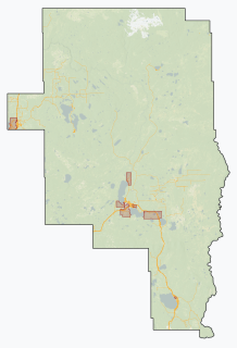
Wabasca, also known as Wabasca-Desmarais, is a hamlet in northern Alberta, Canada, within the Municipal District of Opportunity No. 17. It is located between and along the South and North Wabasca Lakes, at the intersection of highways 813 and 754. It is approximately 123 km (76 mi) northeast of Slave Lake.

The Municipal District of Greenview No. 16 is a municipal district (MD) in northwest Alberta, Canada. It covers the full extent of Census Division 18, and with an area of 32,984 km2 (12,735 sq mi), it is the largest municipal district in Alberta. Its administrative office is located in the Town of Valleyview.

Wabasca is an oil field in a remote area of northern Alberta, Canada. It is the fourth largest deposit of oil sands located in Alberta, located southwest of the larger Athabasca oil sands deposit. It is also known as the Pelican Lake Oilfield.

Utikuma Lake is a large lake in north-central Alberta, Canada. It is located 30 km (19 mi) north of the Lesser Slave Lake, between the Bicentennial Highway and Highway 750.

The Wabasca River is a tributary of the Peace River in northern Alberta, Canada.

The Bigstone Cree Nation is a First Nations band government in Alberta, Canada. As Woodland Cree, they are a western branch of the larger Cree nation, and are a party to Treaty 8 with Canada. The Bigstone Cree Nation was divided into two bands in 2010, with one group continuing under the former name, and the other becoming the Peerless Trout First Nation.

Northern Alberta is a geographic region located in the Canadian province of Alberta.

Cadotte Lake is an unincorporated community in northern Alberta, Canada within Northern Sunrise County. It is located on the northern shore of the homonymous lake, along Highway 986, 79 km (49 mi) east of Peace River and 68 km (42 mi) west of the Bicentennial Highway.
Calling Lake is a hamlet in northern Alberta, Canada within the Municipal District of Opportunity No. 17. It is located on Highway 813 along the eastern shore of Calling Lake, immediately north of Calling Lake Provincial Park. It is approximately 59 km (37 mi) north of Athabasca and 113 km (70 mi) south of Wabasca and has an elevation of 595 m (1,952 ft).

The Fort McKay First Nation (FMFN) is a First Nations government in northeast Alberta comprising five Indian reserves – Fort McKay 174, Fort McKay 174C, Fort McKay 174D, Namur Lake 174B and Namur River 174A. The FMFN, signed to Treaty 8, is affiliated with the Athabasca Tribal Council and its members are of Cree, Metis and Dene heritage. The FMFN's traditional lands include portions of the Athabasca oil sands.

Wabasca 166D is an Indian reserve of the Bigstone Cree Nation in Alberta, located within the Municipal District of Opportunity No. 17. It is 78 kilometres north of Slave Lake. In the 2016 Canadian Census, it recorded a population of 188 living in 47 of its 58 total private dwellings.

Wabasca 166C is an Indian reserve of the Bigstone Cree Nation in Alberta, located within the Municipal District of Opportunity No. 17. In the 2016 Canadian Census, it recorded a population of 188 living in 47 of its 58 total private dwellings. The community is located along the northeast shore of North Wabasca Lake.

Wabasca 166B is an Indian reserve of the Bigstone Cree Nation in Alberta, located within the Municipal District of Opportunity No. 17. In the 2016 Canadian Census, it recorded a population of 190 living in 43 of its 52 total private dwellings. The community is located on the southern shore of North Wabasca Lake and to the west of the hamlet of Wabasca.

CanWest Air is a charter airline based in La Crete, Alberta. Founded in 1986 as Little Red Air Service, CanWest Air provides on-demand charter services to the communities of the Little Red River Cree Nation as well as to various other companies throughout northern Alberta. Nor-Alta Aviation also provides Air Ambulance services under contract from Alberta Health Services. Nor-Alta Aviation purchased Can-West Corporate Air Charters Ltd., and became Can-West Corporate Air Charters a Nor-Alta Aviation Company in late 2015.
Little Buffalo is a hamlet in northern Alberta, Canada within Northern Sunrise County. It is located on Highway 986, approximately 100 kilometres (62 mi) northeast of the Town of Peace River and 47 kilometres (29 mi) west of Highway 88. Little Buffalo Lake is to the south of the community.
The Beaver Lake Cree Nation is a First Nations band government located 105 kilometres (65 mi) northeast of Edmonton, Alberta, representing people of the Cree ethno-linguistic group in the area around Lac La Biche, Alberta, where the band office is currently located. Their treaty area is Treaty 6. The Intergovernmental Affairs office consults with persons on the Government treaty contacts list. There are two parcels of land reserved for the band by the Canadian Crown, Beaver Lake Indian Reserve No. 131 and Blue Quills First Nation Indian Reserve. The latter reserve is shared by six bands; Beaver Lake Cree Nations, Cold Lake First Nations, Frog Lake First Nation, Heart Lake First Nation, Kehewin Cree Nation, Saddle Lake Cree Nation.

The Peerless Trout First Nation is a First Nations band government in northern Alberta, Canada, that is based out of Peerless Lake. It is part of the Treaty 8 Confederacy and was formed as Alberta's forty-fifth First Nation in 2010.
North Wabasca Lake is located in northern Alberta, Canada, 322km north of Edmonton and is the fifteenth largest lake in Alberta. The hamlet of Wabasca is located along the southeast shore of the lake, and along the path of the river flowing north from South Wabasca Lake. Two First Nations Reserves border the lake, Wabasca 166C in the northeast, and Wabasca 166B in the south.