The Swiss rail network is noteworthy for its density, its coordination between services, its integration with other modes of transport, timeliness and a thriving domestic and trans-alp freight system. This is made necessary by strong regulations on truck transport, and is enabled by properly coordinated intermodal logistics.

Bern railway station serves the municipality of Bern, the capital city of Switzerland. Opened progressively between 1858 and 1860, and rebuilt several times since then, it lies on the Olten–Bern and the Lausanne–Bern lines and is near the end of the Lötschberg line. The station is owned by the Swiss Federal Railways (SBB CFF FFS). Train services to and from the station are operated by the Swiss Federal Railways, the Bern-Lötschberg-Simplon railway (BLS) and the metre gauge Regionalverkehr Bern-Solothurn (RBS). Trains calling at the station include TGVs, ICEs, and international trains to Italy.

The Munich S-Bahn is an electric rail transit system in Munich, Germany. "S-Bahn" is the German abbreviation for Stadtschnellbahn, and the Munich S-Bahn exhibits characteristics of both rapid transit and commuter rail systems.

The Hamburg S-Bahn is rapid mass transit railway network in the Hamburg Metropolitan Region. Together, the S-Bahn, the Hamburg U-Bahn, the AKN railway and the regional railway form the backbone of railway public transport in the city and the surrounding area. The network has operated since 1907 as an electric rapid transit system, under the direction of the state railway, and is member of Hamburger Verkehrsverbund (HVV), Hamburg's transport association. There are six lines, serving 68 stations, on 147 kilometres (91 mi) of route. On an average working day the S-Bahn transports about 590,000 passengers; in 2010 about 221 million people used the S-Bahn.

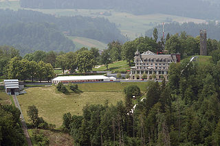
Muri bei Bern is a municipality in the Bern-Mittelland administrative district in the canton of Bern in Switzerland.

Mannheim Hauptbahnhof is a railway station in Mannheim in the German state of Baden-Württemberg. It is the second largest traffic hub in southwestern Germany after Stuttgart Hauptbahnhof, with 658 trains a day, including 238 long-distance trains. It is also a key station in the Rhine-Neckar S-Bahn. 100,000 passengers embark, disembark or transfer between trains at the station each day. The station was modernised in 2001. It is classified by Deutsche Bahn as a category 2 station.

Line S1 is a line on the Munich S-Bahn network. It is operated by DB Regio Bayern. It runs from Munich Airport station and Freising to Neufahrn bei Freising station, where most trains are coupled. Trains continue via Feldmoching, Laim, central Munich to Munich East.

The Bielefeld Stadtbahn is a metre gauge light rail network in the German city of Bielefeld, North Rhine-Westphalia, Germany. The system does include some segments built to rapid transit standards. It is operated by moBiel, a subsidiary of the Bielefeld municipal authority (Stadtwerke). It served 32.77 million passengers in 2012.
The Kramgasse is one of the principal streets in the Old City of Bern, the medieval city centre of Bern, Switzerland. It was the center of urban life in Bern until the 19th century. Today, it is a popular shopping street. Its length, slight curve and long line of Baroque façades combine to produce Bern's most impressive streetscape.

The Münstergasse is one of the streets in the Old City of Bern, the medieval city center of Bern, Switzerland. It is part of the Zähringerstadt which was built during the foundation of the old city in 1191. However, until 1967 it was parts of several other streets. It runs along the Cathedral and it is part of the UNESCO Cultural World Heritage Site that encompasses the Old City.
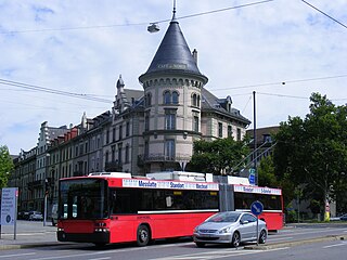
The Bern trolleybus system is part of the public transport network of Bern, the capital city of Switzerland. Opened in 1940, it combines with the Bern S-Bahn, the Bern tramway network and Bern's urban motorbus network to form an integrated all-four style scheme.

S-Bahn Mitteldeutschland represents an enlargement of the previous Leipzig-Halle S-Bahn. It is an electric rail public transit system operating in the metropolitan area of Leipzig-Halle, Germany. This S-Bahn network had developed from two separate S-Bahn networks of Halle (Saale) and Leipzig, which were established separately in 1969 and then linked in 2004. With the opening of the Leipzig City Tunnel on 15 December 2013 as a new artery, the network was extended to the federal states of Thuringia and Brandenburg. The locomotive-hauled double-decker trains had been replaced by electric multiple unit Bombardier Talent 2 trains.

The Biel/Bienne tramway network was part of the public transport network of the bilingual city of Biel/Bienne, in the canton of Bern, Switzerland, and its environs for more than 70 years. Opened in 1877, the network operated as a horsecar tramway (Rösslitram) until 1902, when it was electrified and converted from 1,435 mmstandard gauge to 1,000 mmmetre gauge.
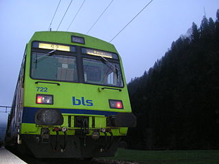
The Bern S-Bahn is an S-Bahn commuter rail network focused on Bern, the capital city of Switzerland. The network is roughly coterminous with Bern's urban agglomeration.

Wabern bei Bern is a railway station in the Swiss canton of Bern and municipality of Köniz. It serves, and derives its name from, the village of Wabern bei Bern, in reality a suburb of the city of Bern. The station is on the Gürbetal line and is operated by BLS AG. It is an intermediate stop on the Bern S-Bahn lines S3 and S31 between Bern and Belp. Both lines operate half-hourly for most of the day, combining to provide a quarter-hourly service to and from Bern.

Bern Europaplatz is a railway station in the Swiss canton of Bern and city of Bern that is a major public transport interchange. The station has two levels and groups of platforms, with the upper one on the SBB-owned Olten to Lausanne line and the lower one on the BLS-owned Gürbetal line. Until 2014, the two groups of platforms were regarded as separate stations, known as Ausserholligen SBB and Ausserholligen GBS respectively, but in that year they were both renamed after the adjacent Zentrum Europaplatz and are now shown as a single station on public transport maps.