
Breitung Charter Township is a charter township of Dickinson County in the U.S. state of Michigan. As of the 2020 census, the township population was 5,831.

Monroe Charter Township is a charter township of Monroe County in the U.S. state of Michigan. As of the 2020 census, the township population was 14,391.

Elmira Township is a civil township of Otsego County in the U.S. state of Michigan. The population was 1,714 at the 2020 census.

Oak Grove is a town in Dodge County, Wisconsin, United States. The population was 1,126 at the 2000 census. The unincorporated community of Minnesota Junction is located in the town. The unincorporated community of Rolling Prairie is also located partially in the town.

The headwater of a river or stream is the farthest point on each of its tributaries upstream from its mouth/estuary into a lake/sea or its confluence with another river. Each headwater is considered one of the river's sources, as it is the place where surface runoffs from rainwater, meltwater and/or spring water begin accumulating into a more substantial and consistent flow that becomes a first-order tributary of that river. The tributary with the longest course downstream of the headwaters is regarded as the main stem.
The Tugaloo River is a 45.9-mile-long (73.9 km) river that forms part of the border between the U.S. states of Georgia and South Carolina. It was named for the historic Cherokee town of Tugaloo at the mouth of Toccoa Creek, south of present-day Toccoa, Georgia and Travelers Rest State Historic Site in Stephens County, Georgia.
The Plum River is a tributary of the Mississippi River, about 46.6 miles (75.0 km) long, in northwestern Illinois in the United States. It rises in Jo Daviess County and flows generally south-southwestwardly into Carroll County, where it joins the Mississippi at Savanna. Among its several short tributaries are:
The Whitefish River is an 11.9-mile-long (19.2 km) river on the Upper Peninsula of the U.S. state of Michigan. The mouth of the river is in Delta County at 45°54′34″N86°58′01″W on the Little Bay De Noc of Lake Michigan. The main branch of the river is formed by the confluence of the east and west branches at 46°03′25″N86°52′17″W.
Mission Creek is a water body west of Topeka, Kansas, United States. The 30-mile-long (48 km) tributary of the Kansas River goes through Wabaunsee County and Shawnee County, Kansas. Mission Creek was named for a Kaw mission near the banks.
The Mitchigan River is a 14.9-mile-long (24.0 km) stream in the Upper Peninsula of the U.S. state of Michigan. It flows into the Fence River at 46°17′27″N88°09′58″W in northeast Iron County in Mansfield Township. The Fence River is a tributary of the Michigamme River, which is itself a tributary to the Menominee River, flowing to Lake Michigan. The Mitchigan River has its source in the southeast corner of Baraga County at 46°24′58″N88°08′05″W. It flows mostly southward along the boundary between Iron and Marquette counties, crossing briefly into western Marquette County.
Midway is an unincorporated community in Greene County, Virginia. It lies at an elevation of 659 feet.
The East Branch Cupsuptic River is a short tributary of the Cupsuptic River in Maine. It flows about 4 miles (6 km) from its source in a cirque between Snow Mountain and Twin Mountains, to its mouth on the Cupsuptic.
Molunkus Stream is a tributary of the Mattawamkeag River in Maine. From the confluence of the stream's East Branch and West Branch in Sherman, the river runs 35.6 miles (57.3 km) southeast to its mouth on the Mattawamkeag in Kingman.
The Passadumkeag River is a river in Maine. From the confluence of its East Branch and West Branch in Maine Township 3, Range 1, NBPP, the river runs 48.2 miles (77.6 km) south and west to its mouth on the Penobscot River in Passadumkeag.
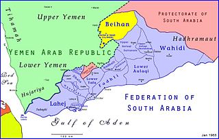
Bayhan District is a district of the Shabwah Governorate in Yemen. As of 2003, the district had a population of 48,347 inhabitants.
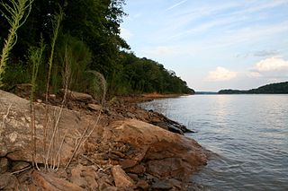
Fall River is a river in Fall River County, South Dakota. The river is the namesake of Fall River County.
Telbasta is an unincorporated community in Washington County, Nebraska, United States.

The mining industry of Yemen is at present dominated by fossil mineral of petroleum and liquefied natural gas (LNG), and to a limited extent by extraction of dimension stone, gypsum, and refined petroleum. Reserves of metals like cobalt, copper, gold, iron ore, nickel, niobium, platinum-group metals, silver, tantalum, and zinc are awaiting exploration. Industrial minerals with identified reserves include black sands with ilmenite, monazite, rutile, and zirconium, celestine, clays, dimension stone, dolomite, feldspar, fluorite, gypsum, limestone, magnesite, perlite, pure limestone, quartz, salt, sandstone, scoria, talc, and zeolites; some of these are under exploitation.
Haseltine is an unincorporated community in Greene County, in the U.S. state of Missouri. The community location was west of Springfield on U.S. Route 266, adjacent to Interstate 44.
Parker is an unincorporated community in Scott County, in the U.S. state of Missouri.
