
The Jordan River or River Jordan, also known as Nahr Al-Sharieat, is a 251-kilometre-long (156 mi) river in the Levant that flows roughly north to south through the freshwater Sea of Galilee and on to the salt water Dead Sea. The river passes by Jordan, Syria, Israel, and the Palestinian territories.
Beth-Nimrah or Beth-nimrah, also called Nimrin and Bethennabris, was an ancient city in Transjordan, which features prominently the history of ancient Israel and Judah. Tell Nimrin has been identified by Nelson Glueck as the last of three sites successively occupied by the ancient city.
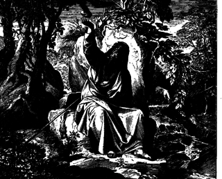
Chorath, Kerith, or sometimes Cherith, is the name of a wadi, or intermittent seasonal stream mentioned in the Hebrew Bible. The prophet Elijah hid himself on the banks of the Chorath and was fed by ravens during the early part of the three years' drought which he announced to King Ahab.
Haplography, also known as lipography, is a scribal or typographical error where a letter or group of letters that should be written twice is written once. It is not to be confused with haplology, where a phoneme is omitted to prevent two similar sounds from occurring consecutively: the former is a textual error, while the latter is a phonological process.

Wadi al-Hasa, known from the Hebrew Bible as the valley and brook of Zered, is a wadi in western Jordan. It is located between the Karak and Tafilah governorates.

The Stations of the Exodus are the locations visited by the Israelites following their exodus from Egypt, according to the Hebrew Bible. In the itinerary given in Numbers 33, forty-two stations are listed, although this list differs slightly from the narrative account of the journey found in Exodus and Deuteronomy.

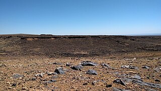
Numeira is an archaeological site in Jordan near the southern Dead Sea. The site has substantial Early Bronze Age remains.

The Wadi Mujib, also known as Arnon Stream, is a river in Jordan. The river empties into the Dead Sea circa 420 metres (1,380 ft) below sea level.
Jordan is a sovereign Arab state in the Middle East. The capital, Amman, is Jordan's most populous city as well as the country's economic, political and cultural centre.

Wadi Gaza and Besor Stream are parts of a river system in the Gaza Strip and Negev region of Palestine and Israel. Wadi Gaza is a wadi that divides the northern and southern ends of the Gaza Strip, its major tributary is Besor Steam. In 2022 work began to rehabilitate Wadi Gaza Nature Reserve.
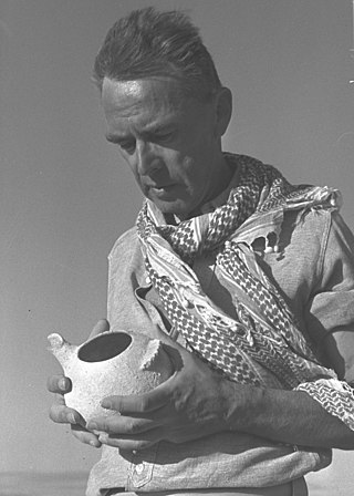
Nelson Glueck was an American rabbi, academic and archaeologist. He served as president of Hebrew Union College from 1947 until his death, and his pioneering work in biblical archaeology resulted in the discovery of 1,500 ancient sites.
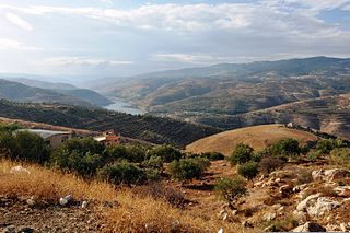
The Zarqa River is the second largest tributary of the lower Jordan River, after the Yarmouk River. It is the third largest river in the region by annual discharge and its watershed encompasses the most densely populated areas east of the Jordan River. The Zarqa rises in springs near Amman, and flows through a deep and broad valley into the Jordan, at an elevation 1,090 metres (3,580 ft) lower.
Jawa is the site of the oldest proto-urban development in Jordan, dating from the late 4th millennium BC. It is located in one of the driest areas of the Black Desert of Eastern Jordan.

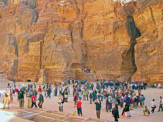
Little Petra, also known as Siq al-Barid, is an archaeological site located north of Petra and the town of Wadi Musa in the Ma'an Governorate of Jordan. Like Petra, it is a Nabataean site, with buildings carved into the walls of the sandstone canyons. As its name suggests, it is much smaller, consisting of three wider open areas connected by a 450-metre (1,480 ft) canyon. It is part of the Petra Archeological Park, though accessed separately, and included in Petra's inscription as a UNESCO World Heritage Site. It is often visited by tourists in conjunction with Petra itself, since it is free and usually less crowded.

Wadi Auja, also spelled Ouja, known in Hebrew as Nahal Yitav is a valley or stream, in the West Bank, originating near the Ein Samia spring and flowing to Al-Auja near Jericho before it runs into the Jordan River.

Tell el-Hammam is an archaeological site in the Amman Governorate of Jordan, in the eastern part of the lower Jordan Valley 11.7 kilometers east of the Jordan River and not far from its mouth. It lies 12.6 kilometers northeast of the Dead Sea. The site has substantial remains from the Chalcolithic, Early, Intermediate and Middle Bronze Age, and from Iron Age II. There are different attempts at identifying the site with a biblical city. The Hammam Megalithic Field lies nearby. Other archaeological sites in the vicinity include Tall Nimrin, Tall Bleibel, Tall Mustah, Tall Iktanu, Tall Tahouna, Tall Barakat, Tall Kafrayn, and Tall Rama.

The Plains of Moab are mentioned in three books of the Hebrew Bible as an area in Transjordan, stretching along the Jordan "across from Jericho", and more specifically "from Beth Jeshimoth to Abel Shittim". Here is the last Station of the Exodus and the place from which Moses climbs up on Mount Nebo "to the top of Pisgah", where he dies.
Tell el-Maqlub is an archaeological site in Ajloun Governorate, Jordan. It is dated to the Bronze and Iron Ages.

Nahal Zin is one of the largest intermittent streams in the Negev, and it is commonly seen as the border between the northern and central Negev. The stream flows from the Plain of the Winds north of the Ramon Crater, passes south and at the foot of the Ben-Gurion Institute, and continues from there. In the northern Arava, the stream is dammed by an earthen embankment, flows into the drainage systems of the Dead Sea Works, and is diverted to the northern basin of the Dead Sea. The length of the stream is about 120 kilometers, and it is the second largest intermittent stream in Israel after Nahal Paran.
 In the Siq
 Wadi Numeira In the Valley
 Wadi Numeira Siq
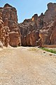 Starting Point of the Gorge
 Wadi Numeira in the Siq


