
The Taupo Volcanic Zone (TVZ) is a volcanic area in the North Island of New Zealand that has been active for the past two million years and is still highly active. Mount Ruapehu marks its south-western end and the zone runs north-eastward through the Taupo and Rotorua areas and offshore into the Bay of Plenty. It is part of the larger Central Volcanic Region that extends further westward through the western Bay of Plenty to the eastern side of the Coromandel Peninsula and has been active for four million years. The Taupo Volcanic Zone is widening east–west at the rate of about 8 mm per year. It is named after Lake Taupo, the flooded caldera of the largest volcano in the zone.

Ohope Beach is a beach in the eastern Bay of Plenty, on the northeast coast of the North Island of New Zealand, six kilometres east and over the hill, from Whakatane.
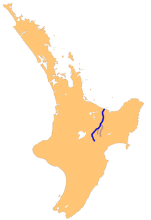
The Rangitaiki River is the longest river in the Bay of Plenty region in New Zealand's North Island. It is 155 kilometres (96 mi) long, and rises inland from northern Hawkes Bay to the east of the Kaingaroa Forest.

The Whakatane River is a major river of the Bay of Plenty Region in the North Island of New Zealand.

Te Kaha is a small New Zealand community situated in the Bay of Plenty near Opotiki. It has a population of about 387, up from 306 in 2006. Approximately 85% of whom are of Māori descent.

Maketu is a small town on the Bay of Plenty Coast in New Zealand.

Motu River is a major waterway in the eastern portion of the North Island of New Zealand. It rises on the slopes of Maungahaumi on the southern side of the Raukumara Range south of Opotiki, heads east and cuts its way through the range, where its important tributaries merge with it, and empties into the Bay of Plenty to the north.
Papatea Bay is one of numerous small bays which lie between the eastern end of the Bay of Plenty and East Cape in the northeast of New Zealand's North Island. a wide, gently curving bay, it lies approximately halfway between East Cape and Opotiki. The small settlement of Raukokore lies on the shore of the bay.
The Haparapara River is a river in the Bay of Plenty area of New Zealand. It starts in the Raukumara Range and flows north-west to join the Waikakariki River, which exits in the South Pacific Ocean at Omaio Bay, 9 kilometres (6 mi) south of Te Kaha.

The Hawai River is a river of New Zealand. It flows from the Raukumara Range northeast into the Bay of Plenty. The locality of Torere is 7 kilometres (4 mi) southwest of the river mouth, and Houpoto is 8 kilometres (5 mi) northeast.
The Kereu River is a river of New Zealand's northeastern North Island. It flows northwest from its headwaters, the largest of which ios the Hauhauponamu Stream, reaching the sea in the extreme east of the Bay of Plenty, close to the township of Te Kaha.
The Nukuhou River is a river of the Bay of Plenty Region of New Zealand's North Island. It flows north from its origins 20 kilometres (12 mi) southwest of Opotiki, reaching the Bay of Plenty at Ohiwa Harbour, halfway between Opotiki and Whakatane.
The Takaputahi River is a river of the Gisborne Region of New Zealand's North Island. It has its origins in numerous streams which rise in rough hill country close to the eastern end of the Bay of Plenty, the longest of which is the Rawea Stream. The Takaputahi flows generally east, away from the Bay of Plenty coast, before meeting the Motu River. Much of the river's length is within the Raukumara Forest Park.
The Torere River is a river of the eastern Bay of Plenty Region of New Zealand's North Island. It flows northwest from its sources within Raukumara Forest Park to reach the Bay of Plenty 30 kilometres (19 mi) southwest of Te Kaha. It is also known to the local Ngaitai tribe as Wainui or Large River.
The Waiaua River is the name of two rivers in New Zealand.
The Waikakariki River is a river of the eastern Bay of Plenty Region of New Zealand's North Island. It flows west from its sources in the foothills of the Raukumara Range to reach the coast 5 kilometres (3 mi) southwest of te Kaha.
The Waiotahe River is a river of the Bay of Plenty Region of New Zealand's North Island. It flows north from its origins west of Oponae to reach the Bay of Plenty 5 kilometres (3 mi) west of Opotiki.
The Whangaparaoa River is a river of the Gisborne Region of New Zealand's North Island. It flows northwest from the Raukumara Range to reach the Whangaparaoa Bay, an indentation in the far east of the Bay of plenty, 5 kilometres (3 mi) south of Cape Runaway.
The Waikare River is a river in the Bay of Plenty Region of New Zealand' North Island. It flows north from its origins between the peaks of Matawhio and Papakai north of Lake Waikaremoana to reach the Whakatane River 25 kilometres (16 mi) east of Murupara.


