Related Research Articles

The Taupō Volcanic Zone (TVZ) is a volcanic area in the North Island of New Zealand. It has been active for at least the past two million years and is still highly active.
The Heretaunga Plains is a 300 square kilometres (120 sq mi) alluvial plain at the southern end of Hawke Bay on the east coast of the North Island of New Zealand. The towns of Napier, Hastings and Havelock North are on the plain.

Toetoes Bay is the easternmost of three large bays lying on the Foveaux Strait coast of Southland, New Zealand, the others being Te Waewae Bay and Oreti Beach. The 240 km Mataura River drains to sea at Toetoes Bay, first passing through the Toetoes Harbour estuary. Thirty kilometres in length, the bay is the southern end of the Awarua Plain, an area of swampy land stretching inland for about fifteen kilometres. The eastern end of the bay is close to Slope Point, the South Island's southernmost point, and the western end of the Catlins.
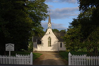
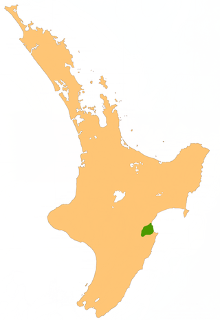
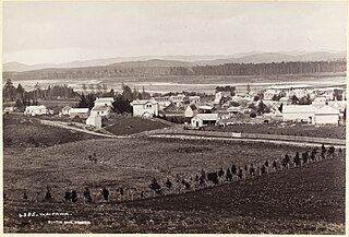
Pukehou is a farming locality in southern Hawke's Bay, in the eastern North Island of New Zealand.
The Allan Hills are a group of hills, mainly ice free and about 12 nautical miles long, lying just north-west of the Coombs Hills near the heads of Mawson Glacier and Mackay Glacier in the Oates Land and Victoria Land regions of Antarctica.

Los Navalmorales is a municipality located in the province of Toledo, Castile-La Mancha, Spain. According to the 2006 census (INE), the municipality has a population of 2636 inhabitants.
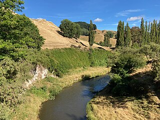
The Waipawa River is a braided river of southern Hawke's Bay, in New Zealand's eastern North Island. It flows southeast from the slopes of 1,687 m (5,535 ft) Te Atuaoparapara in the Ruahine Range, past the town of Waipawa, before joining the Tukituki River. The river rises at the 1,326 m (4,350 ft) Waipawa Saddle, which is also the source of the Waikamaka River. The Mangaonuku Stream is a tributary on the northern bank, west of Waipawa, near Ruataniwha. The Waipawa's flow is generally greater than that of the Tukituki River, into which it flows.
Te Atua Mahuru is a prominent peak in southern Hawke's Bay, in New Zealand's eastern North Island. It lies in the Ruahine Range, within the boundaries of the Ruahine Forest Park, of which it is the second highest peak, at 1534 metres. The Makaroro River has its source on the eastern flanks of Te Atua Mahuru. The slightly smaller Mount Maropea lies just to the south.
Shakhsevan Tretye is a village in the Beylagan Rayon of Azerbaijan.

Taylor Valley77°37′S163°00′E is an ice-free valley about 18 nautical miles long, once occupied by the receding Taylor Glacier. It lies north of the Kukri Hills between the Taylor Glacier and New Harbour in Victoria Land, Antarctica. Taylor Valley is the southernmost of the three large McMurdo Dry Valleys in the Transantarctic Mountains, located west of McMurdo Sound.

Tauranga Harbour is the natural tidal harbour that surrounds Tauranga CBD and the Mount Maunganui area of Tauranga, New Zealand, and which flows into the Pacific Ocean at Mount Maunganui. The harbour is effectively two flooded river systems separated from the Pacific Ocean by Matakana Island.
The Jackson River is a river of the southwestern South Island of New Zealand. It flows predominantly northeast, flowing into the Arawhata River close to the latter's outflow into Jackson Bay.
The Mangatera River is a river of the Manawatū-Whanganui region of New Zealand's North Island. It flows northwest from its origins in the Ruahine Range to reach the Rangitīkei River 25 kilometres (16 mi) east of Taihape.
The Maraekakaho River is a river of the Hawke's Bay region, New Zealand. It flows into the Ngaruroro River.
The Moawhango River is a tributary of the Rangitīkei River and is located the central North Island of New Zealand.
The Morse River is a river of the West Coast Region of New Zealand's South Island. It flows generally northwest from its source in the Strachan Range, reaching the Mahitahi River 14 kilometres south of Bruce Bay.
The Ōamaru River is a river of the centre of New Zealand's North Island. One of the headwaters of the Mohaka River, it flows generally northeast from its source 35 kilometres (22 mi) southeast of Tūrangi, and forms the boundary between the Kaimanawa and Kaweka Forest Parks.
The Whakaurekou River is a river of the Manawatū-Whanganui region of New Zealand's North Island. It flows northwest from its origins in the Ruahine Range to reach the Rangitikei River 25 kilometres (16 mi) east of Taihape.

Kukri Hills is a prominent east-west trending range, about 25 nautical miles (46 km) long and over 2,000 metres (6,600 ft) high, forming the divide between Ferrar Glacier on the south and Taylor Glacier and Taylor Valley on the north, in Victoria Land, Antarctica. They are south of the Asgard Range, east of the Quartermain Mountains and north of the Royal Society Range.
References
"Place name detail: Waikorure River". New Zealand Gazetteer. New Zealand Geographic Board . Retrieved 31 May 2021.
39°43′S176°38′E / 39.717°S 176.633°E