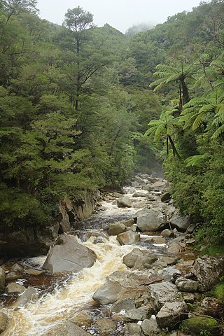
Abel Tasman National Park is a New Zealand national park located between Golden Bay and Tasman Bay / Te Tai-o-Aorere at the north end of the South Island. It is named after Abel Tasman, who in 1642 became the first European explorer to sight New Zealand and who anchored nearby in Golden Bay.

The Wainuiomata River runs southwest through the Wainuiomata Valley located in the southern Remutaka Range in the North Island, New Zealand.

Tāneatua is a small town in the Bay of Plenty region of New Zealand's North Island, 13 kilometres south of Whakatāne. State Highway 2 passes through the town on its route between Edgecumbe and Ōpōtiki. The small settlements of Ruatoki and Waimana are to the south and south-east of Tāneatua.
Wainui is a locality in the Rodney Ward of the Auckland Region of New Zealand. It is 5 kilometres north-east of Waitoki and 10 km west of Orewa. The Wainui Stream flows south-west through the area and into the Kaukapakapa River.

Waitoki is a locality in the Rodney District of New Zealand. Wainui is approximately 5.5 kilometres to the north-east, Kaukapakapa 6.5 km to the north-west, and Dairy Flat 10 km to the south-east. The Wainui Stream joins the Waitoki Stream just to the north-east of the locality. The stream flows west into the Kaukapakapa River.
Whatatutu is a small settlement in the northeast of New Zealand's North Island. It is located north of Te Karaka on the upper reaches of the Waipaoa River, close to its meeting with its tributaries, the Mangatu River and Waingaromia River.

Wainui Beach is a small settlement on the coast of New Zealand's North Island, located just to the north of Tuaheni Point, some 8 km to the east of Gisborne, to which it is linked by State Highway 35.
Herbertville, earlier known as Wainui after the Wainui River, is a small settlement on the eastern coast of the Tararua District. It lies just south of Cape Turnagain, a promontory named by Captain Cook who used the location as a well-remembered point where he turned his ship and retraced his journey.
The Tōrere River is a river of the eastern Bay of Plenty Region of New Zealand's North Island. It flows northwest from its sources within Raukumara Forest Park to reach the Bay of Plenty 30 kilometres (19 mi) southwest of Te Kaha. It is also known to the local Ngaitai tribe as Wainui or Large River.
Wainui River is the name of four rivers in New Zealand. There are also several streams in New Zealand called Wainui Stream. Furthermore, several other New Zealand rivers have names starting in "Wainui-", and some of these are colloquially known as "The Wainui River". This is perhaps unsurprising - "Wainui" is Māori for "big water/river".
Lake Wainui is a lake in the Northland Region of New Zealand.
Wainui railway station was a flag station between Paekākāriki and Paraparaumu on the Wellington-Manawatu Line in New Zealand, when the line was run by the Wellington and Manawatu Railway Company. This line is now part of the Kapiti section of the North Island Main Trunk.

Ranana is a settlement 60 kilometres (37 mi) up the Whanganui River from Whanganui, New Zealand.
The Wainui River is a river of the Bay of Plenty Region of New Zealand's North Island. It flows north from the Kaimai Range to reach Tauranga Harbour 10 kilometres (6 mi) south of Katikati. The catchment has 191 km (119 mi) of stream margins. 41% of the catchment remains covered in native bush, but 48% is under pasture and suffers soil erosion.
The Wainui River is a river of the Tararua District in the Manawatū-Whanganui Region of New Zealand's North Island. It rises on Mt McCartie and flows approximately 28 km (17 mi) southeast through isolated hill country to reach the Pacific coast at Herbertville, five kilometres west of Cape Turnagain. The name Wainui means large waters. It is derived from the Maori words wai meaning water and nui meaning large.

The Wainui River is a river of the Tasman Region of New Zealand's South Island.

State Highway 35 (SH 35) is a New Zealand state highway on the East Coast of the North Island. It is the main highway that services the East Cape of New Zealand as well as many other rural towns such as Hicks Bay, Ruatoria, Tolaga Bay, and the city of Gisborne.
Sean Wainui was a New Zealand rugby union player. He played on the wing for provincial side Bay of Plenty, the Chiefs in Super Rugby, and for New Zealand's Māori international side the Māori All Blacks.

Wainui Falls is a 20-metre (66 ft) waterfall in Wainui Bay, in the Tasman region of New Zealand. The waterfall is part of the Wainui River and cascades over granite bedrock into a deep pool at its base. It is the largest and most accessible waterfall in the Abel Tasman National Park and the Nelson-Golden Bay area, and can be reached via the short Wainui Falls Track. The track is popular as a day walk among tourists, and while the waters of the Wainui River can be too cold for swimming much of the year, the plunge pool is a favoured swimming hole in the summer months.

Wainui Bay is within Golden Bay, and at the south-eastern end of Golden Bay, in the Tasman Region of the South Island, New Zealand.


