
Hawke's Bay is a region on the east coast of New Zealand's North Island. The region is named for Hawke Bay, which was named in honour of Edward Hawke. The region's main centres are the cities of Napier and Hastings, while the more rural parts of the region are served by the towns of Waipukurau, Waipawa, and Wairoa.

Whanganui, also spelt Wanganui, is a city in the Manawatū-Whanganui region of New Zealand. The city is located on the west coast of the North Island at the mouth of the Whanganui River, New Zealand's longest navigable waterway. Whanganui is the 19th most-populous urban area in New Zealand and the second-most-populous in Manawatū-Whanganui, with a population of 42,800 as of June 2023.

The Clutha River is the second longest river in New Zealand and the longest in the South Island. It flows south-southeast 338 kilometres (210 mi) through Central and South Otago from Lake Wānaka in the Southern Alps to the Pacific Ocean, 75 kilometres (47 mi) south west of Dunedin. It is the highest volume river in New Zealand, and the swiftest, with a catchment of 21,000 square kilometres (8,100 sq mi), discharging a mean flow of 614 cubic metres per second (21,700 cu ft/s). The river is known for its scenery, gold-rush history, and swift turquoise waters. A river conservation group, the Clutha Mata-Au River Parkway Group, is working to establish a regional river parkway, with a trail, along the entire river corridor.
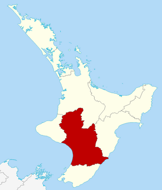
Manawatū-Whanganui is a region in the lower half of the North Island of New Zealand, whose main population centres are the cities of Palmerston North and Whanganui. It is administered by the Manawatū-Whanganui Regional Council, which operates under the name Horizons Regional Council.

The Taieri River is the fourth-longest river in New Zealand and is in Otago in the South Island. Rising in the Lammerlaw Range, it initially flows north, then east around the Rock and Pillar range before turning southeast, reaching the sea 30 kilometres (19 mi) south of Dunedin.

The Ōreti River is one of the main rivers of Southland, New Zealand, and is 170 kilometres (110 mi) long. The river has been identified as an Important Bird Area by BirdLife International because, for much of its length, it supports breeding colonies of black-billed gulls.

The Clarence River is a major river which flows through the Kaikōura Ranges in the northeast of New Zealand's South Island. At roughly 209 kilometres (130 mi) long, it is the longest river in Canterbury and the eighth longest in New Zealand.

The Waiau River is the largest river in the Southland region of New Zealand. 'Waiau' translates to 'River of Swirling Currents'. It is the outflow of Lake Te Anau, flowing from it into Lake Manapouri 10 kilometres (6 mi) to the south, and from there flows south for 70 kilometres (43 mi) before reaching the Foveaux Strait 8 kilometres (5 mi) south of Tuatapere. It also takes water from Lake Monowai.

Lynfield is a suburb of Auckland, New Zealand. It is under the local governance of Auckland Council. The suburb is located on the southwestern Auckland isthmus bordering the Manukau Harbour, much of which is densely forested with native forest. Lynfield was developed for suburban housing in the late 1950s and 1960s, modelled after American-style suburbs.
Ohai is a town in the Southland region of New Zealand's South Island, 65 kilometres northwest of Invercargill and 25 kilometres west of Winton.

The Zealand River is a 6.3-mile-long (10.1 km) river in the White Mountains of New Hampshire in the United States. It is a tributary of the Ammonoosuc River and part of the Connecticut River watershed.

John Parkin Taylor was a 19th-century New Zealand runholder, and a politician in Otago and Southland. In his early life, Taylor lived in various countries and studied languages in Germany. He worked as a merchant and was married when he returned to England. Taylor's family emigrated to New Zealand in 1849 and he was a sheep farmer in various parts of the South Island before finally settling on a run near Riverton in Southland, where he had his homestead 'Waldeck' built. He entered the House of Representatives for the Dunedin Country electorate through a by-election in 1858 but fell out with many of his constituents over a broken election promise, as he helped the Southland Province to break away from the Otago Province. He eventually became Southland's second Superintendent and served from 1865 to 1869, and also represented an electorate on the Southland Provincial Council for a few months. In 1865, he was appointed to the New Zealand Legislative Council and with one break in membership due to non-attendance, he remained a member until his death. He served for one year as mayor of Riverton (1872–73) but did not stand again due to poor health. Taylor had a painful illness and died in 1875.
The Poihipi Power Station is a geothermal power station owned and operated by Contact Energy. It is located on Poihipi Road near Taupō in New Zealand.

Lower Hutt is a city in the Wellington Region of New Zealand. Administered by the Hutt City Council, it is one of the four cities that constitute the Wellington metropolitan area.
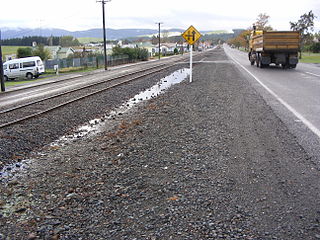
The Ohai Railway Board (ORB) was a short railway in Southland, New Zealand. The railway line itself still exists as the Ohai branch line, but the ORB was dissolved in 1990, and in 1992 the Southland District Council sold the board's assets to New Zealand Rail Limited.
Waitaha is a Māori iwi of New Zealand. The tribe lives in the Bay of Plenty region and descends from the Arawa waka.

Browning Pass / Nōti Raureka is a mountain pass across the Southern Alps, on the South Island of New Zealand. The pass reaches an elevation of 1,411 metres (4,629 ft) above sea level, connecting the upper reaches of the Wilberforce River with the West Coast.

The Butler Range, also known as North Butler Range, is a range located in the Westland District of the West Coast Region on the South Island of New Zealand. The range has also been known as Peaks of the Mist Range.

A sanctuary area is a type of New Zealand protected area. They exist to preserve populations of important forest types, like the remnants of kauri forests in Northland.
